BUILT CONTINUITIES
A Study of the Use of Variable Access Systems for Architectural Design by
RICHARD JONATHON FURMAN
B.S.A.D., Massachusetts Institute of Technology Cambridge, Massachusetts
June 1981
Submitted to the Department of Architecture in Partial Fulfillment of the Requirements of the Degree of Master of Architecture at
Massachusetts Institute of Technology
February 1984
@ Richard Jonathon Furman 1984
The author hereby grants to M.I.T.
copies of this thesis
permission to reproduce and to document in whole or in part.
distribute
Signature of author ... *.,-... ...
Richard J. Furman, Department of Architecture January 18, 1984
Certified by
Maurice K. Smith, Professor of Architecture, Thesis Supervisor
Accepted by ... -. .. .. .. . . . ..
Chester Sprague, Chairman Departmental Committee for Gra a e Students
otchl
MASSACHUSETS iNSTiTUTEOF TECHNWLOGY
APR 19
44
MITLibraries
Document Services
Ph: 617.253.2800 Email: [email protected] http://Iibraries.mit.edu/docsDISCLAIMER OF QUALITY
Due to the condition of the original material, there are unavoidable
flaws in this reproduction. We have made every effort possible to
provide you with the best copy available. If you are dissatisfied with
this product and find it unusable, please contact Document Services as
soon as possible.
Thank you.
The images contained in this document are of
the best quality available.
Built Continuities
A Study of the Use of Variable Access Systems in Architectural Design
by
Richard Jonathon Furman
Submitted to the Department of Architecture on January 18, 1984 in partial fulfillment of the requirements for the Degree of Master of Architecture.
ABSTRACT
The purpose of this thesis is to develop an alternate process of architectural design based on a variety of schemes which respond to different aspects of any
given project and site. The major focus of each exploration is the influence of
pedestrian access on the building form. After the investigations are compiled a
final projection will be synthesized as an assemblage of the strengths of each
exploration. This method should enable the project to contain more than a
strong design decision.
Thesis Supervisor: Maurice K. Smith
Acknowledgements to Maurice K. Smith to Shun Kanda to Bob Slattery to Don Mills to Dennis Carlberg to Grace Napier to my parents friend
-my consultant without whose direction none of the questions would have been in focus.
-for Sushi, Sake and the beginning of my design awareness.
-for friendly, therapeutic fishing trips.
-for the jokes (I was blamed for), the influence of clarity, and the comraderie.
-for asking "What do you want to do that for?", the, "built" peanut butter sandwiches, and a sense of light and all that entails.
-though she never knew it, with the love, under-standing and friendship she helped my through the worst times.
Larry__Furman for their patience, unquestioning Gloria
support and invaluable guidance through the longest process.
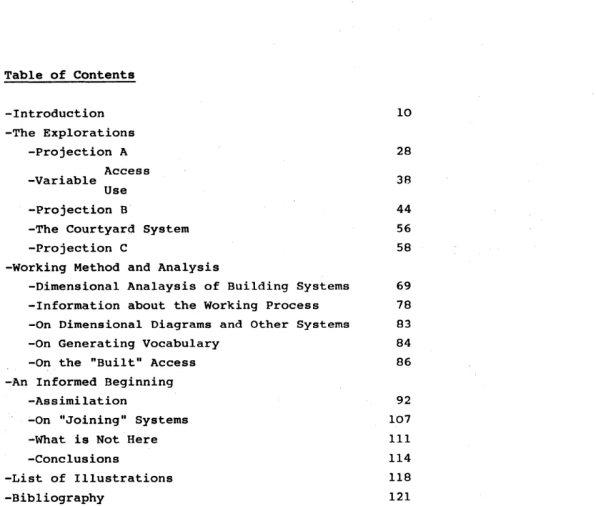
Table of Contents -Introduction 10 -The Explorations -Projection A 28 Access -Variable 38 Use -Projection B 44
-The Courtyard System 56
-Projection C 58
-Working Method and Analysis
-Dimensional Analaysis of Building Systems 69
-Information about the Working Process 78
-On Dimensional Diagrams and Other Systems 83
-On Generating Vocabulary 84
-On the "Built" Access 86
-An Informed Beginning
-Assimilation 92
-On "Joining" Systems 107
-What is Not Here 111
-Conclusions 114
-List of Illustrations 118
10
-NTRODUCTION
Whether -walking down a busy street
-hiking in the woods
-navigating a raging river -trout fishing in a stream
the perception of our
environment depends on our
In fact, much of our time is spent moving -location -sense of smell taste touch hearing sight
-movement through that particular region
-from place to place -past territories -through experiences
That may or may not be perceived.
I r~
4 1 A-ar -1 lo 'Noy~"~ -WA; WO; .u~-. ~ %. ~& I -. A 0
-12
Because of this our view
and understanding of the environment is determined
by -knowing how to get
somewhere
-where a particular place is in relation to another
From Webster's Unabridged Dictionary
access - (ak ses) 1. permission, liberty or ability to enter, approach, communicate with or to pass to and from.
2. freedom or ability to obtain or make use of.
This demonstration reaffirms the suspicions that much of
' beliefs
the user's time is occupied with the question,
use
"how can I get to...?" enter
All of the issues of
building organization are
loaded into the word access.
Issues of
public light screen
private shadow wall
form
depend on the locationf
the public realm; not simple adjacencies. For the most public place in many
14
Assumption - the experience
of movement -is a strong influence on
our perception of the environment
-should be a powerful means of designing the built world.
Method - (given a particular site and program) is to explore different projections advocating a responses specific of the criterion
project. The final response is an assemblage of all.
Site - Harvard Sq. Cambridge, Mass. is bordered by
Mt. Auburn St. Holyoke Place
Winthrop St.
Boylston St.
dense urban fabric strong pedestrian
force
variety of users.
-O
.
16
Program - retail/commercial leasible office space Harvard University office space Harvard Student Housing and support facilities.a multi-faceted program
When dealing with
a complex site
one can employ one of four methods
of design:
1) juxtaposition
2) juggling
or"fit the pieces" one works with all
facets of the design until
everything fits.
keep every aspect up in the air until the optimal situation is
found. One change
can effect every decision.
18
3)
selection
4) variable advocacies
simply deal with a select number of
influences and the others are either
subservient to those or not
addressed at all.
work out three or more schemes
rein-forcing a
different aspect each time to
ascertain the use
and position of
each in the final projection.
~uII
'a
-I
ITl-A---4
6
.20
In Harvard Square the different
pedestrian forces can support
distinct parts of the program. 1) movement in the Mt. Auburn St. direction (A) 2) movement perpendicular to Mt. Auburn St. (B) -promotes retail/ commercial development at ground -reinforces the long dimension of the site -provides more public contact
with the site.
-Harvard students' path to/from class -promotes student related facilities -allows less public contact with site. OsMgS 7S-9S-mbw&93. *
3) perimeter access (C)
In addition each advocacy would require a slightly different method of design-ing. This attitude is
expounded further along in this paper (see dimensional diagrams), however,
initially it is crucial to
exaggerate the differences among the three explorations in order to see each
advocated aspect in its own light. -no site penetration of access -public zone is always at street -similar, in theory, to most block develop-ments in the area
..SL
--
---
qp mi
II.FL
If7Saj-*-I.
PiE!
4
General List of Illustrations
include:
1) simple access diagrams (already shown) 2) diagrams of site organizations 3) dimensional analyses of diagrams 4) design _of building assemblage systems vocabularies 5) dimensional analyses of building systems to illustrate:
-the underlying principle or generating force of the particular exploration. -annotated systems used to
build the diagram and the relationships among the various constituents -the dimensional
correpondence
at the site size, between the design and the context, and within the design
-the working method of each exploration
-the differences in the
physical definition of each projection.
-dimensional consistency within each system
-relationships to other building methods.
~ypratfons
*the cow rfyftuJymr
t
28
Site Diagram A
this shows the relationship among -the square system -the frame system -the access system
In general, the squares are
present at the exchange
between the use territory
and the access zone.
There are places where there
is access without the
presence of the squares...
...and conversely there is a
region where the squares
build the use territory.
II
II
11
HamaF~L
L
Wa17H
T.
-
f
A~r
UbUM
G
sew
t
V
29
'a #~' F' -~ * a.-I.
ii
'if1/
~1ItI.
.1
Dimensional Diagram of organization A
Certain dimensions are used consistently to give a
larger order to the three systems working together in this projection.
The longest straight
dimension of access possible before entering a territory.
Based on the length of the neighboring Lutheran Church.
Length and/or depth of the two building systems
together based on the depth of some of the buildings on the site.
Depth of the built territory belonging to one system
only. Also based on
dimensions of buildings on the site. - M -" M -. U.- U -m m sa *m au -m .. U.... -... K -.. = amN m I ... ...
L
I
L.
.
Is
4 i --I .- - - - -----32
The smallest building size dimension in the context used, primarily, as the usual displacement from the public access into a built
territory.
The addition of the squares and the fran is assembled throughout the site as a surrogate street edge to bring the "street public" into the building.
-fra
Syst'M
---...
1±.
~J.
56inmu.inuinuinUin 4.--. * ggin.inum.in.inuso%&A
A
...34
Plans
Building System A
Sections
This system is designed to
be open and frame-like
users
because the of a
tenants
retail
commercial building may
change frequently.
Therefore, it is flexible -to accommodate frequent
changes
not neutral -so the system can live with the secondary and tertiary inhabitations.
g
r'W ndary
444&j
- -0L O.4'
'41?
~~4I
.,,. 4.. SQ' -~OlIN1G
66YSTEM PLAN
ill
-A.--.
JL.4
*1- --r.
.
(
,-Y .-----I11I1.
L,11.
..11
'0 d~0. A.' '4.'..----
1--1
-op
~o.
VA' .4. C.. 4. --4 .43
AL4
-0 g ~. A.-r
4~. .. 0r -- 4 .038
Access
Variable Use
The preceeding drawings show possible variations of enclosure. The building system...
-street edge inhabitations
A & B
-open frame
-permits change within the defined territory
...when added to the
propped slab system makes deep zone of exchange between the use territory
and the access.
This allows -the enclosure to
define
claim
territory outside of the
frame system
-some of the public access to move easily into the zone of the frame system.
4
Is
T
I
.40 0:H
&
:
h.P:
me
'V -'0 01*
~
.~
*
~*
* I~
I
V
*6 0* .0 0. I.. ~. * ,4L~~'<
4
~
A
1
.. i.-t m*
~0 -$A
* -*~ *~ * -.. ,j.- I-I.-I
I
I
* S me40
I
4. I. 4 .~'. ~: -~ S * I Sa' it .4I 4.z.t~.
IIK1i.~!ZNLLk I ~ 4'
"'~ 4S.w W~
. -* AI
Fe~
T
r&*
'v .IN.,(4,
a. .1-. . - -- ~-r- -.5. .Iq. ~I '9£ --4.lHftlTAIIOrf
jut
of Butler Square shows the static
relationship between an existing building system and the office enclosures. This is a one to one
relationship between
primary system and enclosure.
The street, where there is a lot of public life, is no place for such predetermined hierarchies. If that sort of design wWere to be
insisted upon at the public interface, the result would be minimal relationship inside between the semi-public outside and public.
42
The usual relationship in these cases is visual
connection through a planar, tempered glass storefront
and maybe a depressed
entrance.
This system is against that kind of apathetic response. If the building is to be part of the street it should
take part in the street ,l
44
SITE DIAGRAM B
In this scheme access -is perpendicular to Mt. Auburn Street
-accommodates the Harvard student flow to and from class
-promotes student-related uses
The student-related use
referred to is a development of student housing and some
support facilities.
The housing will be -"object-like" (in form) -similar to neighboring
private clubs
-very "wall-like" and solid
- Gore
Q W*A99C Zu t... r u wroamv ;mw~rU 0 (i) '-4
I
4i
K /~4I'
0 0~*1
I.
4
F~
In this diagram the housing
cores are shown as 50' X 50' squares. The "field" of
support facilities in which the objects live is less complete but more
"wall-like" than Scheme A.
the "field" -helps to reinforce the strength of the Mt.
Auburn Street direction. -channels the movement into
the site at specific points -provides some protection
from the street to the inner most zone of the site.
48
The general site organization -reinforces the understanding of the interior private zone
-is a courtyard system
-by making a plaza or stopping place claimed by the buildings
-which clues
movement from the lighted street to a lighted court-yard through a dark region -larer courtyArd
Ji4ar
Jcer
ri
d
courtyardt
prd
&t.
Dimensional Diagram of Organization B
-eoe - u -m U m - u m m
... .... m .. . muu...
-the dimensions of a block which
has been displaced in this projection. It is the distance between the two entries to the site.
-appears here as the longest
dis-tance from the site entry to a
building entry. This is taken from the Holyoke Center where
the dimension is from the street
to the building entry.
-taken from the small buildings in the context this becomes the
dimension of the housing core as
well as some "designed" open space
-taken from the context this is
the smallest significant dimension at the "site" size
(smaller dimensions depend upon the building system for their
existence)
--
- -
---
---"" mmml muss -.
...
50
in addition the site is comprised of five
zones 1) Mt. Auburn St. -Cambridge public edge 2) Winthrop St. -Harvard public edge 3) Interior private -private open space
landscape 4) Margin between Winthrop and Interior 5) Margin between Mt. Auburn and Interior
4110
~
JI
-most building entries are in these zones
dyerrt
~Js
Y
yrY4uy
*1 I
I..
j.4.~i
I
~III.I..1
I
--PIMEN61MAL
I Z'I 551
.
09g
so
to
ss
o
ng52
Plan Building System Elevation
The housing has -less variable design than Scheme A
-because of the more private and less changeable nature of the use.
This plan shows
-reference to existing -while not direct copies of morphology any particular building, they
do share some material and dimensional relationships
-system of building -deployment of housing -building of access
through the site.
Therefore, an exhibition of all of the factors which work together to acknowledge the different zones in the site.
A
01'
OVILVIrid
S)MI FlfLAI
OcIet1.
v
-04r*T - -A/lo
AL
4ST!
T4'1
0 t4 8 1 3r.56
IL= - -o ~0
4T
~
F7
4~
..... ... AG jr r.--U~I1L-
_ -- 0_"1 _______*___The Courtyard System
The courtyard system is a spatial structure that allows larger openplazas
spaces to have separation and privacy from other places. The process of moving from a
lighted area through a
darker passage back into the light brings one through various degrees of privacy. This enables one to design a
collective place that is away from the street and
define it as such. One example of this is Ciudad Knossos in Santiago, Chile. The plan shown here (drawn by Fernando Domeyko as part of his compiled research of Santiago, Chile) illustrates this principle at work. The
collective plazas are
public
places off of which every house has an entry. They are linked by dark "streets" which serve as connections to the main street but also define the plazas as
discrete territories. There is one difference between this system and the system used in Scheme B. Here the street is private and all entries are on the plaza. In Scheme B all entries are in the dark street. That
leaves more territory in the plaza for use.
~58
Site Diagram C
The public access never permeates the site in this
exploration. Therefore,this exploration is
concerned with -the building and modulation of the street zone
-relationship between the built street zone and the surrounding context
-the understanding of the street
zone as building -building the
street zone is a major step in realizing the space around a building is as important as the building itself.
--LJk4
Iiuilg~.
-- - MITT r " - , 46 a2-. -.--- -- * -t - .- 4-. , . . . .*I;
(
£ I 4 i- A. firThe elements used in this scheme are
as well as
-the propped up slab system... -frame system
wall i
r
continuous surface system
trees and paving
.
..
. .
The trees and paving are the only building elements that can be controlled outside of
the immediate site. They -extend the zone of the site -support relationships present
in the context.
-62
Dimensional Diagram of Organization C
This diagram shows the
samm m-um mm.samummm mmm
U
-m -
mm-amm-amm
-dimensional relationships between the building and
context
-effort to support them
reinforce
-a common large building dimension in this context
-next largest building size used to illustrate the relationship between the Lutheran Church and
the site.
-small building size
used as the largest wall dimension.
-small building size used
to dimension the open
public plazas and access
zones.
-largest building size
-reinforced by trees
and paving
to show from where
it originates.
I-J+II
160
...-. - - . - -- L ...~
... -+ .*--...----.+-r - - -T Emmnemet einm ins n'.. -
-we mama= ul '701 .. ... I n aa a m MBm .m
~
a an ana- mon * m mm;.. . .... ..+.t=-=~r
*.
maon -w Irj
j14______
U~wa
."S-oon-_ M- www a SO _ _ _ +1 + i M S.. + ... 'I is 'IME~c 0
V15M ~164
Building System Plan C
These systems -are similar to those used in Scheme A.
-contain wall-like charac-teristics to prevent
penetration through the site.
-when added together allow for a street zone that is more than 40' deep.
This drawing also explores
some of the various ways territorial entries can
be designed defined
(i.e. with level
material change direction
1
__________ ~~1I
__________tzi~
ii
~iJ.F.
I
~ ~~Io 4' -~ TIJjj
4-.' 4. '-*0 *1. 44 *.1 'z~ I. ,. 0*~ I I, I I *1'~~~ . I I Ijill
* 4 ~*1
-- -~tLL ________ / ____ -- LU ______ -- I-. --4-~%9 t7 *~
i*;*
~
~*. -- ___ ~'1T~~L4 -K
I.--. * ... 4 I. 4.4 J~ l~.. ~ Je -- ~---4TI~c
J$)Qtng
*
trww~7na5( awn(jf
1f jgrFu'(
~§Jyfrn7
*t
lrlcatu'4 aI6cut
f
t
~c
$l2rEif
Irocelrs
*~
~
Cr1
§at we
II
Dimensional Analysis of Building Systems B
C
these drawings show -the dimensional system
being used
-correspondences with the other explorations
-more information about the working process.
-
-
-r..t
-
-- ---
.:
4
-
j
-U-.... .. .. . .. ..
-.
I--
e-4 I 4' -smallest dimension private entry light from above8' -private access width
threshold between two territories
space between two systems
.0
0* 0* ~ .. At * * -I.height 12' -standard room
size 16' -public access width
standard dimension of most elements in the building system.
201 -usual bay size (frame system)
24] -small access related
territories
32' -the largest open public plaza territories
40' -clear height in public access territories 48' -deepest dimension of
use territories before more top/sky light is admitted.
afznAn-'Ad 4m
#4n44
4 5ft/t>
* 4. 4 4' * I 2,
-F
N
~4) r U ma+u mmmi m I U I U ~4I, * -mum 6 I u injuum. ~uii
U S SiL
U '.5 S-. Al. -- .4. V mm '-4,
I 'I ~~
A
mining * *4 .5~
~. 5' 4 ~.I
2
I &$ss
Md aIA
I I I. a I -. .0 4, 2 'sag * ". 5, * .:* v .9.; ~I
4-4*
5.4U
~
11
A Lr\J *zt 2 p 17'~IM~HEIO(IAL PiA~AM
I
~uILV1r1a
s~'rin
f~Lq1&iI1- -
-I
a I lot"C-£
Sm mImji
2-- --"
I
I
- - -- -- - -- I - -14.1 -mi 1 mmrns . mama--- --- m-. .. tI-ama
ma md
$mu~ M
h
AH.-someme".o
EaCO
-4
751
I'-OR
F' -m -mr
ii V -I78
Information about the Working Process
There are three distinctions among the dimensional
correspondences -leading decision
-following decision
-gift
-initial systematic
moves
-next layer of adjust-ment
-dimensions already present in the context -a result of specific
deployment of systems but not previously considered.
*
d~ou~4
~~Wee4t~
)uiW tea a,~
For Example
Scheme B -leading decisions -size of territory at streets and plaza
-space between housing units -design of housing units
-following decisons -dimensions of territories
between -threshold dimension
-connection of plazas -areas surrounding
plazas.
-due to compulsive systematic dimensioning of the pieces and deployment in a
system-atic manner...
... there are more common dimensions created than
actively designed.
~-1T
LiI
r~1
-0 0 - -(7
g1
iaI1I
iiijjujI;
I.
*~f~
I
4
-
I~
fI
I I.
i~~'!-
T
IT,
I-
K
_1)
~ ~
7
f\D
D4QSIONS
80
I
I
011,1
. ~L
-- 4 -
1-I
82
45I
*T
I
On Dimensional Diagrams and Other Systems
The dimensional system is an understanding of the use of dimensions within a given territory. It is not a grid or insistant imposition on
the site. These dimensional diagrams are simply a
"check" and illustration of this understanding. In addition, the system should be developed to accept the presence of something very different from itself and
should be relatively "self-stable" at a small size so that pieces of the system can be assembled in different ways.
This is so that one system does not necessarily control the whole site.
84
On Generating Vocabulary
-For the purposes of compatability.
and -Knowing the final
projection is an
assemblage of many
different systems
The vocabulary of each pieces
system come from a root
similar
background.
The dimensional qualities of each system are similar to
each other so they -can be exch anged at will
-do not have to be located on the site as the projections suggest.
4e r teow
In this way the synthesis will be an easier process of arrangement.
The vocabulary is derived from a simple frame piece which when fattened
becomes a wall piece. The assemblage then can be reversed to get which has much more screen and claims the same amount of territory as < . If the stem is removed from
Q
the shallow "U" resultswhich can be altered in dimensions F or used as
fireplaces . The wall piece may also be
lengthened into a "T"G and that may be assembled with two pieces < . Along with the frame pieces come pieces < and which
are derived in dimension from A but can be used
individually.
CO
:4L1
-Iii.
K~ID
pUlLDIMG 4316TIr1VOCADuLAg4'
014 8 ======= f86
On the "Built" Access
There are three major ways of building the access:
1) building it directly -that is, whatever struc-tural or spatial system being used defines only the access zone.
2) build it with the territories on either side
3) build it optionally
-the access zone is defined as the slack region in between two or more built territoies.
-that is, the access zone is built directly within the neighboring territories and allows for the use to claim some space.
4~aM $.~Air#ced W' CisfrWI4d~ ~f t4~b~4~ ~
a
rM-iD.. Wr&*,K k4' # l 'I L--LI
-C C. '~ .- ~,~'vs~~.b(LA4& #D~A.4C4449 it£
SI
yv6a'uesk
Sd/tt4Icta-s
I II
De4,vpft.f
wow
I
88
The first two methods are used where the access
remains relatively separate from the territories on either side and essentially acts as service. The third method is most useful when there is desired contact and exchange between the access and the use.
RW A.
and/or a4d4tiona4 territory to
be.
100. DARWIN D. MARTIN
HOUSE AND ADJUNCTS,
125 JEWETT PKWAY,
BUFFALO, N. Y. 1904.
ESTATE PLAN.
IA fiW' " ffig Ua~gd
de
a'inet
h
coawns or
rnfrm &
/I
cT
in& t'Y
%I/
/**
Ajflnot
J 7R0/U
Assimilation
The second part in this process has two facets
1) editting
2) assemblage
evaluate -the ability to
criticize
each project in terms of
strengths their
weaknesses.
-the usage of the strong characteristics of each design in conjunction with one another.
This is not a collision or
super-imposition of the
various design projections. "Assemblage" means the
joining, arranging or adding of different pieces Each
systems. projection is made of a distinct system or set of pieces that can continue or not. Therefore, in whole or part, the system can be used independent of other
jII~
El
'-4
I'
94
Schematic Zoning Diagram
This diagram shows a
possible assemblage of the three schemes.
Scheme A)
Scheme B)
the strength of this scheme was its location nearest the Cambridge public
Boylston Street
edges, but as it neared
Mt. Auburn Street
the Harvard student housing on Mt. Auburn the transition to that use and relationship to that section of Mt. Auburn Street became ambiguous.
the strength of this scheme was in its location near the other forms of student housing and activity. Therefore, the Winthrop Street edge of the site was most suitable. However, as it neared the most public edges its relationship with the street seemed brutal. The only housing core that does make it to Mt. Auburn does not enter directly off of the street.
Scheme C) The kind of intensity of street zone design used in this scheme is most appropriate for the retail/commercial zone of this project. Therefore, the most definition is on Mt. Auburn in relation to the "Cambridge public" movement.
Site Diagram of Final Projection
These diagrams illustrate the schematic zoning diagram. The same symbols are used here as in the previous three
schemes and can be traced back to these projections.
And Dimensional Diagram of Final Projection
The dimensional diagram not only reiterates the the previous three
schemes it also shows the dimensional consis-tencies among them.
Plans Building System Diagrams Section
Elevation
These diagrams show, in more detail, the joining of the three schemes. The first three levels of the sections and elevations is the only zone that has been worked out by this method.
I.
-9
p..---,2~1'
ii
7'
I
I
I
ii
1~
-I .00 .. t___..
..
..
....
.. .
-Ill
II
4~UT4.U4UIf
i~XI"J
L,
III
*~'***~]~
II
I
~~1~-~
-iGL)'Or~-L
~L.--
-4
- I1-rt:ht
JIT
TrrTr
F7 fKK4 777
9
*4 flmM.Ao",T -1 (1 I i.r1 1' r -* 04 F
-/
q * ii, .4- a-Jp~LI
o.N ' -D -. r- --a I- *.J *'*~
~b4 4'I-..
TTt~~A
r~i
-, r.iii)]
;~ A . -B i's. ; -: .4 * ---.v~-*
4~
, k,..-.-.~ h~v,4W . r
I
'IPS
it
CO
K'LqL-On "Joining" Systems
There are three methods of joining systems:
1) direct contact
2) direct transformation
3) spatial assemblage
-that is, where there is no space between systems, one simply becomes the second either through juxtaposi-tion or dimensional
compatability.
-where a separate third system is designed (with attributes of the others) to intermediate between the two systems.
-where the two systems do not come in direct contact with one another. Instead there is some space between
shared that is by both claimed systems. SYSTEM t SYSTEMi t 5YSTSM
I
t
I
Y - - -. '3YSTEM 2108
The method of conjugation used most frequently in this projection is that of direct contact. The systems (as stated earlier) are
compatible because they share the same roots. In addition, the resulting projection could
scheme
be quite different if it
only relied on the influence of the building system and not the context or use.
X XXIL
Orfrt
At
dugr vn
XX X
-
II - - X '-L
--/
___o
IT
-PI-I
...
* I....
~I.
4
1
I'-- --I
5=TJ1M
T$&U
+tu
4MVATM
"IALM1
4
110
AMU
What Is Not Here
The result of this
investigation is information
about making the public
designing
access zone in a project.
What it is not is a
building. While the issue
of movement through a
building drives many other aspects of the design, in general it only touches upon
them in a tangential way.
There are many more issues
which should be advocated in the building design so they may be seen in their own light as well.
1) landscape
vertical access
2) highrise development
-both interior and exterior. To be developed as if it
were the most important issue in the site
development.
-as a possible formal result to the higher density of he the development. Some
aspects of this could be used in the the final building.
3) alternate access
systems -how adaptable is the
building to the reception of horizontal access at a raised level?
How will it change the building?
112
No2 -b A * .~4- Ab --till-11Y
4)v2,
AxON1OMfETNG
-o lp
/.
4
114
Conclusion
This thesis has been an illustration of a working method. No buildings have been designed, although any scheme could be taken to completion. What's more, the true value of this
exploration lies in the development of an attitude
toward working with facts
various
constraints.
Implicit in this process is the analysis and evaluation of the context site.
Initially, the game was to pick one aspect of the
project and push that as far as one could.
Then, three such
investigations were added together.
-to find its strengths and weaknesses
-Coincidentially, each one was strong where the
others were less so.
However, a major benefit of this exploration
method
was to develop dissimilar systems; each one
intensifying the
characteristics of the other.
Therefore, one would work at
more than one or two aspects of the design at a
time. -light could not be seen
without shadow
-public open space would not read without closed, contained privacies. In this project the
program-matic difference between the needs of retail develop-ment and those of housing promoted a major difference
within the design -the development of a flexible,
building system that did allow some options but not all possibilities
-the development of privacies that had some aspects of the other systems but were
extremely closed and contained few options. This difference begins to
promote a clear understanding of whether one is in a
public or private territory.
Architecture-planning in general-breathes with great difficulty today. The breathing image epitomizes my concep-tion of twinphenomena-we cannot breathtone way-either
in or out. I am concerned with
twinphenomena, with unity and diversity, part and whole, small and large, many and few,
simplicity and complexity, change and constancy, order and chaos, Individual and collective; with why they too
are ignobly halved and the
halves hollowed out ; why they
are withheld from opening the
Swi ndows of the mmndl As soon
asthey materialize into house or city their emptiness
materi-4
alizes into cruelty, for in such places everything is alwaystoo large and too small, too
1 few and too many, too far and
4 too near, too much and too
, little the same, too much and
too little different. There Is no question of size (by
right-size I mean the right effect of size) and hence no question of human scale.
What has right-size Is at the same time both large and small, few and many, near and far, simple and complex, open and closed; will furthermore always be both part and whole
and embrace both unity and diversity. No, as conflicting polarities or false alternatives
these abstract antonyms all
carry the same evil: loss of identity and its attribute, monotony.
Right-size will flower as soon
as the mild gears of
recipro-city start working-in the
climate of relaitivity; in the landscape of all twinpheno-menon.
Van Eyck, 1959
116
-the point is all of these places
distinct forms should have uses
different characteristics so they can be understood as different.
-to be sure -it is not clear how acurate a sense of the environment the average consumer has -one does not know how much
form information needs to be present to advise the user on what to do, where to go, etc.
The poor man's portico. Drawing by Saul Steinberg, 1947. (Courtesy, The New Yorker)
The question remains, "can there be too much?"
information (too much -change
differences
If, for instance, there was no signage in public
buildings...
... how much of the organization would be understandable to
the user? (How it would be
understandable
leads back to the issue of access.
-This paper is not against signs.
-It is for a clearer under-standing of the built
environment.
Perhaps one that is designed optional
with a more o method. variable AIL 4_ 10 00
OFF
07
118
List of Illustrations
(all photographs are by the author unless otherwise noted) page
10 Yosemite Falls, Yosemite National Park, California, by William Henry
Jackson, from American Photographers and the National Parks, p. 11.
11 A unknown
B Harvard Square, Cambridge, Mass.
12 Musik Centrum, Utrecht, Holland, Herman Hertzberger, architect.
13 Mikonos, Greece, from Global Architecture, Villages and Towns, # 1,
Aegan Sea, p. 61.
14 Harvard Square, Cambridge, Mass.
16 Ibid.
18 Musik Centrum, Utrecht, Holland, Herman Hertzberger, architect.
20 Cartoon by Saul Steinberg from Streets for People, p. 157.
21 Murano, Italy.
25 A Newbury Street, Boston, Mass.
25 B Home for unwed mothers, Amsterdam, Holland, Aldo Van Eyke, architect.
34 The Garage, Harvard Square, Cambridge, Mass.
41 Butler Square, Minneapolis, Minnesota, Arvid Elness Arch. Inc.
50 Burano, Italy
56 A Ciudad Knossos, Santiago, Chile, drawing by Fernando Domeyko from his analysis of Santiago, Chile.
B Harvard Square, Cambridge, Mass.
57 Mikonos, Greece from Global Architecture, Villages and Towns, # 1,
Aegan Sea, p. 63.
58 Glasgow School of Art, Glasgow, Scotland, Charles Rennie MacIntosh, architect.
61 A Bridge to Galleria Stampalia, Venice, Italy, Carlo Scarpa, architect.
B Drawing of paving by Alvar Aalto from Sketches, p. 117.
64 Edinburgh, Scotland, street entry.
70 Ibid.
78 Drawing of Combarro, Spain by Maurice Smith, Thomas Hille,
Andres Mignucci.
83 Flat Aan de Singel, Amsterdam, Holland, Albert Cahen, architect.
84 Home for unwed mothers, Amsterdam, Holland, Aldo van Eyke, architect.
86 Plan of Primary School, Darmstadt, Germany, Hans Scharoum, architect,
from Scharoun - A Monograph, p. 15.
87 Plan of Casa Andreis, Scandriglia, Italy, Paolo Portoghesi, architect,
120
88 A Aibar, Spain, from Streets for People, p. 100.
B La Alberca, Spain, from Global Architecture, Villages and Towns, # 1,
Iberian Towns, p. 86.
89 A Plan of Darwin D. Martin House, Buffalo, New York, Frank Lloyd Wright,
architect, from In the Nature of Materials, # 100. B Perugia, Italy, from Streets for People, p. 193.
92 Drawing of the Rebuilding of New York City, from Streets for People,
p. 40.
111 Drawing of Price Tower, Bartlesville, Oklahoma, from Frank Lloyd
Wright Three Quarters of a Century of Drawings, # 209.
112 Cartoon by Saul Steinberg from Streets for People, p. 82.
Bibliography Books
American Photogaphers and the National Parks, Robert Cahn, Robert Glenn Ketchum,
The Viking Press, New York, 1981.
Iberian Villages, Norman Carver, Dobbs Ferreri, New York, 1981.
Italian Hilltowns, Norman Carver, Documan Press, Michigan, 1980.
Architettura Moderna in Olanda (1900-1940), Giovanni Fanelli, Monte Oriolo,
1978.
In the Nature of Materials, Henry Russell Hitchcock, Hawthorne Books, 1942. Frank Lloyd Wright Three Quarters of a Century of Drawings, Alberto Izzo, Camillo Gubitosi, Horizon Press, 1981.
Scharoun - A Monograph, Peter Blundell Jones, G. Fraser, London, 1978.
Clarence Schmidt, William Lipke, Greg Blasdell, Robert Hull Fleming Museum,
University of Vermont, 1975.
Streets for People, Bernard Rudofsky, Van Nostrand Reinhold, New York, 1982. Genius Loci, Christian Norberg-Schultz, Rizzoli, New York, 1979.
On the Search for Lost Architecture, Christian Norberg-Schultz, Officina Edizioni, Roma, 1975.
Sketches - Alvar Aalto, edited by Goran Schildt, M.I.T. Press, Cambridge, Mass.,
1978.
Introduction to Architecture, James C. Snyder & Anthony Catanese, McGraw Hill, New York, 1979.
22.
By Their Own Design, Abby Suckle, Editor, Watson Guptill Publishers, 1980.
Modern Dutch Buildings, F.R. Yerbury, Schribner Publishers, New York, 1931.
Theses
Explorations of Collective Form, Thomas Chastain, M.Arch. 1981. People's Places, Renee Chow, M.Arch. 1980.
Architectural Journeying, Steven Imrich, M.Arch., 1979.
Periodicals
Global Architecture, Villages & Towns Series 1-10.
Global Architecture, # 51 Carlo Scarpa, Olivetti Showroon, Querini Stampalia, Castelvecchio Museum.
Spazio e Societa, # 17 & 18, M.I.T. Press.
L'Architecture D'Aujourd'hui, # 141, Herman Hertzberger, Montessouri School,
Delft, Holland.
Bauwelt #64, Herman Hertzberger, Insurance Building, Appeldorn, Holland.