Past climate‐driven range shifts and population genetic diversity in arctic plants
Texte intégral
Figure
Documents relatifs
Benthic species of the Kerguelen Plateau show contrasting distribution shifts in response to environmental
A total of 100 plus trees were phenotypically selected (based on vitality, growth, and stem form) from 43 population sites (one to five trees per site) at the northern range of
Before exploring LGM climates, we simulated the present-day biosphere, using the Shea [1986] climatol- ogy, the Prentice and the Friedlingstein bioclimatic
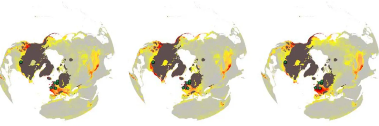
Combining a species distribution model and population genomics approaches we suggest that host characteristics, such as the genomic back- ground of individuals living in
We present data on transcriptional regulation in a shallow-water marine crustacean (Palaemonetes varians) at atmospheric and high HP following 168-h exposures at three
Clade A is composed of JMTV strains mainly isolated from Rhipicephalus microplus (originating from China, Guinea, and Brazil, with the Brazilian strains forming a distinct subclade)
Maps of species distribution models computed from Pl@ntNet data (based on p min (k max |x) = 70%) and of expert count data from the Inventaire National du Patrimoine Naturel
Figure 19: Hydrogrammes des débits observés et prévus avec les données Radar pour 11crues problématiques, TGR (Bleu : Débit observé ; Rouge : Débit prévu ; Vert : seuil de
