Estimating epikarst water storage by time-lapse surface-to-depth gravity measurements
16
0
0
Texte intégral
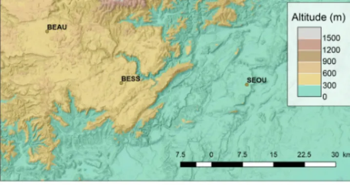
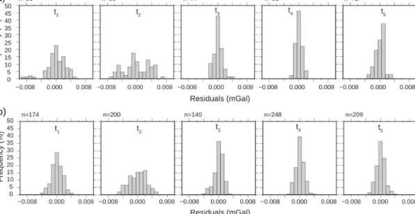
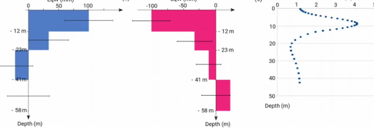
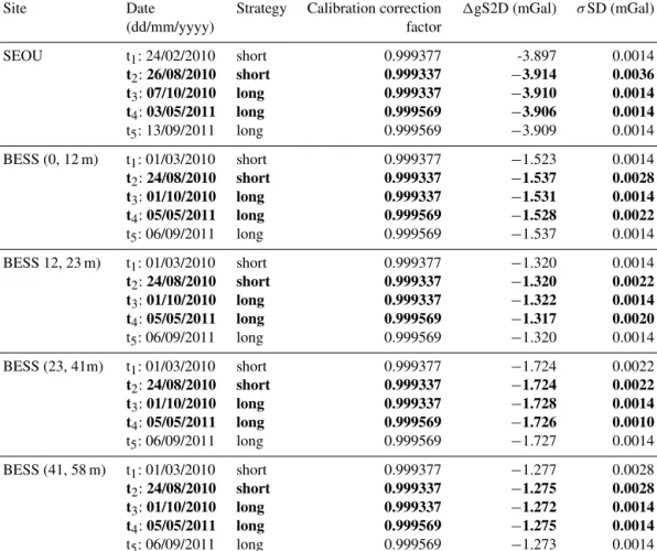
Figure


+4

Documents relatifs