Publisher’s version / Version de l'éditeur:
Vous avez des questions? Nous pouvons vous aider. Pour communiquer directement avec un auteur, consultez la
première page de la revue dans laquelle son article a été publié afin de trouver ses coordonnées. Si vous n’arrivez pas à les repérer, communiquez avec nous à PublicationsArchive-ArchivesPublications@nrc-cnrc.gc.ca.
Questions? Contact the NRC Publications Archive team at
PublicationsArchive-ArchivesPublications@nrc-cnrc.gc.ca. If you wish to email the authors directly, please see the first page of the publication for their contact information.
https://publications-cnrc.canada.ca/fra/droits
L’accès à ce site Web et l’utilisation de son contenu sont assujettis aux conditions présentées dans le site
LISEZ CES CONDITIONS ATTENTIVEMENT AVANT D’UTILISER CE SITE WEB.
Report (National Research Council of Canada. Division of Building Research), 1954-12-01
READ THESE TERMS AND CONDITIONS CAREFULLY BEFORE USING THIS WEBSITE.
https://nrc-publications.canada.ca/eng/copyright
NRC Publications Archive Record / Notice des Archives des publications du CNRC :
https://nrc-publications.canada.ca/eng/view/object/?id=a676f3ac-9937-4884-a3f0-90e1bd5ca27e https://publications-cnrc.canada.ca/fra/voir/objet/?id=a676f3ac-9937-4884-a3f0-90e1bd5ca27e
NRC Publications Archive
Archives des publications du CNRC
For the publisher’s version, please access the DOI link below./ Pour consulter la version de l’éditeur, utilisez le lien DOI ci-dessous.
https://doi.org/10.4224/20338243
Access and use of this website and the material on it are subject to the Terms and Conditions set forth at
Site Investigations at East Three: 1954
SITE INVESTIGATIONS AT EAST llHREE: 1954
by
R . J . E . Brown, G . H . J o h n s t o n , and J . A . P i h l a i n e n
_--P- -.-.-s,- " ..,,.
I
NA'T IONAL RESEARCH COUNCILi
CANADA I fI
!I
Y I P ? 1 i ? i 1 4i
4
i
I
iI
II
[1
f Ottawa December1954
--
A N A L Y Z E D ( p r e p a r e d f o r t h e Department of Northern A f f a i r s and N a t i o n a l ~ e s o u r c e s ) Report No.57
of t h e D i v i s i o n of B u i l d i n g ResearchPREFACE
During t h e summer of 1953, t h e Permafrost Research S t a t i o n of t h e D i v i s i o n of B u i l d i n g Research c a r r i e d out an e x t e n s i v e i n v e s t i g a t i o n of s o i l conditions
a t Aklavik, N .W .T. T h i s program was c a r r i e d out j o i n t l y w i t h t h e Department of Northern p f f a i r s and N a t i o n a l Resources I n c o n j u n c t i o n w i t h t h e c o n s t r u c t i o n of a ten-room s c h o o l and a n e i g h t - a p a r t m e n t t e a c h e r a g e . The i n v e s t i g a t i o n s r e v e a l e d t h a t t h e s o i l s i n Aklavik a r e s i l t s and f i n e sands w i t h e x t r e m e l y h i g h i c e c o n t e n t s making
c o n s t ~ u c t i o n c o s t l y . I n view of a l a r g e a n t i c i p a t e d
Government c o n s t r u c t i o n program a t Aklavik, t h i s i n f o r m a t i o n formed p a r t of t h e b a s i s f o r c o n s i d e r i n g t h e r e l o c a t i o n of t h e town,
A t t h e r e q u e s t of t h e Department of Northern A f f a i r s , pe-sonnel from t h e Permafrost Research S t a t i o n , t o g e t h e r w i t h o t h e r i n t e r e s t e d F e d e r a l d e p a r t m e n t s , formed a survey team t o g a t h e r f i e l d i n f o r m a t i o n d u r i n g 1954 on t h e p o s s i b i l i t y of l o c a t i n g a more s u i t a b l e t o w n s i t e i n t h e v i c i n i - t y of t h e Mackenzie R i v e r d e l t a . M r , C.L. M e r r i l l , Department of Northern A f f a i r s and N a t i o n a l Resources, was l e a d e r of t h e
t eam
.
A e r i a l photographs of t h e Mackenzie D e l t a were assembled i n t o u n c o n t r o l l e d mosaics by t h e D i v i s i o n d u r i n g J a n u a r y , 1954. Analyses of t h e photographs l o c a t e d s i x p o t e n t i a l t o w n s i t e a r e a s and t h e s e were i n v e s t i g a t e d i n t h e f i e l d from A p r i l t o J u l y . A f i e l d a p p r a i s a l of t h e p o t e n t i a l s i t e s e s t a b l i s h e d one on t h e e a s t s i d e of t h e Mackenzie R i v e r d e l t a (known as "East T h r e e " ) as t h e mast s a t i s f a c t o r y and f u r t h e r s o i l i n v e s t i g a t i o n s were c a r r i e d out t h e s e d u r i n g August and September.
The purpose of t h i s r e p o r t fs t o make a v a i l a b l e t o t h o s e a c t i v e l y engaged on t h e Aklavik R e l o c a t i o n P r o j e c t , a r e c o r d of d a t a c o l l e c t e d by Permafrost Research S t a t i o n p e r s o n n e l a t t h i s most s u i t a b l e of t h e s f t e s , E a s t Three. The r e p o r t i s concerned mainly w i t h s o l 1 and p e r m a f r o s t c o n d i t i o n s . I n f o r m a t i o n on o t h e r p h y s i c a l a s p e c t s of E a s t Three i s i n c l u d e d because of i t s i n t e r - r e l a t i o n s h i p w i t h t h e s o i l and p e r m a f r o s t c o n d i t i o n s o r because t h e d a t a were c o l l e c t e d on r e q u e s t by
"Permafrost" p e r s o n n e l .
Ottawa,
TABLE
OF CONTENTS Page 1.
Introduction...
1...
.
.
2 Exploratory Field Work Reconnaissance 33
.
Exploratory Field Work . Soil Sampling...
33.1 Borehole Locations
...
33 . 2 Test Pits
...
3
3.3 3oj.l Samples
...
4
3.4 Presentation of Data by Physical Units
...
4
...
.4.
Topographic Divisions Northern Flats5
4.1 Relief...
5
4 . 2 Drainage
...
5
4 0 3 Vegetation
...
6
4.4
Soils and Permafrost...
6
5
.
Topographic Divisions.
North Central Elevated Flats...
6
5.1 Relief
...
6
5.2
Drainage...
7
5.3
Vegetation...
85.
4
Soils and Permafrost...
9
...
.6
.
Topographic Divisions South Centra 1 Lowland 11 6.1 Relief...
116 0 2 Drainage
...
116.3 Vegetation
...
116
Soils and Permafrost...
117
.
Topographic Divisions . South Central Ridges...
12...
7.1 Relief 12 7.2 Drainage...
12...
7.3
vegetation 12...
7.4
Sof 1s and Permafrost 138
.
Topographic Divisions . Long Lake Flats and Ridges* 13 8.1 Relief...
138.2 Draf nage
...
148.3
Vegetation...
148.4
Soils and Permafrost...
15
9.
Topographic Divisions . Eastern Upland . . . o ~ o o o . o ~ . 16 9 - 1 Relief...
169 . 2 Drainage
...
179.3
Vegetation...
17
9.4
Soils and Permafrost...
18.
....
.
TABLE OF CONTENTS ( ~ o n t i n u e d )
Appendix A
-
Break-up ObservationsA 1, General D e s c r i p t i o n of I c e Movement
A 2 , D a i l y Log
A 3. Water Level Graph
Appendix B
-
T e s t P i t Logs and S o i l T e s t Summary S h e e t s B 1, S o i l Type B 2 , Gsaphisal S o i l Symbols B3 0
I c e S e g r e g a t i o n i n S o i l s B4 ,
Moisture Content ( I c e c o n t e n t ) B5.
Grain S i z e s B6,
P l a s t i c i t y B7.
S p e c i f i c G r a v i t y B 8, F i e l d Unit Weight B 9 . Organic T e r r a i nSITE INVESTIGATIONS AT EAST THREE: 1954
by R . J .E. Brown, G .H. J o h n s t o n , and J .A. P i h l a i n e n
The Mackenzie R i v e r d e l t a i s approximately 100 m i l e s l o n g and 50 m i l e s wide c o v e r i n g a n a r e a of more t h a n 5,000 s q u a r e m i l e s . Unlike a t y p i c a l d e l t a which f a n s o u t from i t s
s o u r c e , t h i s one i s long and narrow. The shape of t h e d e l t a i s c o n t r o l l e d by t h e a d j a c e n t upland and c u r v e s from t h e s o u t h t o t h e n o r t h w e s t . The west s i d e i s confined by t h e Richardson Mountains, a n o r t h e r n e x t e n s i o n of t h e Rocky Mountains. These mountains, which extend t o t h e northwest a r e predominantly
sandstone and s h a l e of Cretaceous Age, The e a s t s i d e i s confined by t h e Caribou H i l l s , morainic h i l l s , and e x t e n s i v e exposures of Palaeozoic l i m e s t o n e s , s a n d s t o n e s , and s h a l e .
A t t h e s o u t h e r n e x t r e m i t y of t h e d e l t a n e a r P o i n t S e p a r a t i o n , t h e Mackenzie R i v e r d i v i d e s i n t o t h r e e major
c h a n n e l s . The main o r middle channel f l o w s through t h e middle of t h e d e l t a , The E a s t Channel branches from t h e Middle Channel and f l o w s down t h e e a s t s i d e . The Peel C h a n n e l b r a n c h e s f r o m t h e Middle Channel and f l o w s down t h e west s i d e . Approximately
half-way t o t h e c o a s t , t h e Peel Channel becomes t h e West Channel. Aklavik i s s i t u a t e d on a s h a r p bend i n t h e Peel Channel t h r e e m i l e s upstream from t h e beginning of t h e West Channel. E a s t Thpee (68O 211 N , , 1 3 3 O 4 4 ' W . ) i s l o c a t e d on t h e E a s t Channel about t h e same l a t i t u d e a s Aklavik, It i s 35 m i l e s by a i r and 70 m i l e s by w a t e r from t h e s e t t l e m e n t ,
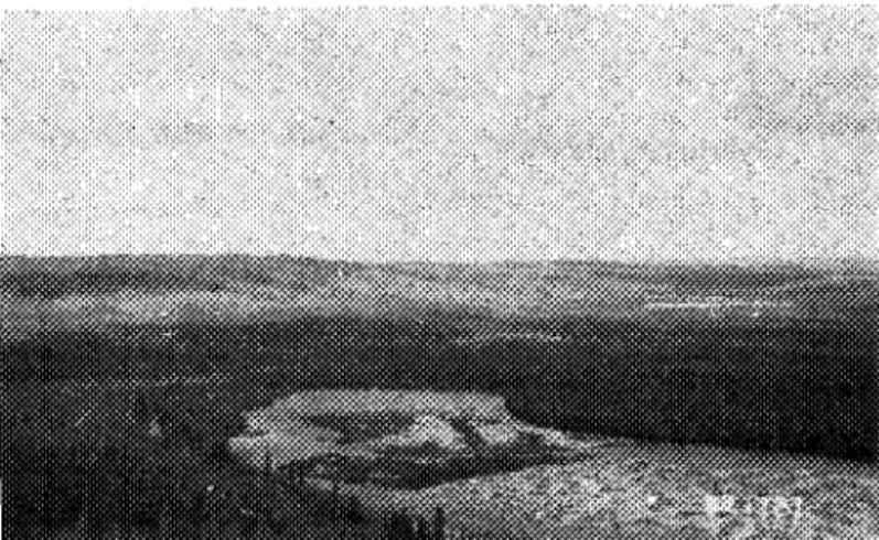
A t E a s t Three t h e r e i s an e x t e n s i v e a r e a of g l a c i a l l y d e p o s i t e d m a t e r i a l d i s p l a y i n g a v a r i e t y of landforms, South of E a s t Three a r e e x t e n s i v e a r e a s of Palaeozoic l i m e s t o n e s ,
sandstone^ and s h a l e s , which b o r d e r t h e e a s t s i d e of t h e
Mackenzie D e l t a . T h i s bedrock o u t c s ~ p s a s s t e e p b l u f f s on t h e n o r t h s h o r e of Dolomite Lake a few m i l e s e a s t of t h e s o u t h end of E a s t Three, These s e d i m e n t a r i e s a p p e a r t o d i p t o t h e n o r t h under t h e g l a c i a l d e p o s i t i o n and may e x e r t some t o p o g r a p h i c c o n t r o l on t h e landforms.
Fsom t h e edge of t h e d e l t a t h e a d j a c e n t upland r i s e s g e n t l y f o r 1 t o 1$ m i l e s . T h i s r e l a t i v e l y low a r e a i s bounded on t h e e a s t by a h i g h i n t e r i o r upland s i s l n g over 150 f e e t .
E a s t Three i s l o c a t e d on t h i s lower l e v e l of t h e country a d j a c e n t t o t h e d e l t a , I t s e a s t e r n boundary is d e l i n e a t e d by t h e s t e e p s l o p e t o t h e h i g h e r l a n d lhihich r o u g h l y p a r a l l e l s t h e edge of t h e d e l t a . The E a s t Three a r e a e x t e n d s g e n e r a l l y i n a northwest-to- s o u t h e a s t d i r e c t i o n on which t h e lar,dEcms a r e o r i e n t e d i n a n o r t h w e s t - t o - s o u t h e a s t and w e s t - t o - e a s t d i r e c t i o n , The g e n e r a l w e s t - t o - e a s t o r i e n t a t i o n of t h e l a k e s er~~plhasfzes t h i s c o n d i t f o n .
The r e l i e f of t h e a r e a i s one of f l a t s a t varying e l e v a t i o n s , g e n t l e u n d u l a t i o n s s e p a r a t e d by shallow swales, rounded k n o l l s , hmnocky h i l l s , and r i d g e s of v a r y i n g h e i g h t s and l e n g t h s .
E a s t Three i s d r a i n e d t o t h e west and northwest by s t r e a m s which emanate from deep g u l l i e s i n t h e h i g h i n t e r i o r upland. The d r a i n a g e i s c o n t r o l l e d by t h e r e l i e f e s p e c i a l l y i n t h e s o u t h p a r t of t h e a r e a where t h e s t r e a m s flow i n p a r a l l e l c o u r s e s between t h e r i d g e s . As a r u l e t h e r i d g e s , k n o l l s , and 1~'1dulations a r e w e l l d r a i n e d w h i l e some of t h e r e l a t i v e l y lower f l a t s a r e n o t ,
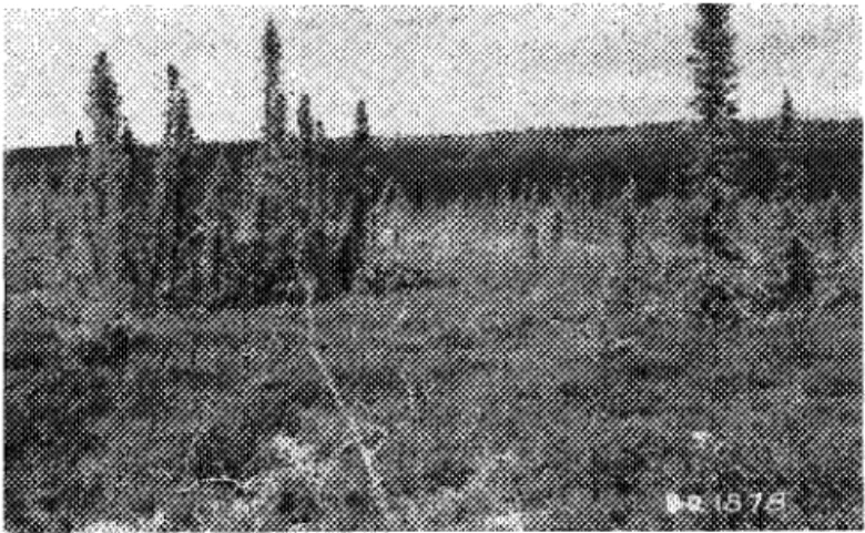
Spruce and b i r c h a r e t h e dominant t r e e t y p e s w i t h s e c o n d a ~ y s t a n d s of willow and a l d e r , The ground i s g e n e r a l l y h l m o c k y w i t h a v e g e t a t i v e c o v e r c f ground b i r c h , r e i n d e e r and
sphagqm moss, g r a s s t u s s o c k s , Labrador t e a 2nd b e r r y p l a n t s . B'rch predominates on t h e s o u t h - f a c l n g s l o p e s of t h e landforms
and on w e l l - d r a i n e d a r e a s . Spruce p-edaminates on t h e n o r t h - f a c i n g s l o p e s w h i l e s t u n t e d s p r u c e , willow, and a l d e r a r e found on more p o o r l y d r a i n e d a r e a s . Few t r e e s grow on low f l a t a r e a s e x c e p t a l o n g s t r e a m c o u r s e s where t h e ~ e a r e dense t h i c k e t s of willow and a l d e r .
A t E a s t Three, f r o z e n ground i s encountered from
6
i n c h e s t o4
f e e t3
i n c h e s below t h e ground s u r f a c e and i scovered by l i v i n g o r g a n i c m a t e r i a l 3 i n c h e s t o
9
i n c h e s i n d e p t h . S o i l s range from g l a c i a l t i l l ( s t o n y . s l L t y c l a y s w i t h v a r y i n g amounts of organic m a t e r i a l ) t o g ~ a v e l a , w l t h t h e f i n e - g r a i n e d mate-pi21 d e p o s j - t s b e i n g of g r e a t e ? exrsrt. The l a r g e s t d e p o s i t s of c o a r s e - g r a i n e d m a t e r i a l s ( s a n d s and g r a v e l s ) a r e found on t h e n o r t h e r n p o r t i o n of t h e s i t e immediately n o r t h of Boot Lake. T h i s a r e a i s thought t o be s u i t a b l e a s a t o w n s i t e l o c a t i o n w i t h Toom r o r expansion. Gravel d s p c a l t s a l o n g the east bank o t Tw.i.n Lake w i l l p r o v i d e much m a t e r l a l f o s f i l l , F u r t h e r deposS.tz. o? cosrse-graLned m a t e r i a l o c c u r , t o a l e s s e r e x t e n t , on and a d j a c e n t t o t h e proposed l o c a t i o n f o ~ t h e a i r s t y i p in t h e 3outhern p o r t i o n oft h e a r e a j u s t n o r t h of Long Lake.
F i n e r g r a i n e d s o i l s ( s t a n y s l l t c l a y s ) a r e found over t h e r e s t of t h e s l t e a r e a -- i n t h e r i d g e s and i n t h e lower a r e a s . They a l s o occur on p a r t of the propcsed a i r s t r i p a r e a . While t h e s e s o f l s a r e l e s s d e s i r a b l e a s f o u n d a t i o n m a t e r l a l no
s e r i o u s t r o u b l e should o c c u r i f p r o p e r c a r e i s e x e r c i s e d . The l i m e s t o n e o u t c r o p s on Dolomite Lake t o t h e e a s t could p r o v i d e s u f f i c i e n t good a g g r e g a t e f o ~ c o n c r e t e ,
Ice s e g r e g a t i o n i n t h e g r a v e l s does not a p p e a r t o be s i g n i f i c a n t . However, t h e i c e phase i n t h e s i l t s and s i l t c l a y s r a n g e s from t h i n l e n s e s t o d e p o s i t s up t,o 1 5 i n c h e s i n t h i c k n e s s .
S o i l and p e r m a f r o s t c o n d i t i o n s v a r y from p l a c e t o p l a c e over t h e E a s t Three a r e a . Some p o r t l ' m s of t h e a r e a w i l l n o t prove s u l t a b l e f o r c o n s t r u c t i o r ~ p u r p o s e s , o t h e r s w i l l be found t o be w e l l s u i t e d . On t h e whole, however, t h e E a s t T h r e e a r e a ahould prove s a t i s f a c t o r y ,
It was t h e o n l y one of t h e s i t e s i n v e s t i g a t e d which had a p p r e c i a b l e a r e a s of c o a r s e - g r a i n e d s o i l s . With c a r e f u l s i t e planning a l l t h e o b j e c t i o n s t o t h e p r e s e n t s i t e of
Aklavik should be a b s e n t when t h e new town i s b u i l t a t East Three.
2 . E x ~ l o r a t o r v F i e l d Work
-
ReconnaissanceI n view of t h e s h o r t f i e l d s s a s o n and t h e l a r g e a r e a s t h a t had t o be i n v e s t i g a t e d , e x p l o r a t o r y s o i l sampling was
ca,rried out a t r e p r e s e n t a t i v e p o r t i o n s of each p o t e n t i a l s i t e . A c c o r d i n g l y . .-econnaissance surveys, by a i r and f o o t
,
preceded e x p l o r a t o r y d r i l l i n g and s o i l sampling,3. E x p l o r a t o r y F i e l d Work
-
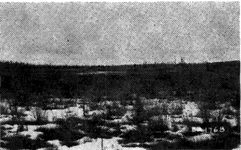
S o i l Samp1ixl.g 3 . 1 Aorehole LocationsA t E a s t Three, a s o i l expoau-e a t Twin Lake ( ~ i g .
7 )
suggested t h e presence of g r a n u l a r m a t e r i a l s i n t h e n o r t h e r n p o r t i o n of t h e s i t e . 'I'wo subsequen: d ~ i l l h o l e s confirmed t h e b e l i e f t h a t a n a r e a l a r g e enough f o r a t o w n s i t e had been l o c a t e d . S o i l sampling i n f r o z e n g r a v e l i s n o t p o s s i b f e w i t h t h e d ~ i l l r i g used and t h e h o l e s were abandoned a t t h % 13-foot d e p t h s b e f o r e any damage could be caused t o t h e Light r i g .3.2 Test P i t s
Having proved t h e presence of g r a n u l a r m a t e r i a l s , twenty-four t e s t p i t s were l o c a t e d a t anticipated c o n s t r u c t i o n a r e a s of t h e s i t e i n a n a t t e m p t t o map and s m p l e t h e s o i l s . T e s t p i t s weye n o t excavated on t h e 0 t ~ 5 . e - a r e a s because t h e
ground appeased t o be less s u i t a b l e f o r c o n s t ~ u c t i o n and because of t h e l a c k of time d u r i n g t h e 1954 F i e l d season.
While f o u n d a t i o n s normally extend t o d e p t h s below
5
f e e t , e n g i n e e r i n g problems i n a r e a s bccur w i t h i n t h e f i r s t 5 f e e t . Thus t h e m a j o ~ i t y of t h e t e s t p i t s on t h e E a s t Three s i t e were excavated t o a d e p t h of about5
f e e ta l t h o u g h s e v e r a l were continued below this d e p t h . The s u r f a c e dimensions of t h e t e s t p i t s averaged
5
by 7 f e e t .A t f i r s t t h e t e s t p i t s were advanced by merely removing t h e thawed s o i l p e r i o d i c a l l y . I n o r d e r t o b r i n g t h e t e s t p i t s t o a d e p t h of a t l e a s t 5 f e e t b e f o r e t h e season ended, t h e remaining few f e e t i n o u t s t a n d i n g p i t s were picked by l o c a l l a b o u r . A l l s o i l samples were shipped ts Noman Wells where t h e y were t e s t e d a t t h e s o i l mechanics l a b o r a t o r y of t h e Permafrost Research S t a t i o n .
3 . 3
S o i l SamplesR e p r e s e n t a t i v e samples f o r i d e n t i f i c a t i o n by s o i l t e s t i n g were t a k e n wherever t h e r e was a n a p p a r e n t change I n s o i l t y p e . "Moisture'! o r , t o be more c o r r e c t , ' ' i c e " c o n t e n t samgles were t a k e n e v e r y f o o t i n f r o z m g r ~ a n d where p o s s i b l e . Samples f o r " i c e " c o n t e n t determinatrf-clns sse e x t r e m e l y d i f f i c u l t
i f n o t i m p o s s i b l e t o o b t a i n i n c o a r s e - g a i n e d s o i l s .
The form of i c e s e g r e g a t i o n i n t h e s o i l s was of t h r e e b a s i c t y p e s :
(1) i c e which c o a t e d i n d i v i d u a l p a r t i c l e s ( w e l l bonded m a t e r i a l ) but was not n e c e s s a r i l y G i s c e r n i b l e t o t h e
eye ;
( 2 ) i c e l e n s e s r e g u l a r l y ( h o r i z o n t a l ) o r i r r e g u l a r l y ( h o r i z o n t a l , v e r t i c a l and d i a g o n a l l y t o g e t h e r )
o r i e n t e d i n t h e s o i l . These Tenses, dykes o r - v e i n s ranged i n s i z e from h a i r l i n e [H.L.) t o 2 i n c h e s ;
( 3 )
"massive" i c e i n t h e s o i l : a r b i t r a r i l y any i c ef o r m a t i o n s x c e e d i n g 2 in:.hes i:-A t h i c k n e s s was
c a l l e d "massive". These c c u l d b e , and were, o r i e n t e d i n a l l d i r e c t i o n s ,
An a e r i a l photograph of E a s t Three ( F i g . 1) shows t h e l o c a t i o n s of t h e v a r i o u s t e s t p i t s and b o s e h o l e s . A l o g of each t e s t p i t and a summary of s o i l t e s t i n g r e s u l t s from each p i t i s i n c l u d e d i n Appendix E.
3.4 P r e s e n t a t i o n of Data by P h y s i c a l LJnits
F o r t h e s a k e o f convenience and $ 6 s i m p l i f y t h e
p r e s e n t a t i o n of m a t e r i a l , t h e E a s t T h x e a x a h a s been d i v i d e d i n t o s e v e r a l t o p o g r a p h i c d l . v i s i o n s , Althoa.lgh t h e s e i s much v a r i e t y i n t h e landforms w i t h i n t h e area, i t h a s been p o s s i b l e t o d e l i n e a t e s i x d i v i s i o n s on t h e bas:s o f t h e c o n f i g u r a t i o n of t h e t e r r a i n . One of t h e s e divisions, t h e i n t e r l o r upland, forms t h e e a s t boundary of E a s t Three. T h e s i x d i v i s i o n s a r e :
Northern F l a t s , North C e n t r a l E l e v a t e d F P % t s u South C e n t r a l Lowland, South C e n t r a l Ridges, Long L ~ k e Fl.ats and Ridges, and E a s t e r n Upland. The f i r s t f-L,ve d i v i s i o r i s aFe l i s t e d i n o r d e r from n o r t h t o s o u t h , w h i l e t h e E a s t e r n Upland forms t h e e a s t e r n boundary of t h e s i t e a r e a . The name g i v e n t o e a c h d i v i s i o n d e s c r i b e s g e n e r a l l y i t s t o p o g r a p h i c appearance and p o s i t i o n w i t h r e s p e c t t o t h e o t h e r d i v i s i o n s . I n some c a s e s t h e t i 5 l e d e s c r i p t i o n can r e f e r o n l y t o t h e n u c l e u s of' t h e d i v i s i o n s i n c e most have i n t e r m e d i a t e a r e a s of t r a n s i t i o r l w i t h a d j z c e n t d i v i s i o n s . I n t h e s e i n s t a n c e s , t h e boundary i s a r b f t s a s l l y d e l i n e a t e d o n l y f o r t h e puypose of p r e s e n t i n g d a t a . ,
F i e l d d a t a w i l l be p r e s e n t e d under t h e s e s i x t o p o g r a p h i c d i v i s i o n s . A d e s c r i p t i o n of t h e topography, d r a i n a g e , and v e g e t a t i o n of e a c h d i v i s i o n i s p r e s e n t e d t o p r o v i d e a n
i n t r o d u c t i o n t o and t o c l a r i f y t h e s o i l s and p e r m a f r o s t
c o n d i t i o n s which a r e i n t e r - r e l a t e d wit.h t h e s e aforementioned f a c t o r s . An a t t e m p t h a s been made t o s i m a r i z e a l l t h i s
i n f o r m a t i o n on a n a e r i a l photograph and maps ( ~ i g s . 1 and 2 1 ) . D e t a i l e d i n f o r m a t i o n from which t h e maps were drawn i s i n t h e a p p e n d i c e s .
9.
P f v f s i o n s-
Northerr?. F l a t s 4 . 1 R e l i e fThe Northern F l a t s a r e t h e northernmost d i v i s i o n of E a s t Three. It i s a f l a t a r e a r i s i n g g e n t l y from t h e E a s t Channel and Mackenzie D e l t a which bounds t h e a r e a on t h e w e s t . To t h e e a s t t h e ayea i s bounded by t h e west s l o p e of t h e E a s t e r n Upland which r i s e s s h a r p l y from t h e s e f l a t s . To t h e n o r t n , t h i s upland s l o p e c u r v e s t o t h e northwest tgward t h e d e l t a and
e n c l o s e s t h e a r e a a p p r o x i m a t e l y
3$
m i l e s n o r t h of Twin Lake. To t h e s o u t h , t h e s e n o r t h e r n f l a t s mepge i n t o t h e u n d u l a t i n g upper l e v e l s of t h e North C e n t r a l E l e v a t e d F l a t s . There i s a low-lying e x t e n s i o n of t h e s e f l a t s e x t e n d i n g t o t h e ~ 0 ~ 1 t h between t h eNorth C e n t r a l E l e v a t e d F l a t s and E a s t e r n Upland which i s t e r m i n a t e d by Hidden Lake.
Tne g e n e r a l appearance of a f l a t a r e a r i s i n g g e n t l y from t h e E a s t Channel i s i n t e r r u p t e d by two low rounded k n o l l s , e a c h r i s i n g a p p r o x i m a t e l y 30 f e e t above t h e g e n e r a l l e v e l of t h e f l a t s . These k n o l l s a r e one m i l e a p a r t and a r e s e p a r a t e d by one
of t h e two major stream c o u r s ~ s which d r a l n t h e a r e a . The n o r t h e r n k n o l l i s a c t u a l l y a low rounded r i d g e o n e - t h i r d of a m i l e long
having a z o r t h w e s t - t o - s o u t h e a s t o r i e n t a t i o n . The only o t h e r l o c a l r e l i e f 1s some v e r y g e n t l e undulations a t t h e west edge of t h e f l a t s a l o n g t h e East Channel.
4 . 2 Drainage
Because of t h e g e n t l e downgrade from east-to-west t o t h e d e l t a , s u r f a c e d r a i n a g e i s a c r o s s t h e f l a t s i n t h i s downslope d i r e c t i o n . There a r e two main s t r e a m s a p p r o x i m a t e l y 1* m i l e s a p a r t emanating from deep V-shaped g u l l i e s i n t h e E a s t e r n Upland t o t h e e a s t , which f l o w a c r o s s t h e f l a t s t o t h e d e l t a , p r o v i d i n g d r a i n a g e f o r most of t h e a r e a . It a p p e a r s t h a t t h e l o s s i n v e l o c i t y when t h e s t r e a m s emerge from t h e g u l l i e s h a s been s u f f i c i e n t t o
b u i l d up e x t e n s i v e " a l l u v i a l f a n - l i k e " d e p o s i t s . These f a n - l i k e a r e a s which merge i m p e r c e p t i b l y w i t h t h e g e n e r a l f l a t a r e a , a r e more c l e a r l y d e f i n e d from t h e a i r . The main flow of w a t e r o c c u r s d u r i n g s p r i n g breakup and t h e s t r e a m s a r e reduced t o a t r i c k l e i n t h e summer. As a r e s u l t , downcutting i s slow and t h e s t r e a m eoupses a r e only a few f e e t i n d e p t h and w i d t h .
To t h e s o u t h of t h e s e two major s t r e a m s a r e two s m a l l e r c r e e k s emanating from t h e E a s t e r n Upland.
4 . 3 V e g e t a t i o n
Throughout t h e f l a t s , e x c e p t on t h e a l l u v i a l f a n - l i k e a r e a of t h e two major s t r e a m s , s c a t t e r e d growths of w h i t e s p r u c e predominate. Low willow and a l d e r scrub,and ground b i r c h ? ~ p t o
4
f e e t h i g h i n s c a t t e r e d clumps form t h e underbrush. I n t h e e x t e n s i o n of t h e f l a t s between t h e North C e n t r a l E l e v a t e d F l a t s and t h e E a s t e r n Upland t h e r e a r e dense s t a n d s of s p i n d l y s p r u c e w i t h a willow and a l d e r underbrush. The ground v e g e t a t i o n i s predominantly r e i n d e e r moss and g r a s s t u s s o c k s growing onhummocks 2 f e e t h i g h . Other ground p l a n t s i n c l u d e Labrador t e a and v a ~ i o u s b e r r y p l a n t s .
On t h e a l l u v i a l f a n - l i k e d e p o s i t s of t h e two major s t r e a m c o u r s e s , t h e v e g e t a t i o n i s s c r u b willow and a l d e r i n
s c a t t e r e d s t a n d s i n t e r m i x e d w i t h ground b i r c h . The ground c o v e r i s r e i n d e e r moss and g r a s s . There a r e many polygonal c r a c k s and f r o s t b o i l s .
B i r c h up t o 25 f e e t h i g h w i t h s c a t t e r e d s p r u c e up t o 3 O f e e t h i g h a r e found on t h e s o u t h - f a c i n g s l o p e s of t h e low k i i o l l and ~ i d g e . On t h e n o r t h - f a c i n g s l o p e s t h e r e i s mixed s p r u c e and b i r c h . The d i a m e t e r s of t h e t r e e t r u n k s a v e r a g e 6 t o 9 i n c h e s a t b r e a s t - h e i g h t .
4 . 4 S o i l s and Permafrost
The Northern F l a t s were a p p r a i s e d i n t h e f i e l d as
u n s u i t a b l e f o r c o n s t r u c t i o n and t h u s o n l y a c u r s o r y examinatior* w a s made. No b o r e h o l e s o r t e s t p i t s were l o c a t e d i n t h i s a r e a
s o t h a t s o i l s and p e r m a f r o s t i n f o r m a t i o n i s l i m i t e d t o i n f e r e n c e from v e g e t a t i o n and t e r r a i n n o t e s .
The e x t e n s i v e a l l u v i a l f a n - l i k e d e p o s i t s emanating f r m t h e F a s t e r n Upiand a r e t3. '?Ti" t o be f i n e - g r a i n e d s o i l s , silts and s i l t c l a y s , w i t h v a r y i n g amounts of o r g a n i c m a t e r i a l .
I n t e n s i v e f r o s t a c t i o n as evidenced by polygonal c r a c k s and f r c s t b o i l s i n t h e a r e a a r e g e n e r a l l y i n d i c a t i v e of f i n e r - g r a i n e d
m a t e r i a l s . The d e p t h t ( c ! f r o z e n ground v a r i e s from
3
f e e t 2.3 areas~ ~ 7 3 t h l i t t l e v e g e t a t i v e coTrer, t o 1 2 o r 18 i n c h e s i n moss eovered a y e a s ( h u g u s t 27 1.954) 8
5 , Topographic D i v i s i o n s
-
North C e n t r a l E l e v a t e d F l a t s 5 . 1 R e l i e fT h i s i s one of t h e most c l e a r l y d e f i n e d d i v i s i o n s of
t h e s i t e a r e a . To t h e n o r t h , j u s t n o r t h of Twin Lake, a r e t h ~ Northern F l a t s . To t h e e a s t i s t h e E a s t e r n Upland r i s i n g from t h e e a s t s h o r e of Hidden Lake. To t h e s o u t h i s Boot Lake V a l l e y which p r o v i d e s t h e most d i s t i n c t boundary l i n e . To t h e west i s t h e E a s t Channel and Mackenzie D e l t a .
There a r e two g e n e r a l l e v e l s which a r e e l e v a t e d above t h e l e v e l of t h e d e l t a and t h e Northern F l a t s . They a r e n o t a s h i g h a s t h e E a s t e r n Upland, however9 but a c t a s a s e r i e s of s t e p s from t h e d e l t a t o t h i s h i g h a r e a ,
The lower l e v e l i s a p p r o x i m a t e l y 60 f e e t above Boot Lake and t h e l e v e l of t h e d e l t a . The s o u t h e r n s l o p e down t o t h e l a k e i s approximately 20 d e g r e e s . F-am t h e t o p of t h i s s l o p e t h e r e i s a n almost i m p e r c e p t i b l e d o w n g r ~ d e t o t h e n o r t h .
There a r e t h r e e p a r a l l e l rounded r i d g e s and k n o l l s whose t o p s a r e a t t h e same l e v g l a s t h e l c w e ~ f l a t , These
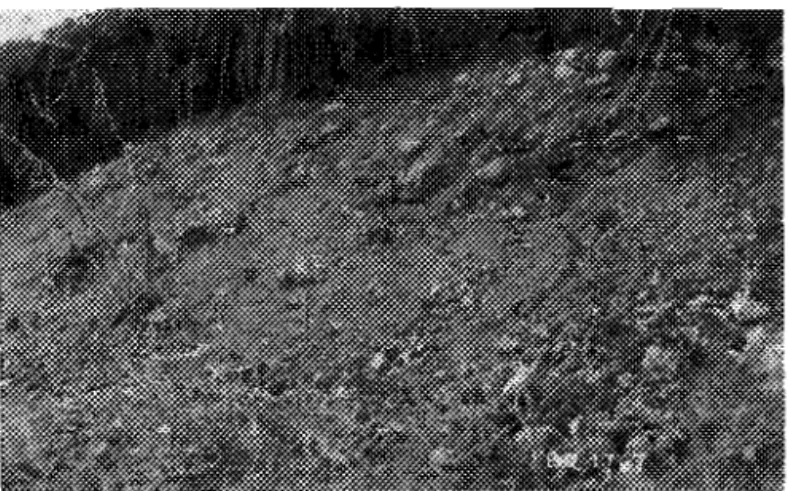
r l d g e s and k a o l l s l i e between t h e f l a t and t h e d e l t a t o t h o w e s t . The r i d g e 8 have a g e n e r a l e a s t - t o - w e s t o r i e n t a t i o n . The solathern r i d g e e x t e n d s t o t h e d e l t a between Boot. Lake and Twin Lake,, The c e n t r e r i d g e e x t e n d s t o t h e s o u t h end of t k e :?orth h a l f of Twin Lake. The exposed bank o f s o i l h e r e g i v e s a c r o s s - s e c t i o n of t h e r i d g e , The n o ~ t h e s q ~ i d g e e x t e n d s t o t h e n o r t h end of t h e n o r t h h a l f of Twin Lake whose c r o s s - s e c t l o n i s r e v e a l e d i n t h e exposed banks of s o i l h e s e . These ~ l d g e s
and k n o l i s a r e s e p a r a t e d by s w a l e s , t h e most prominent of which i s t h e d e p r e s s i o n e x t e n d i n g s o u t h e a s t from Twin Lake. These
r l d g e s a r e ~ o t c o n t i n u o u s w i t h t h e lower f l a t but a r e i n t e r r u p t e d by sbal33w swales and d e p r e s s i o n s .
The upper level. t o t h e n o r t h e a s t i . s approximately 40 feet above t h e lower f l a t . It i s n o t f l a t and l e v e l n o r a s c l e a r l y d e f i x d b u t c o n s i s t s of t h r e e p a r a l l e l . subdued and rounded
~ n d u . l a t i a n s e x t e n d i n g from t h e s o u t h e a s t t o t h e n o r t h w e s t . There i s a c o n t i n u a l d r o p i n e l e v a t i o n t O t h e northwest where t h e s e
u n d u l a t i o n s merge w i t h t h e Northern F l a t s n o r t h of Twln Lake. Between t h e undu2ations a r e wide shallow s w a 1 . e ~ appsoxlrnately
20 f e e t deep. To t h e n o r t h of Hidden Lake and. b o r d e r i n g the ?as% edge of t h i s second upper l e v e l a r e s e v e r a l p-oml,ner_t k-rlolls
approximately
50
f e e t above t h e g e n e r a l l e v e l w l t h side s l o p e s of 30 d e g r e e s . E a s t of t h e lo we^ f l a t t h e s i d e of Boot Gulley r i s e s c o n t i n u o u s l y f o r 100 f e e t t o t h e second eleva2ed leve:.5.2 Drainage
The main f e a t u r e i s t h e l s c k of w e l l - d e f i n e d stream c o u r s e s . During t h e s p r i n g t:gcuk I* m e l t w a t e r i s c a r r i e d In
r i v u l e t s which flow through t h e marly s l a a l 2 9 w swales down t o t3?.e
d e l t a . The most prominent s t r e a m f l o w s I n t o t h e s o u t h ha:? of Twin Lake through t h e depressiora b e t w e ~ n the s ~ u t h agd c e n t r a l r i d g e s e x t e n d i n g from t h e lower e l e v a t e d f l a t ,
N o r t h e a s t of 'Twin Lake i n t h e shallow swalea bezweer, t h e low u n d u l a t i o n on t h e upper f l a t s t F ~ e - 2 ape polygoEal f i s s u r e s a ~ r r o x i m a t e l y 1$ f e e t wide and 2 f e e t deep. Dusing
s p r i n & bl?l-:.~i;,.:.-~ Lhese a r e f l . l l e d w i t h wa.te? .tlcwing downsispe t o t h e nortk.west. On t h e lower f l a t , , s p r l n g me?t,water s t 2 y s t.h?
s c a t t e ~ e d polvgonal c r a c k s and I n t,he depress'ons between t.he
h ~ m o c k s urt.21 semcved by s u r f a c e e v a p o r a t i . ? n , A srn.al-2. stagnant. l a k e a p p r s x i m a t e l y 200 f e e t i n d.i.ameter a t t h e e a s t end 0% t h e
Hidden Lake, between t h e e a s t boundary of t h 3 s e c o r d
l e v e l and t h e E a s t e r n Upland, has a small catchment basin ar.d does n o t a p p e a r t o have any o u t l e t .
5.3
V e g e t a t i o nOr! t h e lower e l e v a t e d f l a t and k ~ o l l s and r i d g e s t~ t h e west between t h e f l a t and t h e E a s t Channel., t h e t r e e s a s e
mixed spruce and b i r c h i n open s t a n d s , The s p r u c e r e a c h a
maximum dlarneter of
9
i n c h e s a t b r e a s t - h e i g h t . The b l r c h , witha v e r a g e t - w k d i a m e t e r s of 6 i n c h e s , r e a c h a maximum height o f
30 f e e t . There a r e s e v e r a l c h a r r e d s t l m p s i n d i c a t i v e ~ f " C ~ m e y burns. I n t e r s p e r s e d w i t h t h e s p r u c e and b i r c h a s e s 2 a t t e ~ e d willow and a l d e r . The ground cover c o n s i s t s of r e d and gseen
s2hagnum moss, Labrador t e a , b e r r y p l a n t s and i s o l a t e d p a t c h e s of r e i n d e e r moss and g r a s s t u s s o c k s . Hummocks up t o 1 f o o t h i g b occur i n s c a t t e r e d a r e a s . There i s sedge and g r a s s growLng F ~ o m
t h e b o t t ~ m o f t h e s t a g n a n t l a k e on t h e lower f l a t .
Willow t h i c k e t up t o 12 f e e t h i g h grows on t h e lower p a r t of t h e s l o p e from Boot Lake. F u r t h e r up t h e s l o p e t h e r e i s mixed s p r u c e and b i r c h which i s c o n t i n u o u s w i t h t h e t s e e v e g e t a t i o n on t h e f l a t . The g r a v e l l y banks on Twin Lake a t t h e west end of t h e r i d g e s e x t e n d i n g f ~ o n t h e lower f l a t s u p p o ~ t gr?wt,h of s c a t t e r e d willow t h i c k e t and a few b i r c h t r e e s . T k s e i s a d e m e willow t h i c k e t approximately 10 f e e t h i g h i n t h e
d e p r e s s i o n e x t e n d i n g s o u t h e a s t from t h e s o u t h h a l f of Twin Lake, T h i s willow growth e x t e n d s n o r t h a l o n g t h e e a s t s h o r e of t h e
l a k e where t h e r e i s a s m a l l s t a n d o r s p r u c e 60 f e e t h i g h .
On t h e second e l e v a t e d l e v e l , t h e vegetation mixed
s p r u c e and b i r c h up t o 30 f e e t h i g h w i t h
5
t o 10 f e e t b e t w ~ e r , i n d i v i d u a l t r e e s , and willow and a l d e r , and grourld b i r c hundergrowth. The ground i s hummocky w i t h a v e g e t a t i v e e w e r + 0%
g r e e n sphagnum and r e i n d e e r moss, Labrador t ? a arAd b e r ~ y p l a n t s , There a s e c h a r r e d stumps and s t i c k s i n d i c a t i r i g a f o m e r bu,-!~-,.
I n t h e polygonal c r a c k s i n t h e shallow swales a t t,he
northwest end of t h e second l e v e l t h e r e a r e l i n e s of w l l l ~ w t h i c k e t . The r a i s e d c e n t r e s of t h e a r e a s e n c l o s e d by t h e s e c r a c k s a r e devoid of t r e e growth. Toward +he rlo~';hwest tk?? i n d i v i d u a l polygonal a r e a s become l a r g ? r and t h ? c e n t r e s more hummocky.
Spruce w i t h some b i r c h and s c a t f 2 2 e d clumps of willow and a l d e r t h i c k e t grow on t h e t o p s of t h e h2gh p ~ o m i n e n t k n o l l s ~ o r t h w e s t of Hidden Lake. On t h e s l o p e s b i r c h p~.?dornfnat.es w t t t r
some s p r u c e up t o 40 f e e t h i g h .
The t r e e v e g e t a t i o n of t h e No-th C e n t r a l E1,evsted F l a t s can be d e s c r i b e d under f o u r d i v i s i o n s . Mixed conifelslous-deciduous. a s s o c i a t i o r - of' spruce and b i r c h w 1 t . h s c a t ' t e ~ e d w l . l . 3 . ~ ~ and a l d . e r
t h i . c k e t grows OP. t h e e l e v a t e d l e v e l s . Ths t r e e s on t h e sle:qea ase
mostly b i r c h w i t h s c a t t e r e d s p r u c e , wj.llow, and a l d e r . Sturltsd s p r u c e predominates on t h e lower more pocrs1.y drained. a r e e s w i t h s c a t t e r e d b i r c h , willow, and a l d e r . Dense willow and a l d e r thl.clset
5 . 4 S o i l s and P e r m a f r o s t
The f i r s t e x p l o r a t i o n work on t h e E a s t Three s i t e was c e n t r e d i n t h i s a r e a . When t h e two b o r e h o l e s ( A R 26 and AB 2 7 )
a s w e l l as t e s t p i t AX 8 d i s c l o s e d t h e e x i s t e n c e of g r a v e l l y m a t e , ~ l a l s ; f u r t h e r t e s t p i t s were e x c a v a t e d i n t h e a r e a t o o b t a i n a d d i t i o n a l . f n f o r m a t i o n on the d i s t r l . b u t S o n of t h e g r a n u l a r d e p c s F t s . ExaninatSon o f s o i l t e s t i n g r e s u l t s , f i e i d n o t e s and l c c a t i o n of t.hs t e s t p i t . % s u g g e s t s t h a t s i m i l a r s o i l c o n d i t i o n s o c c u r f n t h r e e aubdlv3.s.9~?.:3 of t h e a r e a : f . a, l.-me: i l a t
-
p o t e n t i a l t o w n s i t 2 a r e a . ( b ; upper f l s t-
p o t e n t i a l a i r s t r i p a r e a #1 ( c ) rTdges and s w a l e s . (a) L m e F F l a tBor3bole AB 26 and t e s t p i t s AX 10, 11, and 23 were locat.ed on t:he lower f l a t which is t h e a r e a j u s t n o r t h of Boot Lake. A we73.-graded sandy g r a v e l was covored by v a ~ y i n g d e p t h s of' d e c o m p ~ s e d and undecom c s e d organ1.c ma.teria1
(4
i n c h e s in AX 11 t.o 13 f e e t ir. AX 237. The d e p t h t o f r o z e n ground rangedf ~ o m 5 i.;l.?hea t o 28 i n c h e s below t h e ground s u r f a c e ( ~ u g i ~ s t 1, 1 9 5 4 ) . The g r a v e l was p r ~ d o m i n a n t l y w e l l bonded by i c e a l t h o u g h nc: i c e
w a s di_sce.rnible. I c e segregation i n t h e o r g a n i c and s i l t y c o v e r m a t e r l a l ~ s n g o d from i r r e g u 1 a r l . y o r i e n t e d i e r i s e s , h a i r l i n e t o
4
i n c h t%.i.ck ( A X 1 0 ) t o i r r e g u l a r l y or'le.n+;ed n a s s i v e i c e 8 i n c h e s t h i c k (AX 23), No samples were t a k e n f-om t h e g r a v e l f o r m o i s t u r e
( i c e ) c o n t e n t d e t e m i n a t l . o n s b u t s e v e r a l were t a k e n f ~ o m t h e o v e r l y l . n g n?.aterlal
.
Mois5ure c o n t e n t s ( b y weigh.t.) ranged f r o m60 p e r ?.era? i:Sn t h e san.dy e.i!!t) t o 1.,5(2C per sent.* (in t h e decoxr.posn.3 o r g a r ~ l . ~ ma-~e-!.al :I ,
( b )
-
3 p p e r P l a tS w e x a l p i t s ( A X 1 2 , 13,
14,
aad 31.) were dug or2 t h ?l o ~ g rY.c-gew ( u p p e r l e v e l ) on t h e n o r t h e s s t s i d e a? t h i s H o r t h C e n t r a l E l e v a t e d F l a t s r e g i o n . The sell was f r c z e n i ~ 9 X e d f a t e l y
below t h e l l v e a o s s c o v e r of
4
i n c h e s to 1.2 i,ri.ches ( ~ u g u s t 2 5 , 1 9 5 4 ) . Random s t o r ~ e s up t o 1 i n c h i~ d i a m e t e ? weye s . c a t t e r e c ! through3utthe greyl.sEz brown s i l t y c l a y matezaial. R o , r i t n , t w i g s arid s t r e a k s of b l a c k o s g a n i c m a t e r i a l were e v i d e n t t h r o u g h o u t t h e d s p t k of t h e p i t . Jse s e g ~ e g a t . i o n in a 1 1 h o l e s r w g e d from m a t e r i a l v~el.1 bonded by :Lee ( i c e n o t d i s c e r n i b l e by e y e ) t o 2 s r e g u l a r l . y c r i ~ n f e d l&-in<:.h t h l . c k i c e l e n s e s . Massive i - e f s o m 1 foot. t.c 1* f e e t ,
t h i c k was fo1m.d a p p r o x i m a t e l y 2$ f e e t below t3he s u r f a c e . Rep-eseK- t a t i v e m o 1 3 t 7 ~ . r e c o ~ t e n t s ranged fr-OP,
40
p e r cc;'~.t $ 0 260 I;er c.en'Cmrlth. ,an a v e r a g e v ~ l . ~ e cf a b m t 95 p e r c ~ n t ; . The h i g h e r m ~ f s t - ~ l r e c o n t e n t c s c u r r e d w i t h i n t h e f i r s t . 2 f e e t a ~ d v a . l ? ~ e s d e c r c a s 2 d
general-lg w l t h d e p t h .
+ Moistux8e conT.ents o r a weigh^ D a s l a 1.2 c r g a r ~ i c m a t e r i a l t e n d
tr=: give e x a g g e ~ a t - e d r e s u l t s becau.je o f t h e rnluch l o w e r speci!;'lr:
grs7it.g of crga?.lc m a t e r i a l . On a vol-d'~!e Sasis t h e mois%ure
c n n t e n t o f t,ke m g a n i c s o i l would be a p p r o x i m a t e l y o n e - h s l f of 1t.s v a l a e on a weight b a s i s .
( c ) Ridges and Swales
The r e l a t i v e l y s h o r t r i d g e which r u n s i n t o t h e c e n t r e of t h e Twin Lake i n a n o r t h w e s t - s o u t h e a s t d i r e c t i o n exposed a g r a v e l l y m a t e r i a l on t h e e a s t bank of t h e l a k e . Samples t a k e n
from two t e s t p i t s on t h i s r i d e ( A X 8 on t h e northwest end exposure and AX 22 on t h e s o u t h e a s t end7 showed t h o m a t e r i a l t o be predorni- n a n t l y a well-graded sandy g r a v e l w i t h an o c c a s i o n a l l a y e r of
b r o w ~ i s h g r e y sandy s i l t 1 f o o t t h i c k , No f r o z e n m a t e r i a l was encourtered i n AX 8 because i t was d r y i n a n a t u r a l exposure. However, f r o z e n ground o c c u r r e d from
8
i n c h e s t o 1 5 i n c h e s below t h e s u r f a c e in AX 22, depending on t h e d e p t h of moss cover(August 13, 1 9 5 4 ) . I r r e g u l a r l y o r i e n t e d i c e l e n s e s up t o
$
i n c h t h i c k were s c a t t e r e d t h r o u g h t h e f i n e s m z t e r i a l i n t h i s p i t . The c o a r s e r m a t e r i a l ( s t o n e s ) were c o a t e d w i t h i c e up t o 1/16 i n c h Thick. Moisture c o n t e n t s may be e x p e c t e d t o a v e r a g e about 50 p e r c e n t ( b y w e i g h t ) ,,Although no samples were t a k e n i n b o r e h o l e AB 27 i t proved t h e e x i s t e n c e of g r a v e l l y m a t e r i a l i n t h e r i d g e which e x t e n d s t o t h e E a s t Channel j u s t s o u t h of t h e Twin Lake. Many s t o n e s made d r i l l i n g d i f f i c u l t i n t h i s h o l e snd wash-water
d e p o s i t e d m a t e r i a l appeared t o be a s i l t y w n d . A channel exposure of t h i s r i d g e c o ~ f i r m e d t h e p r e s e n c e cf t h e s e s o i l s .
T e s t p i t AX 21 was e x c a v a t e d Ln a 3wq.le between t h e s e two p r e v i o u s l y d e s c r i b e d r i d g e s . The s o i l was predominantly a g r e y c l a y e y s i l t c o n t a i n i n g many rol-wdec? t o s u b a n g u l a r s t o n e s r a n g i n g i n s i z e up t o 5 i n c h e s iri d i a r n e f e ~ , F r ~ z e n ground was encountered a p p r o x i m a t e l y 12 i n c h e s bslors t h e gnolmd s u r f a c e
( ~ u g u s t 13, 1 9 5 4 ) . Moisture c o n t e n t s ( b y weight; sanged from
35
p e r ce.nt t o75
p e r c e n t , t h e s o i l cm.t.a-'.;rtl,ng i s r e g ~ l l a r l y o r i e n t e d i c e l e n s e s up t o$
i n c h t h i c k .T e s t p i t AX was l o c a t e d on a Low r i d g e between AB 27 and t h e lower f l a t .
Frozen
7
round was b s t w e x
9
m c h e s and2 3 i n c h e s below t h e s u r f a c e July
25,
1954; The s o i l i n t h i s p i t was predominantly a s i l t y f i n e sand w i t h o c c a s i o n a l s t r e a k s of b l a c k t o brown o r g a n i c m a t e r i a l o Many s t o n e s up t o 6 i n c h e s i n d i a m e t e r l a y immediately below t h e moss cgves which v a r i e d from 4 i n c h e s t o 14 i n c h e s i n d e p t h . Some of t h e s t o n e s were c o a t e d w i t h a t h i n l a y e r of i c e . The s i l t y sand c ~ n t a i n e d h o r i z o n t a l i c el e n s e s from h a i r l i n e s i z e t o 1,116 i n c h t h i c k , Massive i c e 1 f o o t t h i c k was encountered a t a d e p t h of 4 f e e t 8 i n c h e s and was coritir,u ous from
6
f e e t7
i n c h e s t o t h e bottom of t h e p i t a t 8 f e e t5
i n c h e s . M o i s t u ~ e c o n t e n t s ( b y w e i g h t ) v a r i e d from 30 p e r c e n t t o 85 p e r c e r i tb u t averaged 55 p e r c e n t .
I n summary t h e lower f l a t and w e s t e s n r i d g e p o r t i o n of t h e North C e n t r a l E l e v a t e d F l a t s a r e grsded g r a n u l a r d e p o s i t s w i t h a v a r y i n g o r g a n i c c o v e r , The upper flat r e g i o n 2s composed
6 .
Topographic D i v i s i o n s----
-
South C e n t r a l Lowland----
6 . 1 R e l i e fT h i s i s a low f l a t a r e a e x t e n d i n g s o u t h e a s t from Boot Lake. A t t h e n o r t h edge of t h i s f l a t i s a group of low rounded k n o l l s r i s i n g 15 t o 2 0 f e e t above the l e v e l of t h e fiat To t h e n o r t h of t h e s e k n o l l s a r e low k n o l l s and s h o r t r i d g e s e x t e n d i n g a l o n g t h e s o u t h e a s t s h o r e of Boot Lake r i s i n g 60 f e e t above t h e l a k e l e v e l and 30 f e e t above t h e l e v e l of t h e f l a t t o t h e s o u t h . T h i s s o u t h c e n t r a l lowland a r e a i s bounded on t h e e z s t b y t h e E a s t e r n Upland.
G e n e r a l l y t h e d r a i n a g e i s t o t h e s o u t h away from Boot Lake. The k n o l l s and r i d g e s a r e w e l l d r a i n e d but t h e low f l a t a r e a between them and t h e two l a k e s a t t h e s o u t h e a s t end a r e p o o r l y d r a i n e d . S p r i n g m e l t w a t e r s t a y s i n t h e i n t e r s t i c e s
of t h e many polygons i n t h i s a r e a because of t h e poor d ~ a i n a g e c o n d i t i o n s .
6
- 3 V e g e t a t i o nS c a t t e r e d s t u n t e d s p r u c e grows on t h e low f l a t a r e a . The groursd v e g e t a t i o n i s predominantly r e i r ~ d e e r moss w i t h
p a t c h e s of sphagnum moss, Labrador t e a s k)ePFy p l a t s , and g-ass t u s s o c k s . The ground hummocks r e a c h a h e i g h t of 2 f e e t w i t h t h e d e p r e s s i o n s between t h e hummocks v a r y i n g i n w i d t h from a few i n c h e s t o s e v e r a l f e e t .
Dense spruc2 completely c o v s ~ s t h e low rounded h o l i u a t t h e n o r t h end of t h e low f l a t c r e a t i n g a s h a r p c o n t ~ a s t i n
v e g e t a t i o n w i t h t h e s p a r s e t r e e growth on t h e f l a t . B i ~ c h
predominates on t h e s l o p e s of t h e low h i l l s b o r d e r i n g t h e s o t ~ t h s h o r e of Boot Lake, w h i l e mixed s p r u c e a ~ ~ d b i r c h grow on t h e t o p s .
6.4 S o i l s and Permafrost
No e x p l o r a t o r y s o i l i n v e s t i g a t i o n s were c a r r i e d out i ~ , t h e South C e n t r a l Lowland. From an examination of t h e a e r i a l
photographs and s e v e r a l r e c o n n a i s s a n c e t r i p s t h e a r e a s a d j a c e n t t o t h e n o r t h and s o u t h s h o r e s of Boot Lake a p p e a r s i m i l a r . The
low a r e a s s u r r o u n d i n g t h e s m a l l k n o l l s a r e r e l a t i v e l y h i g h e r tha;? t h e d e l t a . Large polygons a r e e v i d e n t i c t h e s e lower a r e a s w i t h f r o z e n ground approximately
15
i n c h e s below t h e i r c e n t r e s( J U I . ~ 24, 1 9 5 4 ) .
Although t h e a r e a i s low and was a p p r a i s e d i n t h e f i e l d a s u n s u i t a b l e , t h e c h a r a c t e r i s t i c s of t h e s u r r o u n d i n g t e ~ s a l r '
( e . g . , n o r t h of Boot ~ a k e ) s u g g e s t t h a t b e t t e r s o i l c o n d i t i ~ n s may e x i s t . E x p l o r a t o r y work should be c a r r i e d out s i n c e i t s
l o c a t i o n i s important both from t h e p o i n t of view of a c c e s s and p o s s i b l e f u t u r e expansion.
7 . Topographic Di.visions
-
South Central. Rldges7 . 1
R e l i e fThe South C e n t r a l Ridges a r e a p a r a l l e l s e r i e s of r i d g e s oF v a r y i n g h e i g h t e x t e n d i n g I n a s w ~ t h e a s t - t o - n o r t h w e a t d i r e c t i o n from Long Lake t o t h e d e l t a whZch bounds t h e west s i d e of t h e a r e a . The r i d g e s a r e h i g h e a t and most p r s n o w c e d i n t h p n o r t h where t h i s a r e z b o r d e r s t h e E a s t e r n Upland and SOU$? C e n t r a l Lowland. To t h e s o u t h t h e y become more subdued and i n d i s t i x t i n t h e t r a n s i t i o n zone betwoen t h i s a r e a and t h e
e l o r ~ g a t e d p l a t s and r i d g e s t o t h a e 3 s t
The most prominent r i d g e i s approximately
80
f e e t h i g h e x t e n d i n g from t h e d e l t a a l o n g t h e n o r t h s h o r e of Lake"B"
toward Long Lake f o r a t o t a l d i s t a n c e of 2 m i l e s , It i s breached by a ~ t ~ e a m f l o w i n g i n t o t h e n o r t h s h o r e of Lake"B"
and becomes lowca. towasd t h e s a u t h e a s t .To t h e n o r t h i s a n o t h e r r l d g e approximately t h e same hel.ght. It merges w i t h t h e E a s t e r n Upland a t i t s northwest end but t h e ~ e r n a i g d e r is s e p a r a t e d from t h e uplane by t h e lowlying a r e a extan.ding west from Dumbell Lake.
T o t h e s o u t h and e a s t t h e r e l l e f I s more subdued w i t h low s h o r t r i d g e s and u n d u l a t i o n s which merge w i t h t h e a r e a t o t h e e a s t , The low r i d g e between Lakes
"B"
and"C"
i s about40
f e e t h l g h .7.2 Drainage
There i s d e f i n i t e t o p o g r a p h i c c o n t r s l on t h e s u s f a c s d r a i n a g e pat,t.erri. The s t r e a m s drai;c:.ng 502g Lake, D w b e l l Lake, and t h e two l a k e s a t t h e s o u t h e a s t erid of t h e South C e n t r a l
Lowland, f i ~ w i n p a r a l l e l c o u r s e s bstweeri the ~ i d g e s t o Lake
"B"
and t h e d e l t a . The stseams have c u t tr?r.fibes a b ~ u t6
f e e t deep and 3.0 f e e t wide.To t h e s o u t h and e a s t t h e r e ars no d l s t i n c t s t r e a m c o u r s e s and t h e lowlying a r e a s among t h e l.ow s h o r t r i d g e s and u n d u l a t i o n ? a r e p o o r l y d r a i n e d .
V e g e t a t i o n
B i r c h up t o 30 f e e t h l g h pr?dorni:~ate on t h e s o u t h - f a c i n g s l o p e s of t h e h i g h r i d g e s . On th? n o r t h - f a c i n g s l o p e s a r e mixed spruce and b i r c h . The g r o m d cover on both s l o p e s i s Labrador t e a and b e r r y p l a n t s c o v e r i n g subdued hummocks o f
l e s s than 1 f o o t i n h e i g h t . The i m d e r l y l n g s o i l i s exposed i n %he t o p s of some of t h e hummocks r e v e a l i n g p a t c h e s of s m a l l a n g u l a r and rounded sandstone and limes5ore p e b b l e s up t o
Between t h e r i d g e s t h e lowlying ground s u p p o r t s s c a t t e r e d s t u n t e d s p r u c e , grourlu b i r c h , w l ~ l o w and a l d e r , w i t h a gromd
cover of r e i n d e e r and sphagnum moss, Labyador t e a and b e r r y p l a n t s . Dense willow and a l d e r t h i c k e t grow a l o n g t h e banks and i n t h e stream beds.
I n t h e s o u t h p a r t of t h e a r e a whwe t h e r e l i e f i s more subdded, t h e r e i s some b i s c h growigg 3n t h e s o u t h - f a c i n g
s l o p e s . %herwise t h e v e g e t a t i o n i s u?ifarmly s c a t t e r e d s p r u c e , g ~ o u n d b i r c h , willow and a l d e r w i t h a g?wn.d c o v e r of r e i n d e e r and sphag~lxn moss, g r a s s t u s s o c k s , L a b ~ a d ~ ~ r tcta and b e r r y p l a n t s .
7.4 S o i l s and Permafrost
It was thought t h a t t h ? r i d g e s ~ l m n i n g w e s t - t o - s o u t h e a s t i n t h i s a r e a might p r o v i d e a s o u r c e f c - % > a r u e - g ~ a i n e d r n a t e r l a l . Three t e s t p i t s , AX 15, 1 6 , and
17
were 5xcavated on t o p of a h i g h ~ i d g e , i n a low a r e a , and on a low h i l l t o t h e sout,heast of Lake "5".
The ground,with a 5 - i n c h l i v e mos3 c o v e r , was thawed t o a d e p t h of from 12 i n c h e s t o 18 inches *;.?uly 30, 1 9 5 4 ) . The e c . x i c o n s i s t e d of a brown s i l t y c l a y w i f h p a t ~ ? ? ~ s of o r g a n i c rnatesial and s t o n e s lclp t o
3
i n c h e s i n diamet.e- rrik?ch d e c r e a s e d i n nimber wf t h d e p t h . Small p o c k e t s of a g r e y , , g ~ - a K u . l a r - l o o k i n g c l a y e y m a t e r i s l oc2ursed randomly throughout t h , ? d e p t h of t h e p i t . Thep a r t i c l e s i3 t h e p o c k e t s were t h i n l y c..=atsd w i t h i c e a l t h o u g h I,ce s e g r e g a t i o n throughout t h e o t h e r sci:. r a ~ g e d fsom m a t e r i a l w e l l bonded with i c e t o s o i l s c o n t a i n i n g s e g u l a - l y and i r r e g u l a r l y o r - i e n t e d i c e l e n s e s from h a i r l i n e t o
3
i r < c h i n t h i c k n e s s .Moisture c o n t e n t s v a r i e d f ~ o m 22 p e r cen.5 ti] 6 1 p e r c e n t averagi:i.s
39
p e r c e n t ( 5 y w e i g h t ) . I n most 7asm3s t h e m o i s t u r e l ? o n t e n t s exceeded t h e l i q u i d l i m i t v a l u e s of the s ~ I 1 .The above d e s c r i p t i - ? n applLi?3 % c t h e a r e a e a s t of Lake "9"
and n o r t h of Long Lake. No infomatlo:- I s available on t h e a r e a t o t h e soufh a3d west of t h e two la!~ss.
8.
Topographic D i v i s i o n s-
Long Lake P l a t s and Ridges 8.1 R e l i e fThe t o p o g r a p h i c f e a t u ~ e s i c t.he Long Lake f l a t s and r i d g e s a r e a l i g n e d i n a n e a s t - w e s t d i ~ e c t 2 o ~ . The d e p r e s s i o n c o n t a i n i n g Long Lake i s p a r a l l e l t o and c o n t s o l l e d by t h i s
a l i g n m e n t . T h i s d i v i s i o n .is t h e soix+h end of t h e E a s t Three ~ i t e a r e a and i s bounded on t h e 3ou%h by th,? Mazkenzie D e l t a . To t h e west l i e t h e low r i d g e s and lmdulati2i-:s of t h e South Central. r i d g e s . To t h e n o r t h and e a s t 5 ' l l a t s and r l . d g e s of t h l s s o u t h e r n a r e a merge i n t o t h e Easteat-~. iJpla::!.d.
That s e c t i o n of t h e d i v i s i o n l y i n g s o u t h of Long Lake r i s e s from t h e d e l t a i n a s e r i e s of naysow e h n g a t e d f l a t s and r i d g e s o r i e n t e d i n an e a s t - t o - w e s t d i . r e c t i o n . The h i g h e s t r i d g e i s a b o u t . 3 0 0 y a r d s s o u t h of Long Lake a2d approximately l , O O f e e t above t h e d e l t a . From h e r e , t h e r e I s a s t e a d y drop of
8~
f e e t to t h e s h o r s of Long Lake. T h i s ~ l d g e i s h l g h r s t a t t h e e s s triear t h z Eastern Upland and becomes lower azzd more subdued t c t h e west. Opposite t h e s o u t h sho-?e of' Lor'g Lake i t i s 30 f e e t
high afid
60
t o 130 f e e t wide. It s e p a r a t e s two e l o n g a t e d narrow f l a t s e a c h 1 m i l e long and 200 t o 300 y a r d s wide.Y:r.3m t h e 2nd of Long Lake t h e m 1s a low a r e a e x t e n d i ~ g
1 m i l ? t.:? f h s e a s t . It i s bo!.~.ded on t , h e ,?as% by an e a s t w e s t
:;t?f,2g%
l5Q
f 3 2 t hXgh which e x t e n d s t o tSh4 Eas'yern Upland. N o ~ t h of L:ng Lake i s a s e r i e s of s l o p e s , f 13% and low r i d g e s ~ l s l n gc o ~ t i c ~ a L l y t o t h e Eastesr, Upla?d t o t.ht7 no:<th and merging i n t . 0
+9e South C e n t ~ a l Ridge. The wideat 3:::d m3st .;ontSnuous f l.af 1,s t h ? f lrat one n z t h of Long Lake at f3;e t c p of a g e n t l e s l o p e approximately 25 f e e t above t h e l a k e , Th'.? &-\:.?rage width SF t h e f l a t I s
$
m i l e and e x t e n d s from opposi?? t h e middle of Long Lsket o t h e east f s r I-$ m i l e s .
The Long Lake catzhment b a s x i n c l u d e s a l l t h e r i d g e and f l a t ar?a except
for
some p a r t s soufh of Lmg Lake. Long Lake d r a i n s t b r o l ~ g h a stl.eam f l o w f ~ g t.h-ough t h e South C e n t r a l ~ i d g e s to Lake "B".
Spruce up t o 20 f e e t h.?-gh and avesaging 1 0 r e e t a p z r t w i t h s c a t t e s e d b i r c h and alas,- cover t!?.e f ' l r s t s l o p e r . i s i n g f-on +,he d e i k a at t h e soixth end of t h e a-ea,, The g:?amd cover i s pr.edominaaS1y s e l n d e e r moss which i s d ~ y ar,d s p r i n g y . The d e p t h
t o f r o z e n g r o u n d a v e r a g e s 1 5 au:d follows t h e c o n t o w s 13.i
the hummocks (July 24,
1954).
T5ere i s a s h o r t draw 1eadir.g weat and t h e n s o u t h i.nto a s m a l l lak2 a t t h e s o u t h edge of +-he a r e a . Open s t a n d s of
s t u n t e d s p r u c e up t o 20 f e e t h i g h c o v e r t,he n o r t h - f a c i n g s l o p e . ,The ground i s hummocky and covered w i t h . a s i n d e e r moss. On t h e
s o u t h - f a c i n g s l o p e is a dense s t a n d o-i' sp:T7.r2e up t o 45 f e e t 9,tgh.
The average t r u n k d i a m e t e r a t b s e a s t - h e i g h . t i s 9 i n c h e s . The ground hummocks a r e v e r y subdued and have a c o v e r i n g of Labsadas
t e a 9 bekry p l a n t s , and g s a s s .
01:. t h e two long and naysow e ! _ ~ ? . g a t e d f l a t s s o u t h of Long Lake theye I s s c a t t e r e d s t u n t e d sprl.lce up t o
15
f e e t h i g h .The g r o m d cover i s predominantly reir.d.ee:? moss forming a s p c r ~ ~ y l a y e r . The d e p t h tc; f r o z e n ground !.s
15
lnches [ ~ u l y 2 4 ,~954).
The v e g e t a t i o n o? t h e r i d g e between t h e two f l a t s
i~ 2redomlnantly s p r u c e up $ 3
25
f e e t h i g h with s c a t t e r e db i r c h and a l d e r . The ground hummocks a r e
3
f e e t h i g h and 4 f e e t i n d i a m e t e r covered w i t h apongy r e i n d e e r moss, The mossaverages 8 i n c h e s i n d e p t h below which a r e approximately 7
i n c h e s of thawed o r g a n i c m a t e r i a l ( ~ u l y 1 4 , 1 9 5 4 ) . T h e f r o s t t a b l e f o l l o w s t h e c o n t o u r s of t h e hummock6. To t h e e a s t where t h e ~ i d g e becomes h i g h e r t h e r e a r e o c c a s i o n a l pure s t a n d s of b i r c h i n t e r s p e r s e d w i t h t h e mixed s t a n d s of s p r u c e and b i r c h .
On t h e s l o p e r i s i n g from t h s sou-th s h o r e of Long Lake a-e mixed s p r u c e and b i r c h up t o E 5 'eet h i g h . The ground
hummock^ ai?e covered w i t h r e i n d e e r m a s s a v e r a g i n g 12 i n c h e s i n d e p t h , , Beneath t h e moss a r e a fsw i n c h e s of wet unfrozen
brownish g r e y c l a y e y s i l t w i t h f i n e sand and a n g u l a r and rounded s t o n e 3 up 5 3
6
i n c h e s i n d i a m e t e r .On t h e s l o p e s n o r t h of Long Lake a r e mixed s t a n d s of s p r u c e and b i r c h up t o 1 5 f e e t h i g h wizh heavy ground b i r c h , willow and a l d e r . Ground hummocks up t o 1 f o o t h i g h have a
c o v e r i n g of sphagnum and r e i n d e e r moss, Labrador t e a and b e r r y plan+,s. To t h e e a s t on t h e most prominent f l a t n o r t h of Long Lake t h e become more s p a r s e and t h z r e i n d e e r moss mcse c o n t i n u o u s . To t h e n o r t h and upslope i n t o t h e E a s t e r n Upland, t h e b i r c h become more dense.
8.4 Sof l a and Permafrost
A f i e l d a p p r a i s a l of t h e Long Lake f l a t s and r i d g e s showed promise f o r a p o t e n t i a l a i r s t r i p on a l o n g f l a t a r e a j u s t n o r t h of Long Lake. S e v e r a l t e s t p i t s (AX 1 9 , 20, 24, 25, 26,
z7
and 28) were excavated on and a d j a c e n t t o t h i s f l a t t e r a r e a , Three o t h e r t e s t p i t s were a l s o ?xcavated i n t h e v i c i n i t y(AX 18, 29, 391,
Tea5 p i t s AX
19,
20, and 27 l o c a t e d n e a r t h e c e n t r e of t h e f l a t a r e a n o r t h of Long Lake wers $hawed t o an a v e r a g e d e p t h of 12 i n c h e s (August 9 t o 23, 1954) and were covered by3
i n c h e s oP l i v i n g o r g a n i c m a t e r i a l . The f i r s t 2 t o 4 f e e t of t h e s o i l p r o f i l e c o n s i s t e d of a y e l l a w i s h s i l t c l a y w i t h random s t o n e a up t o 3 i n c h e s i n d i a m e t e r . S t ~ e a k s of b l a c k o r g a n i c m a t e r i a l , t w i g s , and r o o t s were s c a t t e r e d t.hrough t h i s d e p t h .I c e s e g r e g a t i o n ranged from v e r y f i n s t o 1 - i n c h t h i c k r e g u l a r l y and i r r e g u l a r l y o r i e n t e d l e n s e s . Moisture c o n t e n t s r a n from 30 p e r c e n t t o 166 p e r c e n t , a v e r a g i n g 106 p e r c e n t (by w e i g h t ) ,
A s i l t y g r a v e l l y sand w i t h p a t c h e s of b l a c k o r g a n i c
m a t e r i a l , t w i g s , and r o o t s m d e r l i e s the yellow s i l t c l a y . S t o n e s ranged from 1 i a z h t o
8
i n c h e s i n d i a m e t e r but averaged about2 i n c h e s I n d i a m e t e r . Some of t h e m a t e s k a l was w e l l bonded w i t h i c e , t h e ~ e r n a i n d e r c o n t a i n i n g i r ~ e g u l a ~ l y o r i 2 n t e d I c e l e n s e s up t o 318 l n c h t h i c k . Moisture c o n t e n t d e t e r m i n a t i o n s ranged from 20 per c e n t t o 95 p e r c e n t and averaged approximately 45 p e r c e n t ( b y w e i g h t ) .