HAL Id: tel-00871864
https://tel.archives-ouvertes.fr/tel-00871864
Submitted on 10 Oct 2013HAL is a multi-disciplinary open access archive for the deposit and dissemination of sci-entific research documents, whether they are pub-lished or not. The documents may come from teaching and research institutions in France or abroad, or from public or private research centers.
L’archive ouverte pluridisciplinaire HAL, est destinée au dépôt et à la diffusion de documents scientifiques de niveau recherche, publiés ou non, émanant des établissements d’enseignement et de recherche français ou étrangers, des laboratoires publics ou privés.
Marine Protected Areas network in the Eastern English
Channel
Juliette Delavenne
To cite this version:
Juliette Delavenne. Conservation of marine habitats under multiple human uses : Methods, objec-tives and constraints to optimize a Marine Protected Areas network in the Eastern English Channel. Agricultural sciences. Université du Littoral Côte d’Opale, 2012. English. �NNT : 2012DUNK0324�. �tel-00871864�
Ecole doctorale: Science de la Matière du Rayonnement et de l’Environnement
Unités de Recherche : Laboratoire d’Océanologie et de Géosciences et Laboratoire
Ressources Halieutiques IFREMER centre Manche Mer du Nord
Pour obtenir le grade de Docteur de l’Université du Littoral Côte d’Opale
Spécialité : Océanographie
Thèse de doctorat de l’Université du Littoral Côte d’Opale
Conservation des habitats marins soumis à des usages
multiples: Méthodes, objectifs et contraintes pour
l’optimisation d’un réseau d’Aires Marine Protégées en
Manche Orientale
Juliette Delavenne
Thèse soutenue le 30 novembre 2012 devant le jury composé de :
Paul Marchal Directeur de thèse
Carlo Rondinini Rapporteur
Philippe Koubbi Rapporteur
François Gauthiez Examinateur
Bernard Drobenko Examinateur
Sandrine Vaz Encadrant scientifique
Robert J. Smith Encadrant scientifique
Jean-Claude Dauvin Co-Directeur de thèse
Conservation of marine habitats under multiple human
uses. Methods, objectives and constraints to optimize a
Marine Protected Areas network in the eastern English
Channel
Résumé
La Manche orientale représente une zone économique importante qui supporte diverses activités anthropiques comme le tourisme, le transport maritime et l’exploitation de ressources vivantes ou minérales. De plus, cette région possède un riche patrimoine biologique illustré par sa grande diversité d’habitats. Les Aires Marines Protégées (AMP) sont souvent évoquées comme un instrument de gestion permettant d’aménager l’exploitation durable de ces ressources marines, dans le cadre d’une gestion écosystémique intégrée et responsable. Si les Etats ont pour obligation de créer des réseaux d’AMPs dans leurs eaux nationales, chacune d’elles est souvent localisée au cas par cas. Afin de coordonner la mise en place des différents réseaux d’AMPs, une démarche de planification spatiale systématique de la conservation est de plus en plus encouragée. Cette démarche a pour but de proposer un réseau d’AMP qui soit cohérent, même dans un contexte transfrontalier, comme c’est le cas en Manche orientale. Les travaux de recherche menés lors de cette thèse apportent ainsi une contribution scientifique à la mise en cohérence de l’aménagement des activités anthropiques avec les objectifs de conservation de l’écosystème marin de Manche orientale.
Dans le cadre d’une approche de conservation intégrée, toute la biodiversité de la Manche orientale doit être représentée. Pour cela, en complément des typologies benthiques existantes dans la zone, une typologie des masses d’eau a été proposée et validée avec différents jeux de données d’espèces pélagiques.
Marxan et Zonation, deux logiciels largement répandus en planification de la conservation ont été comparés dans le processus de conception du réseau d’AMP en Manche orientale. La conclusion a été que Marxan serait le logiciel utilisé pour la suite des analyses. En effet, ce logiciel est conçu pour atteindre clairement les cibles de conservation, ce qui facilite l’interprétation des résultats. L’utilisation de Marxan requiert cependant de fixer des objectifs de conservation précis permettant une représentation satisfaisante de la biodiversité à conserver. Pour cela, des cibles de conservation par habitat ont été calculé en utilisant les relations aire-espèces par habitat. Les cibles de conservation par habitats sont influencées par divers paramètres tels la taille de l’échantillon ou le niveau de précision de l’habitat. Ici, il a été démontré qu’en plus de la quantité de données disponible, leur qualité et leur pertinence par rapport à l’habitat considéré affectait les résultats. De plus, il apparait que des AMPs conçues pour conserver les habitats benthiques ne seraient pas vraiment appropriées pour conserver la biodiversité de la colonne d’eau sus-jacente.
Puis une étape essentielle de planification de la conservation a été réalisée à travers une analyse des lacunes (gap analysis) à l’échelle de la Manche orientale. Elle a permis de montrer que le réseau d’AMP existant atteint les cibles de conservation calculées dans cette thèse et qu’il couvre 33% de la Manche orientale. Il faut toutefois noter que l’étude des possibles lacunes au niveau de la gestion des AMPs n’a pu être réalisée de façon approfondie car la majorité de ces AMPS ne possèdent pas encore de plan de gestion défini.
Finalement, l’influence de l’intégration des activités humaines dans le processus de conception du réseau d’AMP a été explorée grâce à l’utilisation de données d’effort de pêche et de données de débarquements. De plus, d’autres informations sur le trafic maritime, les extractions de granulats marins et les potentielles zones d’éoliennes en mer ont été ajoutées pour prendre en compte la totalité des usages et réglementation qui génèrent des contraintes spatiales en Manche orientale. Dans le contexte du développement de la stratégie pour le milieu marin et de réseaux d’aires de conservation dans les eaux européennes, les différentes analyses et études menées au cours de cette thèse contribuent à optimiser le développement d’un réseau d’AMPs en Manche orientale en testant et appliquant des techniques novatrices encore peu utilisées en milieu marin.
Mots clés : Manche orientale, Aires Marines Protégées, planification spatiale, biodiversité, Marxan, typologie d’habitat, cibles de conservation, usages anthropiques.
Abstract
The eastern English Channel is a significant economic area that supports a number of human-based activities, such as tourism and recreational activities, international ports and shipping, and the extraction of both living and mineral resources. In addition, the region supports a number of important marine biological features and large habitat diversity. Marine Protected Areas (MPAs) are increasingly used as a management tool to foster a sustainable exploitation of marine resources in an ecosystem based management framework. All European countries have a legal obligation to develop MPA networks in their national waters. However, there has to date been only limited attempts to coordinate the design and positioning of such networks at an international level and the use of a systematic conservation planning approach is now recommended. This process aims to propose a coherent MPA network, even in a trans-boundary context as in the eastern English Channel (EEC). The studies conducted in this thesis contribute to the scientific knowledge needed to support both anthropogenic activities and conservation objectives in the eastern English Channel.
The representation of the whole biodiversity of the eastern English Channel is important in a context of an integrated conservation approach. With this objective, to complete the existing benthic typologies, a pelagic typology was produced and validated with various pelagic species distribution data to ensure that the total biodiversity of the eastern English Channel would be considered.
Marxan and Zonation, two widely used conservation planning software packages that provide decision support for the design of reserve systems were compared in the MPA network design process in the EEC. It was found that Marxan was most suitable for subsequent analyses in this thesis because it found reasonably efficient and clear solutions to the problem of selecting a system of spatially cohesive sites that met a suite of biodiversity targets, and the results were easily interpretable. However, Marxan needs ecologically relevant conservation targets to ensure a good representation of the biodiversity to conserve. Thus, habitat conservation targets were calculated using habitat-specific species area relationships. Habitat targets are influenced by various parameters such as sample size or the precision level of the habitat classification used. It was demonstrated here that data quantity, but also data quality and relevance to the considered habitat were affecting the results. Moreover, it was found that MPAs based only on benthic habitats may not be fully appropriate to conserve pelagic habitats.
Then, as it is an essential step in a conservation planning approach, a gap analysis was realized at the scale of the EEC. The currently proposed network met conservation targets proposed in this thesis and was found to cover 33% of the EEC. However, a correct assessment of management gaps was not possible as a major part of these MPA do not have management rules yet.
Finally, the influence of the human activity data on the MPA design process was studied using landings and fishing effort data. Other information on maritime traffic, aggregate extraction or offshore windmills zones, and on-going MPA projects were also added to consider the whole set of uses and regulations that generate spatial constraints in the eastern English Channel.
In the context of implementing the Marine Strategy Framework Directive and of developing conservation areas in European waters, the different studies conducted during this thesis may help inform conservation managers in the EEC by testing and applying novel methodologies which are still seldom used in the marine realm.
Keywords: Eastern English Channel, MPA, Spatial planning, biodiversity, Marxan, habitat typology, conservation targets, human uses.
Une thèse de trois ans mais une histoire de cinq ans. En janvier 2008 je suis arrivée à Boulogne sur Mer pour la première fois, « pour 6 mois, pas plus! » (non parce que c’est vachement au nord quand même…). Les rencontres, les opportunités m’ont fait décider de rester et je ne regrette pas ces cinq années en territoire boulonnais que ce soit d’un point de vue professionnel comme personnel ! Une évidence est que pour ces cinq années j’ai beaucoup de personnes à remercier à commencer par mes encadrants, Sandrine Vaz, Bob Smith et Paul Marchal.
Je remercie Sandrine en premier lieu. C’est elle qui a proposé le stage qui m’a fait arriver ici et c’est par elle et avec elle que tout a commencé et que tout a continué pendant 5 ans. Merci de ton accompagnement au cours de cette thèse, merci de ton soutien, merci pour toutes ces intéressantes discussions, pour avoir partagé tes connaissances en écologie marine et autres domaines scientifiques. Tu as été pour moi une très bonne encadrante de thèse, surtout pas envahissante mais toujours présente! Tu mets en avant tes étudiants et tu nous pousse vers l’avant aussi. Ça y est maintenant je m’en vais, mais j’espère vraiment pourvoir continuer à collaborer avec toi.
I thank Bob for the last five years, being my advisor during this PhD and before. Thanks for your concern with this PhD, thank you because before I met you I strictly had no idea about what conservation science really was! I will still be more an ecologist than a conservationist (or a good English writer with a capitalized E..!) but I learned a lot from you.
Merci Paul, tu m’as “récupéré” en chemin si on peut dire et tu as été un directeur de thèse d’une grande qualité. Le sujet ne t’était pas des plus familiers pour une partie et cependant tu t’es toujours investi et m’as soutenu. Il y a 5 ans je ne connaissais pas grand-chose en sciences de la conservation; Et finalement je ne connaissais pas grand-chose à l’halieutique non plus… ! J’ai appris avec toi et tu es un bon professeur ! J’espère vraiment continuer à allier ce domaine de recherche à l’écologie ou la conservation.
Merci Mr Dauvin pour avoir été mon premier directeur de thèse (!). Vous vous êtes investi dans cette thèse en ayant toujours un avis d’écologue/bentholoque sur la question. J’aime beaucoup discuter avec vous car votre avis sur n’importe quelle question d’écologie marine est toujours très intéressant et cela permet souvent d’avoir une autre perspective sur ce qu’on fait.
Je remercie Philippe Koubbi et Carlo Rondinini d’avoir accepté d’être rapporteurs de cette thèse malgré des emplois du temps chargés. Je remercie également Bernard Drobenko et François Gautiez d’avoir accepté de faire partie de mon jury de thèse.
Merci à Jacques Populus, Xavier Harlay, Hannah Thomas et Geoff Meaden d’avoir participé à mon comité de thèse au cours de ces trois dernières années. Cela a toujours donné lieu à des échanges intéressants.
Je remercie le Syndicat Mixte Côte d’Opale (SMCO) qui a financé ma thèse et le projet INTERREG CHARM qui a financé tout le fonctionnement lié à cette thèse en me permettant surtout de participer à des conférences internationales. Je remercie aussi François Schmitt, directeur du laboratoire d’Océanologie et Géosciences de m’avoir accepté dans ses effectifs.
Je remercie maintenant André Carpentier pour m’avoir accueilli au sein du laboratoire RH de l’IFREMER de Boulogne sur Mer. Vraiment un grand merci, sans toi pas de CHARM, sans toi, pas de thèse pour moi ! Merci, pour ta motivation, ta compréhension et ton soutien, toutes ces qualités qui font un bon chef de labo! Je remercie également Dominique Godefroy pour son accueil au centre IFREMER Manche Mer du Nord. Merci d’avoir accepté cette « convention d’accueil » de 3 ans dans les locaux !
Je remercie tout le centre IFREMER Manche Mer du Nord. Tous mes collègues pour ces cinq dernières années ! Pour toutes les discussions, les pauses café, les gâteaux, les nounours, les bonbons (au bureau et sur la Thalassa !), bref tous les bons moments qui font que j’ai toujours aimé venir travailler ici. Et merci pour tout ce que j’ai appris grâce à vous tous. En cinq ans j’aurais fait de très belles rencontres et aussi lié de belles amitiés avec certains. Je ne doute pas que ça durera ! Un merci spécial à Yves pour m’avoir accepté 4 ans sur IBTS ce qui m’a permis de découvrir les campagnes en mer. Merci chef !
Je passe ici à des remerciements un peu plus personnels. Après m’être imaginée plusieurs fois écrire ces remerciements, je m’étais dit qu’un simple « merci à tous ceux avec qui j’ai passé tous ces moments au cours de ces cinq derniers » suffirait et m’éviterait de tomber dans de larmoyantes mièvreries…Mais non cela ne suffit pas. Pour commencer ce n’est pas un simple merci mais un énorme merci. Un énorme merci à vous, à vous avec qui j’ai passé et surtout partagé ces cinq dernières années, pour quelques semaines ou du début à la fin. Merci à vous avec qui j’ai rigolé, avec qui j’ai oublié le travail ou avec qui j’ai partagé mes doutes et mes idées sur cette thèse. Merci à vous qui avez été un des piliers de ma vie au cours de ces années ! Merci à vous, avec qui j’ai partagé une soirée jeux, une soirée crêpe, une soirée foot, une soirée déguisée, une soirée n’importe quoi, avec qui j’ai partagé un moment sur la digue pour profiter du soleil, avec qui j’ai partagé une pause, avec qui j’ai partagé une partie de pétanque, une balade, un apéro (ou deux, ou trois ou trop… !), et merci tout particulièrement à ceux avec qui j’ai partagé un appartement, une maison, une proprio (… !). Bref, MERCI à vous tous, mes potes de Boulogne Beach qui ont permis qu’en parallèle d’un
accomplissement professionnel cette thèse ait été l’occasion d’un enrichissement personnel! Foules de souvenirs pendant ces 5 années...En quittant Boulogne j’espère ne pas vous perdre en chemin ! Après les amis d’ici, les amis de là-bas, en Bretagne (Of course… !). Merci aux Bisounours et associés, pour ces courtes vacances partagées, pour ces courts retours en Bretagne permettant de complètement lâcher prise, pour ces week-ends ici ou ailleurs toujours aussi…euh…fatiguant mais tellement réjouissant ! Pour tous nos souvenirs et nos projets, merci ! Et pour les encouragements dans la dernière ligne droite, un merci final ! Dans les amis de là-bas je remercie aussi tous les copains d’Amsterdam, pour toutes les rencontres et tous les bons moments passés ces dernières années (même ceux dans la vase…) !
Je remercie maintenant ma famille, mes parents, frère et beau-frère, sœur et belle-sœur! Que dire, sinon une énorme merci pour votre présence, votre soutien sans faille, votre écoute et vos conseils avisés. Je peux honnêtement dire que sans votre appui je n’y serais pas arrivé. Je vais maintenant prendre un peu plus de temps pour vous voir, profiter de vous et voir grandir mes neveux et nièces ! Pour finir, je remercie Grégoire, pour tout, pour être là, pour être lui, pour me faire rire et toujours me soutenir, parce que ces 5 dernières années ne peuvent présager que de belles années à venir !
Contents
Résumé ... 4
Abstract ... 6
Abbreviations ... 1
Introduction ... 1
1. Chapter One. Context
... 71.1 Marine Protected Areas ... 8
1.1.1. Definition and origins of Marine Protected Areas ... 8
1.1.2. MPAs benefits... 9
1.2. Marine Conservation policy ... 11
1.2.1. Policy at a global level ... 11
1.2.2. Policy at the North East Atlantic level ... 12
1.2.3. Integration of the international and EU policy in French and English policy ... 15
1.2.4. European and National Marine Protected Areas in the eastern English Channel ... 17
1.3. Conservation planning ... 18
1.3.1. Systematic conservation planning definition ... 18
1.3.2. Biodiversity surrogacy ... 20
1.3.3. Target setting ... 20
1.3.4. Computational tools ... 21
1.3.5. Where are we now? ... 24
1.4. The eastern English Channel ... 25
1.4.1. The eastern English Channel environment ... 26
1.4.2. Habitats in the eastern English Channel ... 28
1.4.3 Human uses in the eastern English Channel ... 30
1.5. Objectives, methods and plan of the thesis ... 33
1.5.1. Objectives and plan ... 33
1.5.2. Methods ... 35
Abstract ... 40
2.1. Introduction ... 40
2.2. Materials and methods ... 42
2.2.1. The study area ... 42
2.2.2. The descriptors of the water column ... 42
2.2.3. Classification methodology ... 43
2.2.4. Interpolation and regionalisation of the classification:... 43
2.2.5 Evaluation of the classification using Principal Component Analysis ... 44
2.2.6. Ecological validation of the typology... 44
2.3. Results ... 47
2.3.1. The seasonal typologies ... 47
2.3.2. The biological validation ... 53
2.4. Discussion ... 54
3. Chapter Three. Habitat targets using the Species-Area Relationships with different
biological datasets and typologies
... 57Abstract ... 58 3.1. Introduction ... 58 3.2. Methods ... 60 3.2.1. Habitat maps ... 60 3.2.2. Species data ... 60 3.2.3. Sensitivity analyses ... 62
3.2.4. Calculating habitat targets ... 63
3.2.5. Determining the effects of using different habitat targets in Marxan analyses ... 65
3.3. Results ... 66
3.4. Discussion ... 74
3.4.1. Effects of source data ... 75
3.4.2. A MPA network reflecting which diversity? ... 77
4. Chapter Four. A Gap Analysis of the Marine Protected Area network in the eastern
English Channel
... 81Abstract ... 82
4.1. Introduction ... 82
4.2. Methods ... 85
4.2.1. Classifying and mapping the Marine Protected Area network ... 85
4.2.2. Ecological data ... 86
4.2.3. GIS analysis ... 87
4.2.4. Conservation targets ... 88
4.3. Results ... 88
4.3.1. The MPA network ... 88
4.3.2. Habitats coverage by the MPA network... 89
4.3.3. Species preferential habitats coverage by the MPA network ... 93
4.4. Discussion ... 94
4.4.1. The MPA network ... 95
4.4.2. How successful is the MPA network at representing biological diversity of the EEC? ... 95
4.4.3. How efficient could be MPA network to conserve biological diversity of the EEC? ... 98
4.4.4. Conclusions ... 99
5. Chapter Five. Systematic conservation planning in the eastern English Channel:
comparing the Marxan and Zonation decision-support tools
... 101Abstract ... 102
5.1. Introduction ... 102
5.2. Material and methods ... 105
5.2.1. Mapping the physical data ... 105
5.2.2. Mapping the biological data ... 105
5.2.3. Designing the conservation planning system ... 106
5.2.4. Marxan and Zonation analyses... 108
5.4. Discussion ... 111
5.4.1. Comparing software packages ... 113
5.4.2. Implications for designing MPA networks ... 114
6. Chapter Six. Cost representation in conservation planning.
... 117Abstract ... 118
6.1. Introduction ... 118
6.2. Materiel and Methods ... 120
6.2.1. Parameterization of the cost function ... 120
6.2.2. Calculation of the cost metric equation ... 122
6.2.3. Marxan analyses ... 125
6.3. Results ... 125
6.3.1. Producing the cost layers ... 125
6.3.2. Marxan results using fishing activities as cost layers ... 128
6.3.3. Marxan results using other human activities as cost layers. ... 131
6.2.4. The two final cost equations and their integration in Marxan ... 131
Discussion ... 132
7. Chapter Seven. General Discussion
... 1377.1 Contributions to marine policy and management ... 138
7.1.1 An Ecosystem-based management perspective ... 138
7.1.2 Advances in marine ecology and conservation sciences. How can they inform an EBM implementation? ... 140
7.2 Limitations and further research ... 143
7.2.1 Uncertainty in environmental data and models ... 143
7.2.2 Uncertainty in conservation planning ... 144
7.2.3 Further research ... 146
8. Conclusion ... 149
Abbreviations
CBD: Convention on the Biological Diversity CGFS: Channel Ground Fisheries Survey
CHARM: CHannel integrated Approach for Marine Resources Management COP: Conference Of the Parties
EBM: Ecosystem Based Management EEC : eastern English Channel
EMS: European Marine Site EU: European Union
EUNIS: EUropean Nature Information System IBTS: International Bottom Trawl Survey
ICES: International Council for the Exploration of the Sea MCAA: Marine And Coastal Act
MCZ: Marine Conservation Zone MPA: Marine Protected Area
MSFD: Marine Strategy Framework Directive MSP: Marine Spatial Planning
NE: North East OSPAR: OSlo-PARis PA: Protected Area PU: Planning Unit
SAC: Special Area for Conservation SAR: Species Area Relationship SPA: Special Protected Area
UNESCO: United Nations Educational Scientific and Cultural Organization VMS: Vessel Monitoring System
1
Introduction
L’Homme dépend des océans pour un grand nombre de services écosytémiques comme la production de nourriture pour des millions d’individus ou la régulation du climat (Costanza et al., 1997 ; Worm et al., 2006). Cependant, la biodiversité marine doit faire face à un nombre croissant de pressions comme la surexploitation des stocks halieutiques, la pollution, l’extraction de matières minérales, le nombre croissant d’espèces introduites et d’espèces invasives, la dégradation d’habitats et le changement climatique (Bostford et al., 1197 ; Eastwood et al., 2007 ; Ormerod, 2003 ; Roberts, 2003 ; Worm et al., 2006) (Figure 1). Les activités humaines et les pressions qu’elles engendrent ont un effet de plus en plus délétère sur le fonctionnement de l’écosystème marin global (Diaz et al., 2004 ; Sarkar et al., 2006). De plus, une importante perte de biodiversité se surajoute à la perte de services écosystémiques (Worm et al., 2006). Cinq extinctions de masse ont déjà eu lieu sur Terre, qui étaient toutes caractérisées par la perte de 75% des espèces vivantes sur une période de moins de deux millions d’années (Barnosky et al., 2011). Certains scientifiques évoquent maintenant l’imminence d’une sixième extinction, qui pourrait être causée par les activités humaines et leurs influences sur les écosystèmes (Barnosky et al, 2011 ; Hugues et al., 1997).
Les extinctions d’espèces en milieu marin sont plus difficilement observables qu’en milieu terrestre. Elles sont toutefois nombreuses, et des pertes de populations, d’espèces et de groupes fonctionnels, ont été observées dans des écosystèmes tels que les récifs coralliens ou les communautés de poisson côtiers (Jackson et al., 2001 ; Worm et al., 2006).
Figure 1 : Séquence historique des perturbations humaines qui affectent les écosystèmes côtiers (d’après
2 L’intensité des activités humaines varie géographiquement, en fonction de l’océan ou de la mer considérée. La région de la mer du Nord, et spécialement la Manche, font partie des domaines maritimes les plus impactés dans le monde (Halpern et al., 2008). La Manche Est est une importante zone économique, scène de nombreuses activités comme le tourisme, la plaisance, le fret, l’extraction de granulats, l’exploitation d’énergies renouvelables et l’activité la plus dominante, la pêche (Carpentier et al., 2009). Les activités de pêche jouent un rôle majeur dans la dégradation des écosystèmes marins, et leurs impacts ont toujours été les premiers à avoir été mis en évidence (Jackson et al., 2001).
Afin de gérer au mieux les multiples activités et de maintenir les services socio-économiques tout en préservant la biodiversité, les nombreux impacts de l’Homme sur les écosystèmes doivent être atténués, et cela peut passer par la mise en place de mesures de gestion écosystémiques (Fraschetti et al., 2011 ; Halpern et al., 2010). En 2005, près de 200 scientifiques se sont réunis et se sont mis d’accord sur une définition de l’approche écosystémique appliquée au milieu marin : « l’approche écosystémique correspond à une approche intégrée qui considère l’écosystème dans son ensemble en prenant en compte l’Homme. L’objectif est de maintenir l’écosystème dans des conditions propices à la production et permettant la résilience afin qu’il soit à même de fournir les services écosystémiques voulus et requis par l’Homme » (McLeod et al., 2005 ; Rosenberg and McLeod, 2005). Cette approche se doit d’être basée sur les meilleures données scientifiques disponibles, et doit être mise en place avec tous les acteurs de la zone concernée. L’approche écosystémique est maintenant recommandée dans des textes de loi internationaux et régionaux, et sa mise en place constitue par exemple l’un des objectifs principaux de la Directive-Cadre Stratégie pour le Milieu Marin (EC, 2008).
Dans ce contexte, le projet multidisciplinaire INTERREG franco-anglais CHARM (CHannel integrated Approach for Marine Resources Management) a été développé afin de produire de l’information scientifique pour les gestionnaires impliqués dans la conservation et l’utilisation des écosystèmes marins de Manche Est (Carpentier et al., 2009). Le projet de recherche va de la description de la Manche, de ses ressources vivantes et de ses activités de pêche à la description des cadres législatifs français et anglais. Ces informations ont ensuite été intégrées à travers diverses approches, telles que la modélisation d’habitats, la description des réseaux trophiques de la Manche, et des analyses exploratoires concernant la mise en place d’une approche systématique de planification spatiale de la conservation (Margules and Pressey, 2000). Cette thèse abonde cette dernière thématique, et aborde différents aspects de l’approche systématique de planification spatiale de la conservation :
3 Disponibilité des données et influence sur la conception d’un réseau d’Aires Marine
Protégées (AMP).
o Quelles sont les données sur la biodiversité disponibles en Manche Est et quels indicateurs de biodiversité devraient être utilisés (Margules and Pressey, 2000)? Comment le choix de données de biodiversité peut-il influencer la création d’un réseau d’AMPs à travers le processus de calcul des cibles de conservation (Metcalfe et al., 2012 ; Rondinini and Chiozza, 2010) ?
o Quelles données économiques devraient être utilisées dans le cadre de la création d’un réseau d’AMPs (Naidoo et al., 2006) ? Comment ces données peuvent-elles influencer la conception du réseau d’AMPs (Carwardine et al., 2009 ; Klein et al., 2009 ; Richardson et al., 2006)?
Dans quelle mesure les réseaux d’AMPs français et anglais en Manche Est réussissent-ils à conserver la biodiversité marine (Scott et al., 1993) ?
Quels outils d’aide à la décision sont les plus appropriés pour guider la conception des réseaux d’AMPs (Carwardine et al., 2007 ; Moilanen et al., 2009c) ?
4
Introduction
Mankind depends on oceans for important and valuable ecosystems services, such as provision of food for millions of people or climate regulation (Costanza et al., 1997; Worm et al., 2006). However, marine biodiversity is under increasing pressure due to a diverse range of threats, including overexploitation by fisheries, marine pollution, mineral extraction, introduced and invasive species, habitat destruction and global climate change (Botsford et al., 1997; Eastwood et al., 2007; Ormerod, 2003; Roberts, 2003; Worm et al., 2006) (Figure 1). Human activities and pressures continue to have a detrimental effect on the global marine ecosystem functioning (Diaz et al., 2004; Sarkar et al., 2006). In addition to a degradation of ecosystem services, oceans have suffered a large loss of biodiversity (Worm et al., 2006). The Earth already experienced five large mass extinctions, characterized by a loss of about 75% of living species in a period of less than two millions years (Barnosky et al, 2011). Some scientists point at the risk of entering a sixth mass extinction, caused by human activities and their influence on ecosystems (Barnosky et al., 2011; Hughes et al., 1997). Although marine extinctions are more slowly uncovered, compared to those of the terrestrial realm, particular ecosystems such as coral reefs or coastal marine fish communities are losing populations, species or functional groups (Jackson et al., 2001; Worm et al., 2006).
Figure 1: Historical sequence of human disturbances affecting coastal ecosystems. (from Jackson et al, 2001)
The intensity of human activities varies across oceans and seas worldwide. Thus, the North Sea region and especially the English Channel appears to be one of the most highly impacted maritime
5 domains in the world (Halpern et al., 2008). The eastern English Channel is an important economic area for various activities such as tourism, leisure, shipping, aggregate extractions, renewable energy production and most of all fishing (Carpentier et al., 2009). Fishing activities have been claimed to play a central role in the degradation of marine ecosystems, always preceding other human disturbance (Jackson et al., 2001).
To deal with multiple activities and maintain socio-economical services while preserving biodiversity, the various human effects on marine ecosystems need to be mitigated. This can be achieved by implementing an ecosystem-based management (EBM) strategy (Fraschetti et al., 2011; Halpern et al., 2010). In 2005, over 200 scientists agreed a definition of EBM for the oceans: “EBM is an integrated approach to management that considers the entire ecosystem, including humans. The goal of EBM is to maintain an ecosystem in a healthy, productive and resilient condition so that it can provide the services humans want and need.” (McLeod et al., 2005; Rosenberg and McLeod, 2005). Such a management approach should be based on the best available science, and should be implemented in collaboration with all concerned stakeholders. The EBM has started to be recommended in international and region policy. In particular, EBM is now a central objective of the Marine Strategy Framework Directive (EC, 2008).
Within this context, a multidisciplinary INTERREG French-English project, CHARM (CHannel integrated Approach for marine Resources Management), was developed to provide scientific information for managers involved in the conservation and utilisation of marine ecosystems in the eastern English Channel (EEC) (Carpentier et al., 2009). This research project encompassed the description of the EEC environment and its living resources, as well as the fishing activities and the French and English legal policy framework. This information was then integrated using a range of approaches, such as population distribution modelling and prediction, description of the trophic network of the EEC and exploratory analyses for applying a conservation planning approach (Margules and Pressey, 2000). This thesis belongs to the latter research topic, and aimed to explore different aspects of the systematic conservation planning. These were:
Data availability and its influence on the Marine Protected Areas (MPA) network design. o What biodiversity data are available in the EEC and what biodiversity surrogate
should be used (Margules and Pressey, 2000)? How does the choice of biodiversity data influence MPA network design in the conservation target setting process (Metcalfe et al., 2012; Rondinini and Chiozza, 2010)?
6 o What socio-economic data should we use in the MPA network design process (Naidoo et al., 2006)? How does socio-economic data influence MPA design (Carwardine et al., 2009; Klein et al., 2009b; Richardson et al., 2006)?
How well do French and English MPA networks conserve important marine biodiversity features in the EEC (Scott et al., 1993)?
What computational tool is the more appropriate for helping to inform MPA network design (Carwardine et al., 2007; Moilanen et al., 2009c)?
7
8
1.1 Marine Protected Areas
1.1.1. Definition and origins of Marine Protected Areas
The need to devise methods to conserve and manage the marine environment and resources became apparent during the 1950s and early 1960s. Thus, the first world conference on National Parks (1962) considered the need for protection of coastal and marine areas (Kelleher and Kenchington, 1992).
At the same time, improvements in technologies for the exploration of the seabed for mineral resources and for the exploitation of fishery resources led to large international debates about sea management, sovereignty and jurisdictional rights of nations to the seabed beyond the 3 nautical miles (nm). The third United Nations conference of the Law of the Sea finally enabled nations to take measures (including fishing regulations and protection of living resources) beyond their territorial waters to the 200 nm limit. Since then, various international treaties and conventions have addressed aspects of marine conservation in the context of fisheries, pollution, shipping and science (Cf. section 1.2). In the 1970s IUCN (International Union for the Conservation of Nature) started to produce guidelines for Marine Protected Areas implementation (Kelleher and Kenchington, 1992). In 1970, 118 MPAs existed in 27 nations, increasing to 430 in 69 nations in 1985. Eventually, by the 1990s, almost every countries with a shoreline had at least one MPA implemented (Agardy et al., 2003; Kelleher and Kenchington, 1992).
The term Marine Protected Area is loosely defined as in-water designations, coastal management units that include terrestrial and marine areas, strictly protected areas, or any kind of marine managed areas (Agardy et al., 2003). Each agency or country has its own definition but two core objectives have motivated the establishment of most marine reserves: conservation and sustainable provision for human use (Agardy et al., 2003; Roberts et al., 2003a; Wood et al., 2008). Quoting the IUCN definition as one of many examples, a MPA may be “Any area of inter-tidal or sub-tidal terrain, together with its overlying water and associated flora, fauna, historical, or cultural features, which has been reserved by law or other effective means to protect part or all of the enclosed environment” (Kelleher and Kenchington, 1992). The variety of existing definitions and objectives has resulted in a profusion of specific terms to describe various types of MPAs and protection levels: marine park, marine reserve, fisheries reserve, closed area, marine sanctuary, marine and coastal protected areas, nature reserve, ecological reserve, replenishment reserve, marine management area, coastal preserve, area of conservation concern, sensitive sea area, biosphere reserve, ‘no-take area’, coastal park, national marine park, marine conservation area and marine wilderness area, which were reviewed in Agardy et al. (2003).
9 In addition to the development of these recent conservation goals, in some places, closed areas for fishing management have been used for centuries, such as in Pacific islands (Gell and Roberts, 2003; Roberts, 2007). Even in France, some areas were prohibited to trawling at the beginning of the 19th Century in front of Marseille to benefit adjacent fisheries. At this time, the fishery scientist Marcel Hérubel was the first to advocate the use of closure areas, or “cantonnemenent” in French, to manage fisheries stocks (Roberts, 2007). Research on Marine Protected Areas is quite recent though, after scientists “rediscovered” the benefits of protecting areas from fishing during the 1970s (Roberts, 2007). Therefore, marine conservation lags several decades behind the land-based conservation movement (Agardy, 1994) which started in the late 19th century in USA with a movement motivated by a desire to preserve sites based on aesthetic criteria and to ensure the survival of threatened species (Whittaker et al., 2005).
1.1.2. MPAs benefits
MPAs can help achieve a broad range of objectives, such as biodiversity conservation and management of human uses including fisheries (Halpern, 2003). The limitations of authorized uses in a MPA help to preserve its biodiversity and maintain the associated ecosystem services (Claudet et al., 2011; Lubchenco et al., 2003). Without fishing activities, fishing mortality is eliminated. The abundance and biomass of commercial species is expected to increase in the short term, while habitat quality could also be improved (Claudet et al., 2011; Lester et al., 2009). In the medium to long term, MPAs would be expected to foster the recovery of populations’ size and age structure to pre-exploitation levels and lead to an increase in spawning activities, restoration of trophic cascades, enhancement of species diversity and richness, and the preservation of genetic diversity (Claudet et al., 2011; Gladstone, 2007; Roberts et al., 2005).
MPAs can benefit adjacent fisheries through two phenomena: spillover (net emigration of adults and juveniles) and export of eggs and larvae (Gell and Roberts, 2003; Halpern, 2003). However, the majority of the studies highlighting these positive effects were undertaken in warm waters and coral reefs areas (Bohnsack, 1998; Gell and Roberts, 2003), and the benefits of MPAs in temperate waters with highly mobile species is still questioned (Gell and Roberts, 2003; Kaiser, 2005). However, a review of observed effects of towed-gear exclusion MPAs on fisheries in temperate soft-bottom ecosystems by Goñi et al (2011) identified studies where MPAs had a real positive impact for fishers and local fisheries, with increased catch rates and/or increased sizes of targeted fish. Though, MPAs considered in this review, as in most of empirical studies alike, are strict reserves or “no-take” areas.
10 However, even if species do not spend their entire life cycle within a MPA, such a reserve can provide valuable protection for fish species at vulnerable stages (e.g., juveniles, spawners), or during migrations (Blyth-Skyrme et al., 2006; Gell and Roberts, 2003). However, such MPAs often result in partial or seasonal fishing closures and in partial protection areas, so their benefits are generally more limited (Lester and Halpern, 2008), or even non-existent (Di Franco et al., 2009), compared to those of no-take areas. Even worse, the significant increase in fishing efforts in adjacent buffer zones can result in an overall negative impact of the MPA (Claudet et al., 2008).
For example, the ‘plaice box”, a 38 000 km² off the Danish, German and Dutch coasts, was designed to protect juvenile fish for the majority of the commercial fish in the area such as plaice (Pleuronectes platessa), sole (Solea solea) and to a lesser extent cod (Gadus morhua) (Piet and Rijnsdorp, 1998). Seasonal areas closures were introduced in 1989 with fishing restrictions. Its first goal was to reduce discard mortality but no positive effects on targeted species could be measured (Piet and Rijnsdorp, 1998), although the lack of representative reference areas has hampered the evaluation of the plaice box (Pastoors et al., 2000). Moreover, such fishing closures have been shown to displace trawling effort to adjacent areas, thereby threatening non-targeted species, including benthic communities (Dinmore et al., 2003), which are highly sensitive to bottom trawling (Kaiser et al., 2000). Hiddink et al (2006) found that fishing closures could have either positive or negative effects on benthos depending on the fishing activity regulation outside the closure areas.
Partial or seasonal closures and their related effects such as fishing effort reallocation, show that in the fisheries management context, MPAs should be part of a wider ecosystem-based management approach, including marine spatial planning (MSP) (Stelzenmüller and Pinnegar, 2011). MSP is a management tool which aims to develop comprehensive marine spatial plans that are typically implemented through zoning approaches, regulations and consent systems (Douvere, 2008). Local fisheries management measures should be integrated as a component of a large-scale management system, as well as marine spatial plans. That large-scale management system would provide an appropriate platform for managers to make decisions on MPA implementation, of course, but also for other management measures such as fishing effort restrictions, and for stakeholders to get involved in the decision-making process.
Moreover, to consider MPAs as a component of MSP would allow MPA monitoring to be a part of ecosystem monitoring programs, consistent with recommendations by the Marine Strategy Framework Directive (Cf. section 1.2.2) (Douvere, 2008; Halpern et al., 2010; Stelzenmüller and Pinnegar, 2011). Thus, for efficient monitoring, MPAs should have precise and defined goals. Clearly defined management objectives are central to successful MPA networks (Agardy et al., 2003), these
11 should be set to build working collaboration between scientists, local communities, users and management authorities (Agardy et al., 2003; Margules and Pressey, 2000).
1.2. Marine Conservation policy
Many marine conservation management measures result from supra-national decisions or recommendations, which are integrated in the European Union (EU) policy and transcribed at the national level. Marine Protected Areas (MPAs) always arise as a possible management and conservation tool (Roberts et al., 2005; Wood et al., 2008). In 2004, 0.5% of the ocean surface was part of an MPA, and this proportion increased to 1.17% in 2010 (IUCN, 2010). This increase, although far from enough to reach the international recommendations, is the result of regional and national actions to develop MPAs. This percentage should have increased even more, as EU countries committed to develop their MPAs networks by 2012.
In the eastern English Channel, an MPA network exists composed of French and English MPAs, which have different conservation objectives and corresponding legislation. Their origins and related legal frameworks are described here.
1.2.1. Policy at a global level
The consideration of Marine Protected Areas in international texts first occurred in 2002 in the plan of implementation of the World Summit on Sustainable Development (Johannesburg, South Africa) which committed to establish a representative global network of MPAs by 2012 (United Nations, 2002). Then in 2003, at the 5th World Park Congress, the recommendation was made to “ greatly improve the marine and coastal areas managed in MPAs by 2012; these networks should include strictly protected areas that amount that amount to at least 20%-30% of each habitat” (Wood et al., 2008).
The Convention on Biological Diversity
At the international level, the United Nation Environment Programme (UNEP) created in 1988 a working group to explore the need for an international convention on biological diversity. The Convention on Biological Diversity (CDB) was open for signatures at the United Nations conference on environment and development (the “Earth summit”) in Rio in 1992, committing 193 parties (192 countries and the EU). The primary objectives were the conservation of biodiversity, the sustainable
12 use of its components and the fair and equitable sharing of benefits arising from uses of genetic resources (CBD, 1992).
In 2004, the seventh meeting of The Conference Of the Parties (COP), the governing body of the Convention, adopted the Program Of Work On Protected Areas (POWPA) with the objective to establish and maintain, by 2010 for terrestrial areas, and by 2012 for marine areas, “comprehensive, effectively managed and ecologically representative systems of protected areas” (CBD, 2004), with a target of “at least 10% of each of the world’s ecological regions effectively conserved” (CBD, 2004). Then, in 2009, at the tenth meeting of the COP, in Nagoya (Japan), the parties adopted a revised strategic plan for biodiversity (CBD, 2010) which among other decisions established a conservation target of 17% of terrestrial and inland water areas and 10% of marine and coastal areas (CBD, 2010).
The RAMSAR Convention
The RAMSAR convention was open for signatures in 1972 in Ramsar (Iran) and has been effective since 1975. It consists of a set of member countries and aims to maintain their wetlands of international importance. RAMSAR sites are present both in France and in the United Kingdom, RAMSAR sites protecting intertidal or subtidal habitats and species are considered as MPAs.
1.2.2. Policy at the North East Atlantic level
The OSPAR convention
The convention for the protection of the marine environment of the North-East (NE) Atlantic was open for signatures in 1992 and replaced the previous Oslo Convention (to control pollution from dumping) and Paris Convention (to control pollution from land-based sources and conserve the marine environment of the NE Atlantic). It entered into force in 1998 with 16 contracting parties (15 countries and the EU) (Ardron, 2008a; O'Leary et al., 2012; OSPAR, 1992). Under its five NE Atlantic environment strategies, the OSPAR convention is promoting the implementation of an ecosystem-based approach. Within this context, in 2003, OSPAR ministers adopted recommendations 2003/3 or the establishment of a MPA network of well managed MPAs in the NE Atlantic by 2010 (OSPAR, 2003). It was decided that MPAs should not just be situated in national waters but also in waters beyond jurisdiction. Thus, in 2010, OSPAR Ministers established the world’s first network of MPAs on the high seas (O'Leary et al., 2012). They declared six protected areas covering 286,200 km² of the NE Atlantic (Figure 2). Within national waters, each state proposed MPAs to the OPSAR commission, most of which are part of the already existing Natura 2000 MPA network (Ardron, 2008b). The OSPAR
13 commission also produced a list of threatened species and habitats in the NE Atlantic and produced various recommendations for the management of the region (OSPAR, 2008).
Acting under the overarching legal framework of the United Nations Convention on the Law of the Sea (UNCLOS, Montego-Bay, 10 December 1982), OSPAR is an example of regional seas cooperation whereby States can collectively decide to adopt measures to protect the marine environment (O’Leary et al, 2012). This framework makes OSPAR a suitable institution on which to rely for trans-boundaries approaches, facilitating an ecosystem approach and relevant marine planning.
Figure 2: Distributions of OSPAR High Sea MPAS across OSPAR regions. (source: OSPAR commission, 2011 status report on
the OSPAR network of MPAs)
The Marine strategy Framework Directive
At the EU level, the (2008/56/EC) Marine Strategy Framework Directive (often referred to as the Marine Directive or MSFD) was adopted on 17th of June 2008, with the aim to protect more effectively the marine environment across the European Union (EC, 2008). It is the first EU legislative instrument relative to the protection of marine biodiversity with the final objective to achieve Good
14 Environmental Status (GES) in the EU’s marine waters by 2020: “The environmental status of marine waters where these provide ecologically diverse and dynamic oceans and seas which are clean, healthy and productive” (article 3). It also recalls the CBD objectives encouraging countries to develop MPA networks in their waters. The MSFD promotes the development of marine Natura 2000 areas to reach the CBD objectives (Vong, 2010) and its 6th article encourages regional cooperation and thus, trans-boundaries approaches.
Member states were required to adopt the proposed marine strategy which was due to be transposed to national legislation by the 15th of July 2010 (Cf. section 1.2.3).
Natura 2000 directives
The establishment of a Natura 2000 protected areas network is not marine specific. Being part of the CBD, EU heads of state and governments have made a commitment ‘to halt the loss of biodiversity by 2010’. Within the EU, the terrestrial Natura 2000 network of protected sites represents about 26 000 sites covering almost 1 000 000 km² (European Environment Agency, 2006; Opermanis et al., 2012). The sites are designated for European habitats and species of conservation concern, as listed in the EU (79/409/EEC) Bird and (92/43/EEC) Habitat directives (EC, 1979, 1992).
On 22nd of July 2002, the 6th environmental action Program of the European community defined objectives and priority areas for action on nature and biodiversity, which included seeking to “further promote the protection of marine areas, in particular with the Natura 2000 network as well as by other feasible Community means”. As a consequence, all European countries need to fulfill their international obligations and to apply the (92/43/EEC) Habitat and (79/409/EEC) Bird Directives to the marine environment. The marine part of the Natura 2000 network had to be an overall part of the European ecological network. Both France and UK proposed Natura 2000 sites for habitats and species listed on the habitat directives and for species listed on the bird directives. The selected sites are named European Marine Sites (EMS) and more specifically, Special Area of Conservations (SACs) for the ones under the Habitat Directive and Special Protected Areas (SPAs) for the ones under the Bird Directive.
SACs and SPAs should be managed to protect the designated features from any damaging activities. Site selection should not be motivated by economic or social potential impacts, but only based on scientific grounds (JNCC and Natural England, 2010).
15
1.2.3. Integration of the international and EU policy in French and English policy
International policy becomes active when parties sign a convention, and European policy must be transposed into national policy to be applied (Vong, 2010). In France, the MSFD was declined in the “Law Grenelle 2” and in UK in the “Marine Strategy regulations” in 2010. The Natura 2000 directives were more complicated to transpose and their principles can be found in various legal acts.
Both countries developed their own policy about marine conservation and management. In France, the ‘Law Grenelle 2” planned that in 2020, 20% of the national waters would be part of a MPA and the half would be “No-take areas”. Then, the law of the 14th of April 2006 applied the notion of Marine Protected Area arising from international commitments and European directives into its own law. This law created the “Agence des Aires Marines Protégées” (AAMP), a national agency which aims to contribute to public policies for the creation and development of the MPA network. It also defined 6 types of MPAs (Table 1), one of which was new, the Natural Marine Park. The other recognized types of MPAs are: Natural Reserves with a maritime section, European Marine Sites (Natura 2000), National Parks with a maritime section, maritime sections of Maritime Public Domain (MPD) being managed by coastal conservation and biotope protection orders with a maritime section. Then, in a regulation from the 3rd of June 2011, France integrated few more MPAs in the list to officialise the international recognition of MPAs: are concerned the RAMSAR sites, the World Heritage Sites (UNESCO) and the Man and Biosphere Sites (UNESCO).
In the UK, the “Marine And Coastal Act 2009” (MCAA) represents a multi-sectorial approach to marine policy and created a new type of MPA: the Marine Conservation Zones (MCZ). Five other MPAs are defined by the UK policy (Table 1): European Marine Sites, Sites of Special Scientific Interest (SSSIs) or Areas of Special Scientific Interest (ASSIs), the RAMSAR sites, the Scottish MPAs and the Northern Ireland MPAs. JNCC and Natural England share the management of the MPAs and have divided the UK waters in four regional projects to develop the MPA networks. In the EEC, the Balanced Seas project was in charge of identifying and recommending MCZs to the English government.
16
Table 1: Conservation objectives of the different kind of MPAs in UK and France (adapted from Vong, 2010).
BPO is for Biotope Protection Order, NR is for National Reserves, NP is for National Park, MPD id Maritime Public Domain, NMP is for Natural Marine Park, EMS is for European Marine Sites, MCZ is for Marine
Conservation Zones, SSSI for Sites of Special Scientific Interests. French MPAs are in blue, English MPAs are in orange and EMS can be either French or English.
Conservation Status listed species and/or habitats unlisted species and/or habitats Ecosystems (environnement and ressources) landscapes promotion of a sustainable use BPO (marine part)
X
X
NR (marine part)X
X
NP (marine part)X
MPD (marine part)X
X
NMPX
X
X
X
X
EMSX
X
X
X
MCZX
X
X
X
X
RAMSAR sites (marine part)X
SSSI or ASSI (marine part)X
X
X
Comparing French and English MPA types, we found that RAMSAR sites exist in France but were not recognized as MPAs in France till June 2011 (Vong, 2010), National Parks are present in UK but do not contain marine areas and Natural Reserves exist in the UK too but the only one which had a marine part was converted to a MCZ (Vong, 2010).
The French “Natural Marine Park” (Parc Naturel Marin) initiative is adapted for large marine areas in the 12 nautical miles limit. It aims to conserve and develop knowledge about marine ecosystems, to promote sustainable development of marine activities and to conserve cultural heritage. A Natural Marine Park should also participate to reach the Good Environmental Status as requested by the MSFD. In the EEC, the marine park initiative was launched the 19th of February 2008 and should soon lead to the creation of the “parc naturel marin des Estuaires Picards et de la mer d’Opale”. Marine Conservations Zones (MCZs) are a type of MPA aiming to protect nationally important marine wildlife, habitats, geology and geomorphology to follow Natural England and JNCC’s Ecological Network Guidance (ENG) (JNCC and Natural England, 2010). The identification of the sites has been
17 done using a stakeholder engagement process through the establishment of four regional MCZ projects. In the study area, the balanced seas MCZ project was responsible for identifying MCZs in southeast England. Within the proposed 30 MCZs in the balanced seas study area, Reference areas (RAs) are proposed; they represent the highest level of protection and aim to encompass the specific features and the habitat that need to be included in the MPA network in regard to the ENG.
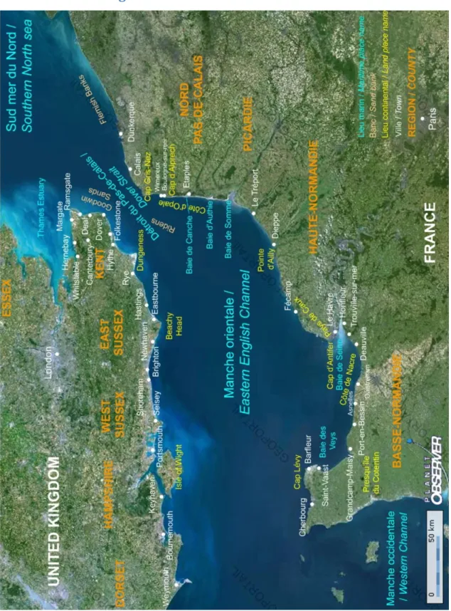
1.2.4. European and National Marine Protected Areas in the eastern English Channel
Not all the described MPAs types are present in the eastern English Channel. Some very coastal MPAs may be not presented in the map (Figure 3), such as the RAMSAR site of the bay of Somme. Concerning the EMS, on the UK side a distinction is made between the coastal and the offshore Special Areas of Conservation. The so-called “UK marine SACs or SPAs” on the map were terrestrial SACs or SPAs with a marine component. The “offshore pSAC” is a potential marine SAC with a perimeter that was proposed to the European Commission the 30th of August 2012. It is also important to notice that the presented Natural Marine Park may not be the definitive one as this perimeter is still under discussion. Many MPAs are found to overlap; this matter will be investigated in the Chapter Four as well as the characteristics of these MPAs in term of their representativity of the biodiversity of the English Channel.
18
1.3. Conservation planning
1.3.1. Systematic conservation planning definition
Despite the increasing popularity of MPAs as management tools, until recently, decision on the design and locations of a majority of MPAs largely resulted from political or social processes (Halpern, 2003; Margules and Pressey, 2000). In parallel to this expert approach, another process was developed about twenty years ago: “systematic conservation planning”.
Systematic conservation planning consists of using specific protocols to identify networks of PAs to be conserved in order to protect biodiversity (Margules and Sarkar, 2007). The key concept underpinning systematic conservation planning is complementarity (Margules and Sarkar, 2007), which means that the biodiversity of a set of locations is a non-additive property of these locations. In other words, the contribution of a given location to the overall representativeness of a PAs network depends less on the local richness of the location than on the extent to which the biodiversity features complement (are different from) those already protected at other locations (Ferrier, 2009; Justus and Sarkar, 2002; Kirkpatrick, 1983). This principle of complementarity requires a dynamic process for PAs selection, because each time a location is selected or added to the existing PA network, the complementarity has to be recalculated for all the other locations (Margules and Sarkar, 2007; Possingham, 2009; Wilson et al., 2009).
Systematic conservation planning can be described as a nine stages process as described in Margules and Sarkar (2007) (Box 1). The detailed investigation of some of these stages is the focus of this thesis and these particular stages will be more precisely described in the following sections.
Box 1: Systematic conservation planning (adapted from Margules and Sarkar (2007) and
Margules and Pressey (2000))
(1) Identify stakeholders for the planning region
(2) Compile, assess and refine biodiversity and socio-economic data for the region
Compile available geographical distribution data on biotic and environmental parameters at every level of organization. Compile Remote-sensing data and survey data at the species level if possible.
Compile available socio-economic data
Assess conservation status for biotic entities (rarity, endemism, endangerment)
Assess the reliability of the data, in particular critically analyze the process of data selection
19 (3) Identify biodiversity surrogates for the region
(4) Establish Conservation goals and targets
Set quantitative conservation targets for species or other features (for example, at least three occurrences of each species or 10% of each habitat surface).
Set quantitative targets for minimum size, connectivity or other design criteria
Set precise goals for criteria other than biodiversity including socio-political criteria (5) Review the existing conservation area network
Measure the extent to which conservation targets and goals are met by the existing conservation areas
Identify the imminence of threat to under-represented features (6) Prioritize new areas for potential conservation action
Using principles such as complementarity, rarity and endemism, prioritize areas for their biodiversity content
Starting with the already existing conservation areas network, repeat the process of prioritization to compare results
Incorporate socio-economic criteria such as various costs
Incorporate design criteria such as connectivity, size etc.
Alternatively, carry out the last three steps using different optimal algorithms (7) Assess prognosis for biodiversity within each newly selected area
Assess the likelihood of persistence of all biodiversity surrogates in the new conservation areas
Assess vulnerability of a potential conservation area to external threats (8) Implement a conservation plan
Decide on the most appropriate and feasible legal mode of protection for each conservation area
Decide on the most appropriate and feasible mode of management for each conservation area
Decide on the relative timing of conservation management when short-term actions are not feasible
(9) Periodically reassess the network
Decide on indicators that will show whether goals are met
Periodically measure the indicators
20
1.3.2. Biodiversity surrogacy
Biodiversity is mainly described at three levels of biological hierarchy: genes (alleles), species and ecosystems. Because of the complexity of biodiversity, surrogates such as sub-sets of species or habitats types have to be used as a measure of biodiversity (Margules and Pressey, 2000). Moreover, the locations or occupied areas of these biodiversity surrogates have to be detailed enough to be mapped. It is unlikely that it will ever be possible to measure the true variation of biodiversity within or between regions and the effectiveness of surrogates is in consequence not really determinable (Wilson et al., 2009). The choice of surrogates can always be criticized but results most of the time more from data availability than any other factor (Margules and Pressey, 2000).
1.3.3. Target setting
The overall goal of MPA networks (conserving the biodiversity, maintaining ecological processes or managing fish stocks for example) reflect political or institutional priorities and result in the various conservation objectives described in section 1.2.1 (CBD, 2004; Rondinini and Chiozza, 2010; Kelleher and Kenchington, 1992; Smith et al 2009). However, these goals have to be translated into quantitative targets for operational uses (Margules and Pressey, 2000; Rondinini and Chiozza, 2010; Desmet and Cowling, 2004; Pressey et al, 2003). Some targets were advised by international conventions like the Convention on Biological Diversity which recommended conserving 10% of each ecological region (CBD, 2004). But these policy-driven targets have been criticized for their lack of ecological credibility (see review by Carwardine et al, 2009). In response to these criticisms, some researchers started to develop quantitative methods for setting targets (Rondinini and Chiozza, 2010).
Setting species targets often uses techniques based on population viability estimates (Justus et al., 2008; Rondinini et al., 2006). Quantitative methods to define percentage area targets for habitat types are reviewed in Rondinini and Chiozza (2010) and are based on five broad principles: (1) Species-area relationship with a fixed percentage target across habitat types, (2) habitat-specific species-area relationship (Desmet and Cowling, 2004) which is the method used in this thesis and which is described in Chapter Three, (3) heuristic principles which can be used when quantitative data lack but most of the time depend on subjective decisions, (4) trade-off target size with reserved area which does not use any biodiversity data and (5) spatially-explicit Population Viability Analysis (PVA). As for the biodiversity surrogate choice, availability of data as well as the broad MPA conservation goal to reach most often conditions the choice in the target setting method.