HAL Id: hal-01773448
https://hal-amu.archives-ouvertes.fr/hal-01773448
Submitted on 8 May 2018HAL is a multi-disciplinary open access archive for the deposit and dissemination of sci-entific research documents, whether they are pub-lished or not. The documents may come from teaching and research institutions in France or abroad, or from public or private research centers.
L’archive ouverte pluridisciplinaire HAL, est destinée au dépôt et à la diffusion de documents scientifiques de niveau recherche, publiés ou non, émanant des établissements d’enseignement et de recherche français ou étrangers, des laboratoires publics ou privés.
Global change effects on land management in the
Mediterranean region
Žiga Malek, Peter H. Verburg, Ilse R. Geijzendorffer, Alberte Bondeau,
Wolfgang Cramer
To cite this version:
Žiga Malek, Peter H. Verburg, Ilse R. Geijzendorffer, Alberte Bondeau, Wolfgang Cramer. Global change effects on land management in the Mediterranean region. Global Environmental Change, Elsevier, 2018, 50, pp.238-254. �10.1016/j.gloenvcha.2018.04.007�. �hal-01773448�
Global change effects on land management in the Mediterranean region
Žiga Malek1, Peter H Verburg1,2, Ilse R Geijzendorffer3, Alberte Bondeau4, Wolfgang Cramer4 1 Institute for Environmental studies, Vrije Universiteit Amsterdam, De Boelelaan 1087, 1081 HV
Amsterdam, the Netherlands
2 Swiss Federal Institute for Forest Snow and Landscape Research, WSL Zürcherstrasse 111,
CH-8903, Birmensdorf, Switzerland
3 Tour du Valat Research Institute for the Conservation of Mediterranean wetlands, Le Sambuc,
13200 Arles, France
4 Institut Méditerranéen de Biodiversité et d’Ecologie marine et continentale (IMBE), Aix
Marseille Université, CNRS, IRD, Avignon Université, Technopôle Arbois-Méditerranée Bât. Villemin – BP 80, F-13545 Aix-en-Provence cedex 04, France
Corresponding author: Žiga Malek, z.malek@vu.nl. Telephone: +31 20 59 88710
Acknowledgements
The research in this paper has been supported by the European Research Council under the European Union’s Seventh Framework Programme project LUC4C (Grant No. 603542), OPERAs (Grant No. 308393) and ERC grant GLOLAND (no. 311819). This paper contributes to the objectives of the Global Land Project (http://glp.earth/) and to the objectives of the Labex OTMed (no. ANR-11-LABX-0061) funded by the French Government Investissements d’Avenir program of the French National Research Agency (ANR) through the A*MIDEX project (no. ANR-11-IDEX-0001-02).
1
1. Introduction
2 Most of the Earth’s land surface has been changed as a result of human use, with large environmental
3 consequences and both positive and negative impacts on human well-being (Ellis et al., 2010; Schmitz et
4 al., 2012). With limited resources of land and water, a large societal challenge consist of meeting the 5 increasing demand for food and living space for growing populations in the context of climate change.
6 These challenges are especially significant for the Mediterranean, a dynamic and densely populated
7 region with severe constraints on land and water resources (Giorgi & Lionello, 2008; Giannakopoulos et
8 al., 2009; García-Ruiz et al., 2011; Fader et al., 2016). The Mediterranean has a long history of land use, 9 resulting in valuable cultural landscapes created throughout centuries (Blondel et al., 2010; Tieskens et
10 al., 2017), and is one of the most rich areas in terms of biodiversity (Cuttelod et al., 2009). On the other 11 side, human activities in the region have resulted in significant degradation of soil and water resources
12 (García-Ruiz et al., 2011; Karamesouti et al., 2015).
13
14 Resulting from its cultural and environmental characteristics and its long land use history, the
15 Mediterranean Basin hosts a diversity of land systems of varying intensities and levels of
16 (multi)functionality. Intensive systems have higher yields and produce most of the crops in the region, a
17 large part of them being exported. These systems however also have high water demands (Daccache et
18 al., 2014) and can negatively affect the quality of soil contributing to land degradation (Karamesouti et al.,
19 2015). Traditional mosaic systems represent landscapes, where human activities and environmental
20 conditions are intricately linked. An example is the dehesa / montado system of Spain and Portugal,
21 where different activities such as livestock grazing, cereal production, and forestry occur simultaneously
22 (Joffre et al., 1999). Although these areas have lower yields, they contribute significantly to total regional
23 food production (Blondel, 2006; McAdam et al., 2008). Many of the traditional mosaic systems are
24 associated with high biodiversity values (Médail & Quézel, 1999). These landscapes are particularly
25 vulnerable to global change, threatening their supply of not only food, but a number of ecosystem
26 services (Zamora et al., 2007; Guiot & Cramer, 2016).
27 The Middle Eastern and North African part of the Mediterranean region is characterized with high
28 population pressures and increasing dependence on food imports (Wright & Cafiero, 2011). Depending
29 heavily on food imports makes the region more vulnerable to fluctuations in food supply and prices
30 (Sowers et al., 2010). The region hosts a considerable portion of cropland with relatively low yields,
31 meaning that future cropland expansion and intensification will play a crucial role in satisfying the demand
32 for food (Mueller et al., 2012). This can however exacerbate soil and water degradation, and appropriate
33 land management will be needed to reduce these consequences, or restore soil and water resources
34 (Cerdan et al., 2010; García-Ruiz, et al., 2011). Moreover, water and land grabbing are also significant
35 issues in the region, leading to conflicts (GRAIN, 2012; Houdret, 2012). The European Mediterranean
37 commodity markets. However, recent socio-economic development, such as the Greek financial crisis,
38 have influenced the steadiness of supply of agricultural products (Pfeiffer & Koutantou, 2015). Other
39 global change effects are the abandonment of traditional livestock grazing systems due to low economic
40 competitiveness and reduction of livestock productivity (de Rancourt et al., 2006; Bernués et al., 2011). In
41 summary, future global change, particularly changes to climate and population, could significantly impact
42 the potential food supply of the Mediterranean region (Evans, 2008; Sowers et al., 2010).
43 Published global land change scenarios suggest significant intensification of crop production and grazing,
44 together with urban expansion in the Mediterranean region (Hurtt et al., 2011; Letourneau et al., 2012;
45 Souty et al., 2012; van Asselen & Verburg, 2013). These global studies often do not consider specific
46 regional characteristics that could affect these processes, such as the existence of a large share of
47 permanent crops and traditional mosaic systems, and severe water limitations. Water limitation also
48 affects intensification and cropland expansion, feedback loops which are currently not possible to study
49 with land use models in which water availability is represented by a proxy, such as precipitation (NRC,
50 2014). Simplified proxies can only influence the spatial distribution of intensive systems and do not limit
51 cropland expansion or intensification based on available water resources. Land use modeling studies that
52 do take into account water scarcity are often unable to generate land use patterns with the spatial detail
53 of most biophysical models (see for example Lotze-Campen et al., 2010).
54 In this study, we determine the impact of two potential future scenarios on land management in the
55 Mediterranean region to study environmental consequences of increasing food production in the
56 Mediterranean for the year 2050. We advance from the existing knowledge by combining global outlooks
57 of socio-economic and climate change in a land system change model with regional spatial
58 characteristics and configuration of land use. We are particularly interested in how global change might
59 affect traditional Mediterranean landscapes and water resources. We also demonstrate how water
60 resources limitations can be represented in land system models.
61
2. Future challenges for land management in the Mediterranean region
62 2.1 The Mediterranean region63 We focused on the Mediterranean ecoregion defined by the approximate extent of representative
64 Mediterranean natural communities from a biogeographical study (Olson et al., 2001). We expanded the
65 ecoregion by also including the Nile Delta, the Po floodplain and numerous “islands” of similar ecoregions
66 within the Mediterranean ecoregion (Fig. 1). Thematically, we divided the region into two parts, North and
67 South, which, based on land use characteristics and biodiversity trends (Galewski et al., 2011), were
71 27 countries with around 420 million inhabitants in 2015 (CAPMAS, 2015; EUROSTAT, 2016c; IIASA,
72 2016).
73 We identified four major challenging trends for the region based on various documents on the future of
74 the Mediterranean (Appendix A): 1) increasing population and continuous urban sprawl; 2) agriculture and
75 food production; 3) threatened biodiversity, and 4) significant climate change impacts and increasing
76 water scarcity.
77 2.2 Population and urban expansion
78 The total population in the southern (Fig. 1) Mediterranean countries is expected to increase by 43% until
79 2050, and by 16% in the North (Fig. 1, including Western Balkans and Turkey) following the Shared
80 Socioeconomic Pathways 2 (SSP2) scenario (Kc & Lutz, 2014; IIASA, 2016). Urban population in the
81 South is expected to increase even more by 82% (Jiang & O’Neill, 2015). Urban expansion in the
82 Mediterranean region is defined by dispersed and poorly managed urban sprawl (Benoit & Comeau,
83 2012; Salvati et al., 2012). Significant portions of Mediterranean coasts are being transformed to built-up
84 coastal landscapes (Munoz, 2003; Parcerisas et al., 2012). Agriculture is pushed further into wetlands
85 where surface water is available (MWO, 2012). As fertile areas in the region are limited to river plains and
86 coastlines, a large extent of cropland is lost due to soil sealing (Mediterranean 2030 Consortium, 2011).
87 Future population increase will undoubtedly result in further pressure on coastal urban areas, especially
88 near existing large urban agglomerations (European Commission, 2011).
89 2.3 Agriculture and food production
90 Agriculture in the region reflects its socio-economic disparities. The northern part hosts high-input
91 intensive agricultural systems, with most of the crops being exported. In contrast, the Southern
92 Mediterranean hosts a considerable portion of cropland with low yields and less efficient agricultural
93 management (Mueller et al., 2012). Trade regulations, protection of the European market and food safety
94 requirements pose serious constraints to the Southern Mediterranean countries to export commodities
95 such as fruit and vegetables (Larson et al., 2002; Cioffi & dell’Aquila, 2004; García Martinez & Poole,
96 2004). Access to agricultural technology, subsidies and loans is unequally distributed in the region and is
97 more accessible to farmers in the north-western part. Pasture based systems are becoming less
98 competitive, due to high labour costs – on-farm resources are being substituted with external inputs,
99 promoting intensive livestock systems near urban areas (Steinfeld et al., 2006; Bernués et al., 2011). This
100 has resulted in the increase in landless livestock systems in the Mediterranean region (Steinfeld et al.,
101 2006).
103 The Mediterranean ecoregion was identified as one of the world’s biodiversity hotspots, as it hosts a large
104 number of plant and animals species, numerous among them endemic (Cuttelod et al., 2009). The
105 presence of these species is closely related to extensive Mediterranean landscapes, particularly
agro-106 silvo-pastoral mosaic systems (Médail & Quézel, 1999) and wetlands (Cuttelod et al., 2009). The
107 transformation of these systems into intensive, single function cropland systems, or their abandonment
108 into woodland can have a significant impact on the biodiversity of the region, including changes in
109 landscape and plant community structure (Médail & Quézel, 1999). Only 5.5% of the region’s area is
110 protected, with 90% of protected areas in the Mediterranean North (Benoit & Comeau, 2012; FAO, 2013).
111 Among the main threats to the region’s biodiversity are also urban concentration and expansion in coastal
112 areas (FAO, 2013). Human activities have also affected Mediterranean wetlands, through increased
113 water extraction or livestock grazing (Houérou, 1993; Ayache et al., 2009).
114 2.5 Climate and water constraints
115 The region is projected to experience warming exceeding global trends, with most climate change
116 scenarios also resulting in reduced water availability (Chenoweth et al., 2011; Keenan et al., 2011; Guiot
117 & Cramer, 2016). Climate change and water scarcity have even been proposed as potential contributors
118 to conflicts in the region (e.g. Gleick, 2014; Kelley et al. 2015). Water scarcity is likely to pose severe
119 limitations to the agricultural sector in the future, as numerous countries risk not being able to meet
120 irrigation requirements (Fader et al., 2016). Already today, freshwater resources in the region are being
121 extracted at unsustainable rates, not allowing for natural replenishment (FAO, 2016). However, improved
122 irrigation efficiency and a shift to crops with lower irrigation demands could considerably lower the
123 requirement for irrigation water withdrawal in the region (Daccache et al., 2014; Fader et al., 2016).
124
3. Methods
125 3.1 Land system change simulation
126 Land systems characterize human-environment interactions in landscapes and are defined as
127 combinations of land use and land cover, livestock and management type and intensity (van Asselen &
128 Verburg, 2012; Turner et al., 2013). The use of land systems is a particularly suitable approach for the
129 Mediterranean region with its diverse mosaic landscapes that may not be easily disentangled into
130 separate land cover classes. Moreover, land systems allow a clear quantification of goods and services
131 provided by each land systems unit, necessary to simulate future change. To simulate future land system
132 change until 2050, we applied the CLUMondo model (Fig. 2). CLUMondo simulates land system changes
133 driven by defined demands for specific goods or services provided by land systems, taking into account
134 the local spatial characteristics (van Asselen & Verburg, 2013). As a baseline, we used the Mediterranean
138 equipped with irrigation. Intensive rain-fed cropland was identified on areas where fertilizer application,
139 field size or yields indicate intensive agriculture. The remaining rain-fed cropland was identified as
140 extensive (for details on the method see Malek & Verburg, 2017a). Every land system provides annual
141 and/or permanent crops, livestock and consists of a certain fraction of built-up area (Appendix B). The
142 land systems’ output of crops (annual and permanent) is a value specific to each land system. These
143 values were calculated based on crop production statistics to land systems and are described in
144 Appendix B.
145 The actual output of annual and permanent crops was based on agricultural production statistics for 2010
146 (EUROSTAT, 2013; 2016a, 2016b). We used subnational statistics to exclude non-Mediterranean parts of
147 countries (France, Spain, Italy, Turkey), where a significant share of crops is produced. For countries in
148 the Southern Mediterranean, we looked at national statistics on cropland areas and production in
149 subnational units within the Mediterranean ecoregion. In most countries, virtually all crops were produced
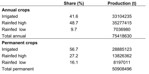
150 in the Mediterranean part (for example, 99% in Algeria and Morocco). The only exception was Egypt,
151 where 65% of the crops are produced in the Nile delta, which we used to adjust national crop production
152 statistics (FAO, 2016; Mohamed, 2016). Crop production was aggregated for each sub-region, and all
153 land system output values present a mean for a specific sub-region. We used the SPAM database to
154 identify the shares of crops produced in irrigated, intensive rain-fed and extensive rain-fed systems (You
155 et al., 2014). Total crop production was then scaled according to these shares and calculated for the
156 appropriate land system type (e.g. irrigated systems were associated with crops produced on irrigated
157 cropland, intensive rain-fed with crops produced in intensive cropland). We used agricultural statistics for
158 2010 for two reasons. First, the year 2010 presents the most recent year where crop production statistics
159 were consistently reported for subnational units in our study area. Secondly, the reported national crop
160 production for 2010 deviates the least from the average national crop production of the last 20 years (less
161 than 2%).
162 Annual crops consist of cereals (wheat, maize, barley and rice), and vegetables (fresh vegetables,
163 potatoes and tomatoes). In the Mediterranean, wheat, maize and barley present the majority of cereals,
164 with rice having a significant share in Egypt and Italy (EUROSTAT, 2013, 2016a, 2016b). Permanent
165 crops consist of fruit , olives and dates. Olives, grapes and citrus alone amount to over 20% of total crop
166 production in the Mediterranean region (Daccache et al., 2014). Livestock output is based on the values
167 derived from a global livestock database, with values for bovines, goats and sheep calculated to livestock
168 units (Robinson et al., 2014).
169 CLUMondo allocates changes to land systems based on spatial preference, spatial restrictions and
170 competition between land systems (van Asselen & Verburg, 2013). Spatial preference or local suitability
171 describes the probability of each location (grid cell) to host a specific land system, based on its
174 the spatial occurrence of a specific land system and location factors (explanatory biophysical and
175 socioeconomic variables presented in Appendix C) are investigated using logistic regression. This results
176 in maps presenting the likelihood of occurrence of different land systems as a function of local
177 environmental and socio-economic conditions (Appendix D). Spatial preference maps are updated
178 annually to account for population and climate change, as described in later sections. Spatial restrictions
179 are constraints for changing specific land systems, such as protected areas. Spatial restrictions can either
180 completely constrain land change, or allow predefined changes to land systems (e.g. woodlands can
181 change into forests in a protected area). To achieve a solution, CLUMondo iterates different land system
182 allocation combinations until it fulfils all demands for a specific year for a specific scenario. Although the
183 model can handle the provision of numerous crops and livestock units by land systems, it will promote the
184 most competitive (while accounting for both the occurrence likelihood and competitiveness in terms of the
185 services delivered towards the demand) system for that demand. The model is described in more detail
186 by (van Asselen & Verburg, 2013) and is available (as open-source) at
187 http://www.environmentalgeography.nl/site/data-models/data/clumondo-model/.
188 3.2 Limiting water resources
189 Besides achieving the most likely land system allocation under the defined demands, CLUMondo can
190 take into account the limitations of the allocated land systems in terms of resource use. In this study, use
191 of water resources was constrained, by applying a threshold on the total irrigation water withdrawal. This
192 situation is implemented using physical limitations as a maximum level of resource use which cannot be
193 overshot. If the demand cannot be satisfied fully with irrigated land systems under the given constraints,
194 CLUMondo has to fulfill it with rain-fed land systems. This limits the allocation of irrigated land systems
195 with high water requirements, although they have the highest crop output (Appendix B) and are therefore
196 promoted by the model if irrigation is not limited. To satisfy the demand for annual and permanent crops,
197 CLUMondo needs to consider other land systems without irrigation demands, but also with lower output
198 for these crops, having a tradeoff on the conversion of (semi-)natural areas.
199 To associate irrigated land systems with irrigation water withdrawal, we used spatially explicit irrigation
200 data on areas equipped with irrigation (Siebert et al., 2005, 2013). Irrigation demand values for irrigated
201 land systems were based on the extent of irrigated areas, which we linked to national and subnational
202 irrigation water withdrawal statistics (EUROSTAT, 2013, 2016a, 2016b; FAO, 2016). This resulted in
203 mean values of irrigation water withdrawal per cell of irrigated land system for each region (Appendix B).
204 The available water resources, that served as a limit for irrigation water withdrawal, are based on water
205 resource statistics on the national (Mediterranean South: FAO, 2016) and subnational level
209 To study potential pathways to fulfill the growing food production and the demand for living area in the
210 Mediterranean region, we have developed two contrasting scenarios: ‘growth’ and ‘sustainability’. The
211 scenarios follow different assumptions in terms of production of annual and permanent crops, and
212 livestock, and the demand for built-up area up to 2050 (Table 1). Both scenarios are based on global
213 SSP2 projections for the region in terms of regionally produced food, however modified to fit the storyline
214 of each scenario as described in Table 2 and Appendix E. The production values for annual and
215 permanent crops, and livestock are based on the SSP2 marker scenario projections for food production
216 (Fricko et al., 2016; Riahi et al., 2016; Popp et al., 2017). These projections are a result of integrated
217 assessment models, where the remaining consumption is satisfied with imports. In the projections, the
218 Mediterranean North maintains producing more than it consumes in 2050, whereas the dependency of
219 the Mediterranean South on food imports increases despite significant crop and livestock production
220 growth (Alexandratos & Bruinsma, 2012). The Mediterranean South imported 56% of its total crop
221 consumption in 2007 (Wright & Cafiero, 2011), which is projected to increase to 73% in 2050 (World
222 Bank, 2009; Alexandratos & Bruinsma, 2012). The demand for built-up areas is based on the population
223 growth rate of the SSP2 scenario (Kc & Lutz, 2014). The scenarios differ from each other significantly
224 regarding the handling of major challenges the Mediterranean region will be facing in the future. In
225 particular, in the sustainability scenario, freshwater is explicitly regarded as a limited resource for
226 irrigation, while in the growth scenario, it is not. Technical details of translating the scenario storylines to
227 the CLUMondo land system model are described in Appendix E.
228 3.3.2 Growth scenario – Production maximization through growth
229 Under the growth scenario the current economic disparities between the sub-regions are assumed to
230 remain unchanged. Each sub-region follows its own goals, aiming to satisfy its own demands.
231 Environmental issues, such as freshwater resources depletion are not considered.
232 Urban expansion. Urban expansion has priority to any other land process. Low density peri-urban 233 systems are promoted, continuing urban sprawl. Rural abandonment continues in the North of the
234 Mediterranean Basin. In the South, rural population increases until 2020, followed by a gradual decrease
235 (Jiang & O’Neill, 2015).
236 Agriculture and food production. Agricultural intensification has priority – extensive areas are promoted to 237 convert to intensive ones, achieved by higher use of fertilizers, irrigation and herbicides. Yield
238 improvement technology remains unequally distributed in the region. Yield gaps are not closed, however
239 achieve 75% of the attainable yield for irrigated systems. Landless livestock systems are promoted –
240 indoor breeding systems on intensive cropland or near urban areas are subject to 15% intensification. No
242 Biodiversity. The extent of protected areas in the Mediterranean does not increase, but existing protected 243 areas are conserved. Cropland and livestock activities with low intensity (extensive cropland and mosaic
244 systems) are allowed in protected areas. Wetlands continue to be used for cropland and used for
245 intensive livestock grazing. Grazing in arid areas is uncontrolled.
246 Climate and water constraints. Same crops are being grown as today which, given the reduction in 247 precipitation and increases in evaporation, results in lower suitability for rain-fed intensive systems
248 occurring in semi-arid areas due to climate change. Water resources can be exploited without limitations.
249 3.3.3 Sustainability scenario – Fulfilling the Mediterranean sustainable development goals 250 The sustainability scenario describes a future, where the future Mediterranean region is characterized by
251 prosperity, solidarity and stability. Throughout the region, national governments and other actors agree to
252 follow shared environmental and development goals.
253 Urban expansion. Urban sprawl is limited and well planned. A new type of a Mediterranean compact city 254 emerges, denser urban areas are promoted. Rural population remains stable.
255 Agriculture and food production. A common Mediterranean market involving all countries around the 256 Mediterranean sea (Fig. 1) is established. It results in a liberalization of agricultural trade, with improved
257 access to agricultural technology, loans and subsidies for everybody. The entire region can easier satisfy
258 its demand through additional food with imports, and can export even more commodities such as
259 permanent crops. Yield gaps on irrigated and rain-fed intensive cropland are closed in the North, and
260 reach 90% (irrigated) and 75% (rain-fed intensive) of attainable yield in the South. Land based livestock
261 systems are promoted. The efficiency of livestock production systems in terms of output is improved, for
262 example by improving breeds or fattening of herds (Bernués et al., 2011). A moderate reduction in food
263 waste due to changed dietary habits (North) and improvement in the food supply chain (South) results in
264 a lower increase in total regional demand for agricultural production.
265 Biodiversity. The entire region applied coherent and consistent environmental policies and conservation 266 tools. The extent of protected areas in the region reaches the 17% of terrestrial ecosystems as specified
267 by the “Aichi target” of the UN Convention for Biodiversity (http://www.cbd.int/sp/targets), being a
268 considerable improvement for the Mediterranean South (Pouzols et al., 2014) (Appendix F). Low intensity
269 cropland and livestock grazing (extensive cropland and mosaic systems) are allowed in newly established
270 protected areas. Wetlands use by intensive crop production system and grazing of livestock is decreased.
271 Grazing intensification in arid areas is limited in order to combat desertification. Ecological focus areas
272 are assigned as 5% of area set aside in all rain-fed systems. This way, landscape elements with higher
274 Climate and water constraints. Due to improvement in cultivars and crop changes (for example with crops 275 with lower water demands), intensive rain-fed areas can expand more than they do in the growth scenario
276 (Daccache et al., 2014). Improvements in irrigation infrastructure and changes to irrigation type (e.g. drip
277 irrigation lead to a 35% improvement in irrigation efficiency . Irrigation water withdrawal is limited to 75%
278 of current total withdrawal, to allow more water for biodiversity and ecosystems.
279 3.4 Climate and population change
280 In both scenarios, global change was included either through a change in the location factors which
281 underpin the spatial preference map for land system transitions, or as a land system change constraint.
282 We used results from downscaled global climate models from CMIP5 (Hijmans et al., 2005; Taylor et al.,
283 2012) forced by the RCP4.5 greenhouse gas radiative forcing representative concentration pathway.
284 RCP4.5 is a cost-minimizing mitigation scenario, presenting a “median” and probable pathway compared
285 to other scenarios (Thomson et al. 2011). We calculated the mean of 19 CMIP5 simulation outputs
286 (Appendix G) for both temperature and precipitation for the years 2041-2060, referred to as year 2050.
287 Based on these projections, we generated annual temperature and precipitation maps, which were then
288 used to derive annual potential evapotranspiration (PET) and aridity index (AI) maps (Trabucco et al.,
289 2008; Zomer et al., 2008) (Appendix H). Temperature, precipitation and PET served as location factors in
290 the logistic regression, and AI was used to limit particular processes (Appendix E). For example, forest
291 expansion was possible only in areas with AI>0.65 (Zomer et al., 2008).
292 To account for population change, we updated the 2010 population density map using the SSP2
293 projection growth rates (CIESIN, 2015; Jiang & O’Neill, 2015). We used urban population growth rates for
294 areas with higher population density (>250 inhabitants/km2) for both scenarios (Appendix I). This
295 corresponds well with population change projections for the Mediterranean region (Benoit & Comeau,
296 2012). Changes to rural population were applied to the rural population density map (Appendix C), and
297 were also based on global SSP2 projections (CIESIN et al., 2011; Jiang & O’Neill, 2015).
298 3.5 Changes to productivity of land systems
299 Changes to productivity were implemented by changing the output of each land system in time (Appendix
300 B). We first studied the current average yield gap of land systems using yield gap data for major crops
301 (Foley et al., 2011). Then, we calculated annual growth rates of land system output changes to achieve
302 crop yields assumed attainable under the scenario conditions (Tables 2 and 3). The attainable yields
303 were based on plausible improvements to nutrient management and irrigation as proposed by Mueller et
304 al. (2012). Mueller et al. (2012) did not consider climate change impacts on crop yields, although the
305 potential to close yield gaps in different regions was constrained by climate conditions.
308 scenario studies that focus on future yield change in the Mediterranean region. Our assumed productivity
309 increases are lower than in other studies, except in both climate change studies (Parry et al., 2004;
310 Giannakopoulos et al., 2009). In these two studies, technological improvements and adaptation were
311 however limited or not considered. In contrast to the studies mentioned in Table 3, we assumed cropland
312 productivity will only increase in intensive rain-fed and irrigated systems, and not overall in the cropland
313 sector. We did not improve the productivity of existing extensive cropland or traditional multifunctional
314 mosaic systems. Moreover, we did not consider potential increases to water demands of different crops.
315 Studies have demonstrated that improving the irrigation efficiency can help maintaining cropland
316 productivity and allow for expansion of irrigated areas in the Mediterranean (Fader et al., 2016; Malek &
317 Verburg 2017b; Saadi et al., 2015).
318
4
Results
319 4.1 Changes to management of Mediterranean land systems
320 In both scenarios, extensive cropland systems decreased most (Table 4). This is either through
321 intensification of management, or due to abandonment and subsequent conversion to woodlands. There
322 is also a drastic increase in urban systems in the Middle Eastern region, particularly Syria, Israel,
323 Palestine and Jordan. The largest expansions of irrigated areas can be observed in Turkey, Tunisia and
324 Morocco. The inclusion of water limitation for crop irrigation in the sustainability scenario impacts the way
325 in which the demands for food are satisfied in comparison to the growth scenario (Fig. 4). In some parts
326 of North-West Africa and Turkey, limited freshwater availability for irrigation results in more rain-fed
327 intensive areas compared to the growth scenario (Fig. 5). In Algeria, the Western Balkans and Turkey,
328 limited water availability does not necessarily result in more rain-fed intensive area, as a significant part of
329 food demands is fulfilled by intensifying mosaics, higher efficiency improvement, while simultaneously the
330 overall food demand is lower due to a decrease in food waste. Land system results for both scenarios are
331 depicted in Fig. 4, with more detailed land system conversions shown in Table 4, Fig. 5 and Fig. 6,
332 Appendix J and downloadable in GIS format from www.environmentalgeography.nl. Fig. 7 presents the
333 two future scenarios in three focus areas, the Iberian peninsula, Middle East and Turkey, and in Tunisia.
334 4.2 Changes to traditional Mediterranean landscapes
335 More mosaic systems are preserved in the sustainability scenario: 60% more compared to the growth
336 scenario. Whereas a significant share of mosaic systems remain the same, still around 58% and 32% of
337 mosaics change in the growth and sustainability scenario respectively. Around 36% of mosaics in the
338 growth and 21% in the sustainability scenario were changed to other mosaic systems (Table 5). Based on
339 the level of multifunctionality, the mosaics either changed to another mosaic with the same level, or to a
343 management on a same level of multifunctionality. The extent of mosaics, that change from another type
344 of mosaic while keeping the same level of multifunctionality is significant in both scenarios (Table 5).
345 Such processes were projected in southern Spain, Portugal, Western Balkans and south-western Turkey
346 (Fig. 6). An interesting process is the increase in functionality, occurring in both scenarios. This process
347 represents additional activities on existing land systems, such as introducing livestock to woodlands or
348 woodland-cropland mosaics. The model transformed land systems with lower output in terms of crops and
349 livestock such as woodlands, to land systems with higher output occurring in similar locations (similar
350 spatial preference) such as woodland-cropland or woodland-rangeland mosaics. These processes are
351 projected to occur on extensive areas in Algeria, Western Balkans and western Syria (Fig. 6). Differences
352 in the extent of losses of Mediterranean agro-silvo-pastoral mosaic systems between the two scenarios
353 are mostly a consequence of cropland expansion and intensification – more than twice as many mosaics
354 are transformed to intensive or irrigated cropland in the growth scenario compared to the sustainability
355 scenario (Table 5). In some areas, agro-silvo-pastoral mosaic systems expand. This is mostly caused by
356 an increase in livestock density in extensive cropland systems, or through the introduction of livestock to
357 cropland that was abandoned during the simulated time period. Increases in livestock density and grazing
358 on abandoned cropland were projected mostly in NW Africa, but also in southern Spain (Fig. 6 and 7).
359 4.3 Water resources
360 As the use of water resources was constrained only in the sustainability scenario, the overall lower water
361 extraction values are considerably lower than in the growth scenario. Clearly, the constraints on water
362 use have influenced the model’s choice of land systems. In the growth scenario, all regions demonstrate
363 a significant increase of irrigation water withdrawal (Table 6). The highest expansions of irrigated
364 cropland systems and consequent increases in irrigation water withdrawal are projected in the
sub-365 regions Western Balkans and Turkey and NW Africa. We used the pressure on freshwater resources
366 index (PFR), to describe the water stress of the sub-regions in the two scenarios (Table 6). It is defined as
367 the share of total irrigation water withdrawal in available freshwater resources (FAO, 2016). There are
368 considerable differences between the regions in the baseline year (FAO, 2016) (Table 6). Both
sub-369 regions of the Northern Mediterranean have a PFR index that is below 20%, which still enables biological
370 functioning of freshwater bodies and does not result in water stress as a limiting development factor
371 (Arnell, 1999). This is mostly due to the more abundant freshwater resources in these regions and a lower
372 dependence of their agriculture on irrigation (Appendix B). The Middle East and NE Africa sub-region
373 already has unsustainable freshwater extraction rates, as some countries (e.g. Egypt and Libya) are
374 already extracting more resources compared to their renewable water resources (Table 6).
375
5
Discussion
377 Modelling the future of land use and management intensity is a central part in integrated assessment
378 models (Wise et al., 2009; Stehfest et al., 2014). However, given the global character of these
379 assessments, and the strongly simplified land cover representations, little insight into the potential
380 changes in the specific Mediterranean land systems is acquired from these studies. While single case
381 studies have documented the (potential) response to global change in the Mediterranean (Bugalho et al.,
382 2011; Keenan et al., 2011; Nainggolan et al., 2012; Parcerisas et al., 2012), no earlier study specifically
383 focused on the impacts of global change across the entire region and took into account the impacts of the
384 limited water availability. Land systems provide highly appreciated benefits for the regional population: the
385 region is a significant producer of highly demanded commodities, such as olives and grapes, and the
386 region hosts vast areas of traditional multifunctional mosaic landscapes, that are well studied (Blondel,
387 2006; Daccache et al., 2014). The region is projected to witness significant climate changes, mostly in the
388 form of temperature increases, decreases of precipitation and more frequent climate extremes. At the
389 same time, demographic changes and fast urbanization will pose additional challenges to land systems.
390 The two fundamentally different scenarios we developed, demonstrate two potential pathways of how
391 land systems may respond to a growing population in the Mediterranean. While the future of land
392 management of the region is more likely to be between these two scenarios, the scenarios sketch how
393 differences in the level of technological development and the implementation of policies concerning rural
394 development, water management and biodiversity lead to strongly different land system outcomes. Both
395 scenarios represent a future, where the southern Mediterranean countries continue to depend on food
396 imports for a significant part of their food demand and are based on global integrated assessment
397 calculations of trade, demand and supply between regions. In all global level scenarios it is acknowledged
398 that to feed the growing population of the region, significant food imports will still be needed (Wright &
399 Cafiero, 2011). Our results indicate that already under those conditions enormous changes in land
400 systems are needed to meet such demands for production in the region. Moreover, when looking at the
401 changes between the two scenarios, we can identify adaptation opportunities in land management to
402 avoid changes to mosaic land systems and cropland expansion (Fig. 8). Significantly more areas are
403 subject to irrigation, intensification and changes to mosaics in the growth scenario compared to the
404 sustainability scenario, suggesting the potential outcomes of successfully following common sustainable
405 development goals. Technological improvements and nutrient management, improved irrigation
406 efficiency, and protection of traditional land use systems were thus recognized as successful measures to
407 increase the resilience of traditional Mediterranean landscapes. Nevertheless, the sustainability scenario
408 also projected changes to intensity and irrigation differently from the growth scenario. These locations
409 mostly present the tradeoffs of expanding the protected areas network (Fig. 8).
413 by high yield gaps (Mueller et al., 2012). The lower use of irrigated cropland to meet agricultural demands
414 therefore comes at the cost of a larger expansion of rain-fed croplands in this scenario. The intensification
415 of rain-fed cropland was mostly projected in areas that will maintain more favorable climatic conditions in
416 the future, such as northeast Spain. Other locations of intensifying rain-fed cropland (e.g. north of the
417 Atlas mountains) correspond well with other research (van Asselen & Verburg, 2012; Mueller et al.,
418 2012).
419 The model projected significant increases in irrigated cropland in both scenarios, because irrigated
420 systems in most sub-regions have the highest output of crops, and were thus promoted by the model to
421 fulfil agricultural demands. Equipping rain-fed cropland with irrigation, particularly in semi-arid regions as
422 the Mediterranean, is among the most implemented adaptation options to reduce risks to climate change
423 (Smit & Skinner, 2002). Due to projected climate change, the extent of areas most suitable for rain-fed
424 intensive cropland systems decreased. A major limiting factor for rain-fed agriculture is high aridity, and
425 arid and hyper-arid areas are projected to expand in the NW Africa sub-region (Appendix H). Although
426 necessary improvements in irrigation efficiency to maintain current water withdrawal with projected
427 expansion of irrigated areas are possible (Fader et al., 2016), the two southern Mediterranean
sub-428 regions already today have unsustainable water withdrawal levels. Furthermore, the growth scenario
429 does not consider projected decreases in water resources as may be expected due to depletion of
430 aquifers and climate change (Vörösmarty et al., 2010; Chenoweth et al., 2011). Despite the efforts on
431 finding new water resources, water reuse and desalination, the growth scenario is strongly overestimating
432 the water availability.
433 The drastic expansion of irrigated areas projected in the sub-regions Western Balkans and Turkey, and
434 NW Africa is expected under the ‘growth’ scenario. Particularly in NW Africa, irrigation is needed in order
435 to increase the yields, as studies suggest that only improving nutrient management and mechanization
436 will not be enough to improve cropland productivity in this area due to local climatic conditions (Mueller et
437 al., 2012). Generally, the sustainability scenario resulted in less intensive rain-fed and irrigated cropland 438 (Fig. 8), which can also be attributed to a 5% lower demand due to a decrease in food waste.
439 Nevertheless, our reduction in demand for agricultural products is conservative, as studies suggest higher
440 potentials to reduce agricultural demands in case of drastic improvements in the supply chain or diet
441 change (Parfitt et al., 2010; Garrone et al., 2014).
442 Expansion of multifunctional systems, projected by the model in both scenarios can be explained
two-443 fold. First, these areas are subject to expansion of protected areas in the sustainability scenario, which
444 prevents more intensive land systems to be established, but allows for the conversions into other (more)
445 traditional extensive systems. Secondly, climatic and soil characteristics of these areas constrain rain-fed
446 intensive agriculture. Similar transitions have already been observed at the local scale in areas such as
449 defined as sustainable intensification, where satisfying future demands for crops and livestock occurs
450 simultaneously with meeting sustainability objectives (e.g. biodiversity protection and strengthening rural
451 communities) (Garnett et al., 2013). Multifunctional land systems have been acknowledged as a
452 significant adaptation option to climate change, particularly for smallholder farmers (Verchot et al., 2007).
453 Although multifunctional areas contribute less to satisfying food demand as compared to intensive
454 cropland, they can also be recognized as an effort to rehabilitate and conserve land and water resources.
455 Such increased land productivity (in terms of crop and livestock production) with simultaneous
456 sustainable land use follows the objectives of the United Nations Convention to Combat Desertification
457 (UNCCD, 1994).
458 This study took into account competing demands for food production and living space. Traditional
459 Mediterranean land systems are, however, providing other significant ecosystem services, such as
non-460 timber forest products like mushrooms or cork, fire prevention, carbon storage, soil erosion prevention
461 and landscape aesthetics (Bugalho et al., 2011; Almagro et al., 2013; Guerra et al., 2016). These
462 services could also act as additional demands especially if covered by environmental, rural development
463 and tourism policies (Eitelberg et al., 2016). Future studies should therefore study the effects of
464 maintaining different benefits provided by traditional Mediterranean mosaic systems besides food. This
465 way, the extent of mosaic systems needed to provide a certain extent of important ecosystem services
466 can be determined, as well as potential tradeoffs in irrigation and intensification in other areas.
467 5.2 Water limitation as a contribution to land change modelling
468 Significant improvements in the modelling of future land use have been made in the recent decades,
469 including more precise coverage of spatial, temporal and thematic resolution and moving beyond an
470 approach based only on dominant land cover (Hurtt et al., 2011; Letourneau et al., 2012; Souty et al.,
471 2012; Bryan et al., 2016). Land management which used to be represented in a simplified manner as a
472 class of regional management factor (Bouwman et al., 2006; Bondeau et al., 2007), can now be
473 described using different management intensity metrics, such as livestock numbers, fertilizer inputs or
474 yield gaps (Souty et al., 2012; van Asselen & Verburg, 2013). This is necessary, as often socio-economic
475 changes are not limited to direct land cover changes, but predominantly lead to changes in management
476 intensity or irrigation. In this study, we managed to quantify the relative changes required for both land
477 management and land cover to fulfill future food demands. Our results show that for the growth and
478 sustainability scenario respectively 61% and 51% of the increase of agricultural demand is met by new
479 irrigation, 23% and 36% by cropland intensification and only 12% each by cropland expansion. Our study
480 therefore confirms that the inclusion of changes in land management (irrigation and intensification) may
481 be more important than land cover changes in modeling of future scenarios. This way we contribute to
484 The growth scenario presented a continuation of worldwide trends, where the demands for food and living
485 space are fulfilled by increasing more productive, monofunctional, land systems at the expense of
486 traditional systems, as is also suggested by global scale studies (van Asselen & Verburg, 2013; Eitelberg
487 et al., 2016). In this scenario, the likelihood of spatial variables and location preferences for where 488 irrigated systems were considered in the allocation of land systems by the model. However, the
489 expansion of irrigated agriculture was not limited by water availability. Consequently, the growth scenario
490 resulted in more than twice as much irrigation water withdrawal in the sub-regions NW Africa and Western
491 Balkans and Turkey. An assumption of unlimited water availability can therefore lead to an overestimation
492 of expanding irrigated areas. Such increases of water extraction are unlikely to happen in the
493 Mediterranean basin, partly because of the regional expected impacts of climate change (Elliott et al.,
494 2014). On the other side, not constraining water availability is a useful scenario exercise as it
495 demonstrates the land systems distribution that might otherwise be possible (Fig. 8). Our results show the
496 necessity of including the reality of limited water availability when simulating future changes to land
497 systems, particularly in (semi)arid regions. Many global studies disregard this issue and suggest
498 significant cropland expansion and intensification in other semi-arid areas (van Asselen & Verburg, 2013;
499 Eitelberg et al., 2016), which undoubtedly will have an impact on future water resources. The approach
500 presented in this paper can, therefore, be applied in areas that face similar resource constraints, and
501 improve the understanding of how future cropland expansion and intensification are responding to
502 situations of water stress.
503 In this study we used spatially explicit irrigation data, linked to irrigation water withdrawal and freshwater
504 resources statistics. This resulted in mean values per cell of irrigated land system, not considering areas
505 where water withdrawal values can be considerably higher due to higher potential evapotranspiration.
506 Incorporating water cycle processes is needed to improve the availability and constraints of water
507 resources. One example could be to use spatially explicit data on water availability and water extraction, if
508 such data was available on a more detailed resolution (Brauman et al., 2016). A higher resolution of water
509 withdrawal of land systems might be achieved, by operating on a catchment scale. Nevertheless, data on
510 crop production is not available on the same scale, which would result in a mismatch of management
511 levels - water management on catchment scale vs. agricultural management on a regional or national
512 scale. Moreover, using spatially explicit water withdrawal data would mean additional uncertainties to our
513 approach, related to the models used to derive such data. Using regional or national scale irrigation
514 withdrawal data furthermore ensures a higher transferability of our approach to similar (semi)arid areas
515 with increasing food demand and high water stress (e.g. other areas in the Middle East, south Asia,
516 China, North America…). Another challenge would be to consider groundwater reserves, as these are
517 often non-renewable, or their exploitation exceeds groundwater recharge rates. Although there is data on
518 irrigation from groundwater resources, for the Southern Mediterranean it is based on national statistics
520 groundwater might also occur in the hyper-arid (desert) part in the Middle East and North Africa, outside
521 our study area (Mediterranean ecoregion).
522 We only focused on water withdrawals for agriculture and did not account for the competing demands for
523 municipal and industrial water use. Whereas in the European Union irrigation amounted for around 40%
524 of total water withdrawals, it is the main source of water withdrawals in other sub-regions (Appendix K).
525 Future socio-economic development particularly in the southern Mediterranean will however also likely
526 result in increased demands for non-agricultural water use (Flörke et al., 2013). Livestock water use was
527 also not considered, mostly as the statistics in all sub-regions except the European Union equal irrigation
528 with agricultural water withdrawals (FAO, 2016). Nevertheless, livestock also has significant water
529 demands influencing freshwater resources (Mekonnen & Hoekstra, 2012). Further research on improving
530 the data on water use and how different sector compete for water resources is therefore needed.
531 5.3 Storyline to modeling translation and uncertainties
532 In this study, we present a transparent and clear methodology on translating storylines to modeling, as
533 demonstrated by detailed supplement information. Individual steps of our study are presented, ranging
534 from preparing dynamic input files for changing temperature and precipitation, to defining model
535 parameters reflecting the storyline. This way, we aimed at improving the presentation of the translation of
536 specific policy assumptions to model parameters.
537 In analyzing global change effects on local scale land management, we went beyond applying global
538 demand projections only. We developed two storylines that describe regional challenges on a higher
539 detail – global SSP storylines are more broad and general (Riahi et al., 2016). For example, in our study
540 water management is one of the most crucial challenges for the Mediterranean, influencing the
541 development of scenarios significantly.
542 Model studies are sensitive to uncertainties and errors in the input data. We aimed to reduce the
543 uncertainties in our approach by relying mostly on crop production and irrigation water withdrawal
544 statistics. Nevertheless, combining numerous spatial data can result in an aggregation of uncertainties.
545 For example, our baseline land systems map is heavily dependent on inputs such as land cover, with the
546 southern Mediterranean having higher observed inaccuracies compared to the northern part (Malek &
547 Verburg, 2017a). Moreover, in this study we focused on the Mediterranean ecoregion. Irrigated systems
548 in deserts, such as oasis like date plantations in North Africa, are also contributing to total crop production
549 and also irrigation water withdrawals.
550 One of the biggest uncertainties for land system modelling are assumptions on improvements in
554 could be linked to the fact that yield gaps are larger in developing countries than in developed countries
555 (Ramankutty et al., 2008; Mueller et al., 2012). Yield improvement scenarios are often optimistic, not
556 considering the expected impacts of climate change (Long, 2006). Our yield improvements were rather
557 conservative, considering the region’s socio-economic and environmental characteristics (Mueller et al.,
558 2012). We did not apply efficiency improvements to all land systems as it is the case in some similar
559 studies (van Asselen & Verburg, 2013; Eitelberg et al., 2016). For example, in NW Africa, improvements
560 in nutrient management are needed to achieve higher yields. Improved nutrient management on
561 extensive cropland could however also mean a transition to a more intensive cropland, resulting in higher
562 yields. Finally, we did not consider potential new crop production systems in the future. One example of
563 such system are greenhouses with significantly higher agricultural output. Such systems could occur on a
564 wider spatial extent, as they are less dependent on local environmental characteristics. Assumptions on
565 technological improvement, particularly increases of yield are significantly influencing the extent of
566 simulated cropland expansion, intensification and new irrigation and need to be considered carefully. To
567 reduce the uncertainties related to future cropland productivity, future research should focus on
568 differences between projected yields or cropland efficiency.
569
6
Conclusions: what are the consequences of global change for the
570
Mediterranean?
571 In this article, we assessed how global change might influence future land systems in the Mediterranean.
572 Similarly to global scale studies, we projected significant increases in intensively managed and irrigated
573 cropland for the Mediterranean basin. Our study shows, that to a certain extent, it is possible to preserve
574 traditional Mediterranean mosaic systems. The growth scenario depicts a future, where more mosaic
575 systems will be abandoned or transformed to more intensive systems. Rural development policies
576 focusing on improving the socio-economic conditions of rural areas, and increasing yields within
577 traditional mosaic systems, as shown in the sustainability scenario, can be an alternative to further
578 cropland expansion or conversion to monoculture intensive cropland systems. We have also shown, that
579 an expansion of protected areas in the region is possible without compromising the region’s abilities to
580 produce food. The same goes for reducing the intensity of cropland and grazing activities in wetlands.
581 The two scenarios represent different pathways on managing Mediterranean freshwater resources and
582 dealing with water shortages. In the growth scenario, water resources are continued to being depleted at
583 unsustainable rates in the future with significant investments into alternative water resources. Some of
584 them are already taking place today: water reuse, desalination, large infrastructural projects such as
585 dams or channels (Hochstrat et al., 2010; Pedrero et al., 2010; El Gammal & Ali, 2011). Improving the
586 state of freshwater resources, as projected by the sustainability scenario, is possible by increasing the
588 Our results indicate, that increased food production in the Mediterranean can be accompanied by
589 preserving landscapes with higher cultural and biodiversity values, and decreasing the pressure on
590 freshwater resources. However, we also show that such a future is only possible under the
591 implementation of common Mediterranean sustainable development goals and orchestrated agricultural
592 and environmental management strategies.
594 References 595
596 Alexandratos N, Bruinsma J (2012) World agriculture towards 2030/2050: The 2012 revision. Rome: Food
597 and Agriculture Organization of the United Nations.
598 Almagro M, Vente J de, Boix-Fayos C et al. (2013) Sustainable land management practices as providers
599 of several ecosystem services under rainfed Mediterranean agroecosystems. Mitigation and
600 Adaptation Strategies for Global Change, 1–15.
601 Arnell N (1999) Climate change and global water resources. Global Environmental Change, 9, S31–S49.
602 van Asselen S, Verburg PH (2012) A Land System representation for global assessments and land-use
603 modeling. Global Change Biology, 18, 3125–3148.
604 van Asselen S, Verburg PH (2013) Land cover change or land-use intensification: simulating land system
605 change with a global-scale land change model. Global Change Biology, 19, 3648–3667.
606 Ayache F, Thompson JR, Flower RJ, Boujarra A, Rouatbi F, Makina H (2009) Environmental
607 characteristics, landscape history and pressures on three coastal lagoons in the Southern
608 Mediterranean Region: Merja Zerga (Morocco), Ghar El Melh (Tunisia) and Lake Manzala
609 (Egypt). Hydrobiologia, 622, 15–43.
610 Benoit G, Comeau A (2012) A Sustainable Future for the Mediterranean: The Blue Plan’s Environment
611 and Development Outlook. Routledge, 465 pp.
612 Bernués A, Ruiz R, Olaizola A, Villalba D, Casasús I (2011) Sustainability of pasture-based livestock
613 farming systems in the European Mediterranean context: Synergies and trade-offs. Livestock
614 Science, 139, 44–57.
615 Blondel J, Aronson J, Bodiou J-Y, Boeuf G (eds.) (2010) The Mediterranean region: biological diversity in
616 space and time, 2nd ed edn. Oxford University Press, Oxford ; New York, 376 pp. 617 Blondel J (2006) The “Design” of Mediterranean Landscapes: A Millennial Story of Humans and
618 Ecological Systems during the Historic Period. Human Ecology, 34, 713–729.
619 Bondeau A, Smith PC, Zaehle S et al. (2007) Modelling the role of agriculture for the 20th century global
620 terrestrial carbon balance. Global Change Biology, 13, 679–706.
621 Bouwman A, Kram T, Klein Goldewijk K (2006) Integrated Modelling of Global Environmental Change. An
622 Overview of IMAGE 2.4. Netherlands Environmental Assessment Agency, Bilthoven.
623 Brauman KA, Richter BD, Postel S, Malsy M, Flörke M (2016) Water depletion: An improved metric for
624 incorporating seasonal and dry-year water scarcity into water risk assessments. Elementa:
625 Science of the Anthropocene, 4, 000083.
626 Bryan BA, Nolan M, McKellar L et al. (2016) Land-use and sustainability under intersecting global change
627 and domestic policy scenarios: Trajectories for Australia to 2050. Global Environmental Change,
629 Bugalho MN, Caldeira MC, Pereira JS, Aronson J, Pausas JG (2011) Mediterranean cork oak savannas
630 require human use to sustain biodiversity and ecosystem services. Frontiers in Ecology and the
631 Environment, 9, 278–286.
632 CAPMAS (2015) Egypt in figures. Central Agency for Public Mobilization and Statistics. Available from:
633
http://www.msrintranet.capmas.gov.eg/pdf/EgyptinFigures2015/EgyptinFigures/Tables/PDF/1-634 %20%D8%A7%D9%84%D8%B3%D9%83%D8%A7%D9%86/pop.pdf (Accessed on: June 12,
635 2017)
636 Cerdan O, Govers G, Le Bissonnais Y, Van Oost K, Poesen J, Saby N, et al. (2010) Rates and spatial
637 variations of soil erosion in Europe: A study based on erosion plot data. Geomorphology, 122(1–
638 2), 167–177.
639 Chenoweth J, Hadjinicolaou P, Bruggeman A et al. (2011) Impact of climate change on the water
640 resources of the eastern Mediterranean and Middle East region: Modeled 21st century changes
641 and implications. Water Resources Research, 47, W06506.
642 CIESIN (2015) Gridded Population of the World, Version 4. Center for International Earth Science
643 Information Network - CIESIN - Columbia University. NASA Socioeconomic Data and
644 Applications Center (SEDAC). Available from:
645 http://sedac.ciesin.columbia.edu/data/collection/gpw-v4 (Accessed on: December 12, 2016)
646 CIESIN, IFPRI, CIAT (2011) Global Rural-Urban Mapping Project, Version 1: Population Density Grid.
647 Center for International Earth Science Information Network - CIESIN - Columbia University,
648 International Food Policy Research Institute - IFPRI, The World Bank, and Centro Internacional
649 de Agricultura Tropical - CIAT. Available from:
650 http://sedac.ciesin.columbia.edu/data/collection/grump-v1 (Accessed on: December 12, 2016)
651 Cioffi A, dell’Aquila C (2004) The effects of trade policies for fresh fruit and vegetables of the European
652 Union. Food Policy, 29, 169–185.
653 Cuttelod A, Garcia N, Malak DA, Temple HJ, Katariya V (2009) The Mediterranean: a biodiversity hotspot
654 under threat. In: Wildlife in a Changing World: An Analysis of the 2008 IUCN Red List of
655 Threatened Species (eds Vie J-C, Hilton-Taylor C, Stuart SN). International Union for 656 Conservation of Nature, Gland, Switzerland.
657 Daccache A, Ciurana JS, Diaz JAR, Knox JW (2014) Water and energy footprint of irrigated agriculture in
658 the Mediterranean region. Environmental Research Letters, 9, 124014.
659 Eitelberg DA, van Vliet J, Doelman JC, Stehfest E, Verburg PH (2016) Demand for biodiversity protection
660 and carbon storage as drivers of global land change scenarios. Global Environmental Change,
661 40, 101–111.
662 El Gammal HAA, Ali HMM (2011) Commissioning of abandoned drainage water reuse systems in Egypt:
664 Elliott J, Deryng D, Müller C et al. (2014) Constraints and potentials of future irrigation water availability on
665 agricultural production under climate change. Proceedings of the National Academy of Sciences,
666 111, 3239–3244.
667 Ellis EC, Klein Goldewijk K, Siebert S, Lightman D, Ramankutty N (2010) Anthropogenic transformation of
668 the biomes, 1700 to 2000: Anthropogenic transformation of the biomes. Global Ecology and
669 Biogeography, no-no.
670 European Commission (ed.) (2011) EuroMed-2030: Long term challenges for the Mediterranean area.
671 Report of an expert group. Publications Office of the European Union, Luxembourg, 139 pp. 672 EUROSTAT (2013) Pocketbook on Euro-Mediterranean statistics. Publications office of the European
673 Union, Luxembourg.
674 EUROSTAT (2016a) Agriculture statistics - North Africa and Eastern Mediterranean. Available from:
675
http://ec.europa.eu/eurostat/statistics-explained/index.php/Agriculture_statistics_-676 _North_Africa_and_Eastern_Mediterranean (Accessed on: June 12, 2017)
677 EUROSTAT (2016b) Agriculture statistics at regional level. March 2016. Available from:
678 http://ec.europa.eu/eurostat/statistics-explained/index.php/Agriculture_statistics_at_regional_level
679 (Accessed on: June 12, 2017)
680 EUROSTAT (2016c) Population statistics at regional level. March 2016. Available from:
681 http://ec.europa.eu/eurostat/statistics-explained/index.php/Population_statistics_at_regional_level
682 (Accessed on: June 12, 2017)
683 Evans JP (2008) 21st century climate change in the Middle East. Climatic Change, 92, 417–432.
684 Fader M, Shi S, von Bloh W, Bondeau A, Cramer W (2016) Mediterranean irrigation under climate
685 change: more efficient irrigation needed to compensate increases in irrigation water
686 requirements. Hydrology and Earth System Sciences, 20, 953–973.
687 FAO (2013) State of Mediterranean forests 2013. FAO, Rome.
688 FAO (2016) AQUASTAT website. FAO’s Information System on Water and Agriculture. Food and
689 Agriculture Organization of the United Nations. Available from:
690 http://www.fao.org/nr/water/aquastat/ (Accessed on: June 12, 2017)
691 Flörke M, Kynast E, Bärlund I, Eisner S, Wimmer F, Alcamo J (2013) Domestic and industrial water uses
692 of the past 60 years as a mirror of socio-economic development: A global simulation study.
693 Global Environmental Change, 23, 144–156.
694 Foley JA, Ramankutty N, Brauman KA, Cassidy ES, Gerber JS, Johnston M, et al. (2011) Solutions for a
695 cultivated planet. Nature, 478(7369), 337–342.
696 Fricko O, Havlik P, Rogelj J et al. (2017) The marker quantification of the Shared Socioeconomic Pathway
697 2: A middle-of-the-road scenario for the 21st century. Global Environmental Change, 42, 251-267.
698 Galewski T, Collen B, McRae L, Loh J, Grillas P, Gauthier-Clerc M, Devictor V (2011) Long-term trends in
699 the abundance of Mediterranean wetland vertebrates: From global recovery to localized declines.