Multiple Criteria Spatial Risk Rating
Soutenue parOussama Raboun
Le16/10/2019 École doctorale no543ED de Dauphine
SpécialitéInformatique
Composition du jury : Lea DelerisHead of RISK AI Research,
BNP Parisbas Rapporteur
José Rui Figuera
Professeur,
CEG-IST, Universidade de Lisboa Rapporteur
Thierry Marchant
Professeur,
Ghent University Examinateur
Meltem Ozturk
Maître de Conférences,
Université Paris Dauphine Examinateur
David Rios
Professeur,
Instituto de Ciencias Matemáticas Examinateur
Eric Chojnacki
Ingénieur de Recherche,
Institut de Radioprotection et de Sureté Nu-cléaire
Directeur de thèse
Alexis Tsoukiàs
First of all, I would like to express my gratitude to my thesis supervisors
Professor Alexis Tsoukias and Eric Chojnacki for allowing me to carry out this thesis. Thank you for everything you have contributed, scientifically
throughout this work. For always letting your door wide open to answer my questions and help me overcome whatever hardships came to my way. Thank
you for your smart orientations in the many moments of my dispersion (I know it was not easy). Thanks to you this thesis has come to an end. Thank you
for your friendship and your undeniable support. Thanks to both of you, I had the chance to experiment and to learn the way of doing fundamental and
experimental research.
Special thanks goes to Professor David Rios. Thanks to you, my research
session in ICMAT Madrid was very comfortable, very successful and full of interesting results. Thank you for all your contributions and comments in our
paper. For your valuable time to evaluate my work in the pre-defense and now for the final defense.
I am very grateful to Professor Meltem Ozturk for the valuable advises
concerning the way to write a coherent manuscript. Thank you for taking time evaluate my work in the pre-defense and for analyzing my method Dynamic-R
when it was just a rough incomplete idea.
concepts in this thesis are inspired from the various works of Professor Jos´e Rui Figuera such as the extended Outranking relation which is very close to
the outranking relation used in ELECTRE-TRI-nB.
It is also my pleasure to have Professor Thierry Marchant in the scientific
committee members of my thesis. My sincere thanks go to you for accepting to thoroughly review my thesis, for your insightful comments and suggestions.
I am very honored to meet you in real. My first steps in decision science were based on the two books “Evaluation And Decision Models With Multiple
Cri-teria: Stepping Stones for the Analyst” and “Evaluation and Decision Models: A Critical Perspective”. These two books, with the example of Thierry who
wants to make a decision about buying a car, inspired me and gave me a plethora of ideas for conducting my research.
My humble gratitude goes to the faculty members of the LAMSADE lab
for all of their scientific support, friendship and encouragement. Particularly, I would like to thank the Professors Juliette Rouchier, Joyce El Haddad and
Furini Fabio for following my advancement during each year of my thesis. I would like also to thank Professor Myriam Merad for her scientific and
personal support. The way she makes the difficult concepts easy to explain is remarkable.
I would like to thank the administration of LAMSADE, particularly Marie Clotilde Quinio, Olivier Rouyer and Eleni Zymari for all their hard work.
Thanks to them we do not feel the heaviness of the administration. I would like also to thank all my colleagues and friends in LAMSADE. Ons Nefla,
Raja Trabelsi, Hiba Alili, Axel Faure Beaulieu, Marcel Haddad, George But-ler, Mehdi Khosravian, Mehdi Acheli, Hossein Khani, Amin Farvardin,
Beat-rice Napolitano, Manel Ayadi, Myriam Mahjoub, Celine Beji, Pierre Cazals, Diana Al Jlailaty, Khalil Labidi, Yassine Naghmouchi, Garrido Lucero Felipe,
and heated discussions, for your friendship, for all the work carried out to-gether and all the time we got to spend in laughter and joy. You made the
lab my second home. Thanks to LAMSADE I met my girlfriend, Ons Nefla, a very smart and kind person. I am quiet sure she will make a wonderful
life partner. It is hard to find the words to express my gratitude to all my outside-the-university friends for their friendship, their support and the
im-portant role they play in my life. If I want to thank each one of you, I will need another Ph.D manuscript size for the acknowledgment.
My acknowledgment would not be complete if I do not thank my family, for supporting me throughout my life and for always being an inspiration and an
infinite source of motivation. My father, thank you for being always present in the right moment to give me priceless advises about life. Mom, thank you
for your emotional supports and for being always present in the bright and the hard moments. I hope I will always make you proud. My brother Amine, a
very cool and smart person. Thank you for your support during all these years of thesis. Conducting a Ph.D in the same university makes me remember our
childhood when we used to go to (and back from) school together. My sister Chaimae and my brother Ayoub, thank you for being in my life. You make
me laugh each time you were asking me when I will finish my thesis. To be honest, I found several answers to many complex theoretical questions before
being able to answer your question.
Finally, would like to thank the “Agence Nationale de la Recherche” (ANR)
project AMORAD for supporting this work and the COST-action IS1304 for supporting a short term scientific mission at the “Instituto de Ciencias
1 R´esum´e 11
1.1 Introduction . . . 11
1.2 Cas d’´etude . . . 13
1.2.1 Le cas de l’IRSN . . . 13
1.2.2 Caract´eristiques du Probl`eme . . . 15
1.2.3 Formulation du probl`eme . . . 16
1.2.4 Hypoth`eses . . . 18
1.3 Un processus d’aide `a une d´ecision convaincante . . . 20
1.3.1 Caract´eristiques des probl`emes d’aide `a la d´ecision . . 20
1.3.2 Probl`emes pratiques . . . 21
1.3.3 Projet de recherche . . . 22 1.4 Conclusion . . . 24 2 Introduction 25 3 Problem Setting 29 3.1 Introduction . . . 29 3.2 Case Study . . . 30 3.2.1 IRSN’s Problem . . . 31 3.2.2 Problem’s Characteristics . . . 32
3.2.4 Hypothesis . . . 36
3.3 Convincing Decision Aiding Process . . . 37
3.3.1 Characteristics of Decision Aiding Problems . . . 37
3.3.2 Practical Problems . . . 38 3.3.3 Research Project . . . 39 3.4 Conclusion . . . 40 4 State of art 43 4.1 Introduction . . . 43 4.2 Main Definitions . . . 44
4.3 Decision Aiding Process . . . 45
4.4 Preference Modeling . . . 51
4.4.1 Perspectives of Preference Modeling . . . 51
4.4.2 Binary relations . . . 52
4.4.3 Preference structures . . . 54
4.5 Multiple criteria decision aiding . . . 57
4.5.1 Main Multiple Criteria Problem Statements . . . 57
4.6 Formulation and the main multiple criteria rating methods . . 59
4.6.1 Utility based methods . . . 60
4.6.2 Outranking based methods . . . 61
4.6.3 Decision rule based methods . . . 66
4.7 Risk in the context of decision science . . . 68
4.7.1 Evolution of risk’s definition in time . . . 68
4.7.2 Uncertainty modelling . . . 69
4.7.3 Vulnerability assessment based on Expert judgment . . 71
4.8 Spatial decision support systems . . . 73
5.1 Introduction . . . 79
5.2 Case study . . . 81
5.2.1 Assets data . . . 82
5.2.2 Generating concentration data . . . 87
5.3 Multiple criteria decision analysis . . . 91
5.4 Construction of criteria . . . 93
5.4.1 Typology of impact functions . . . 94
5.4.2 Tourism . . . 96
5.4.3 Fishing . . . 99
5.4.4 Fish Farming . . . 101
5.4.5 Seagrass ”Posidonia Oceanica” . . . 102
5.5 Multiple impacts . . . 105
5.5.1 ELECTRE-TRI for multiple criteria aggregation . . . . 106
5.5.2 Uncertainty aggregation . . . 112
5.6 Discussion . . . 116
5.6.1 The use of homogeneous zones . . . 116
5.6.2 Analysis of the multiple criteria aggregation procedures 117 5.6.3 Evaluating a map . . . 117
5.7 Conclusion . . . 118
6 Dynamic-R 119 6.1 Introduction . . . 119
6.2 Notations and concepts . . . 121
6.3 General overview of Dynamic-R . . . 124
6.3.1 Outranking methodology for rating problems . . . 125
6.3.2 Description of Dynamic-R and problems to which it fits 126 6.4 Basic concepts within Dynamic-R . . . 133
6.4.1 Methodology for assessing the minimum requirements . 133 6.4.2 Basic definitions . . . 136
6.5.1 Negative reasons against a rating . . . 140
6.5.2 Positive reasons supporting a rating . . . 143
6.5.3 Characteristics of reference profiles and assessment of object’s priority . . . 145
6.5.4 Aggregating of Ur,l+, Ur,h−, without consistency checking . 145 6.5.5 Updating positive and negative reasons . . . 149
6.5.6 Recommendation . . . 155
6.6 Performance quality of Dynamic-R . . . 161
6.6.1 The respect of the convincing condition . . . 162
6.6.2 Statistics about the precision of the rating . . . 163
6.7 Discussion . . . 165
6.7.1 Discussion about negative reasons . . . 165
6.7.2 Discussion about the second level of positive reasons . 166 6.8 Solution to problems mentioned in section 6.7.1 . . . 168
6.8.1 Additional basic materials . . . 168
6.8.2 Definitions of positive and negative reasons in Dynamic-R 2.0 . . . 171
6.8.3 Hypothesis of Dynamic-R 2.0 . . . 171
6.9 Conclusion . . . 175
7 Experimental results 177 7.1 Introduction . . . 177
7.2 Algorithms used in Dynamic-R . . . 178
7.2.1 The sets of objects for which negative reasons are enriched178 7.2.2 The sets of objects for which positive reasons are enriched180 7.2.3 The sets of objects for which negative reasons are with-drawn . . . 181
7.2.4 The partitions of At uinto Hu,ht and Ltu,l, for all h, l ∈J1 ; qK 183 7.2.5 Assessment of Zt+1 . . . 184
7.3.2 Assessment of negative reasons . . . 188
7.3.3 Assessment of positive reasons . . . 198
7.3.4 Assessment of updated reasons and the derived rating . 201 7.4 Application to the IRSN case study . . . 217
7.4.1 Dynamic-R parameters . . . 217
7.5 Results . . . 219
7.6 Conclusion . . . 222
8 General Conclusion 223
1
R´
esum´
e
1.1
Introduction
Aider `a d´ecider dans la plupart des cas n´ecessite des informations li´ees aux pr´ef´erences des d´ecideurs. Cependant, dans de nombreux probl`emes d’aide `a
la d´ecision, le client (l’entit´e n´ecessitant une aide `a la d´ecision) n’est pas un d´ e-cideur, ou du moins, pas le seul d´ecideur. Par exemple, le client peut ˆetre une
entreprise charg´ee de fournir une expertise `a un d´ecideur final. De mˆeme, il est possible que plusieurs parties prenantes soient prises en consid´eration. C’est
le cas dans de nombreux probl`emes li´es `a la prise de d´ecision dans le secteur publique, et notamment dans l’´evaluation des risques environnementaux. Par
exemple, les citoyens n’interviennent pas directement dans le processus de prise de d´ecision, mais ils seront touch´es par le r´esultat de la d´ecision. Par
cons´equent, il est important qu’une aide `a la d´ecision soit “ convaincante ” (coh´erence et possibilit´e de justification du r´esultat), afin qu’elle puisse ˆetre
rapport´ee au d´ecideur final ou justifi´ee aux diff´erentes parties prenantes.
Nos recherches s’appuient sur un vrai cas d’´etude, concernant l’´evaluation
des risques environnementaux, plus pr´ecis´ement en cas d’accident nucl´eaire en milieu marin. Le terme “risque environnemental” couvre un large ´
even-tail de ph´enom`enes li´es `a l’interaction entre les activit´es humaines et les es-paces environnementaux. Le risque est g´en´eralement d´efini comme une
as-sociation du hasard `a la vuln´erabilit´e. Par cons´equent, d’une part, la prise en compte du hasard dans le processus d’aide `a la d´ecision, n´ecessite des
outils de mod´elisation de l’incertitude. D’autre part, la prise en compte de la vuln´erabilit´e n´ecessite l’´evaluation de l’impact d’un accident nucl´eaire
sur les diff´erents enjeux caract´erisant les diff´erentes zones ´etudi´ees. Ainsi, l’´evaluation de la vuln´erabilit´e passe par une analyse spatiale et des outils
d’aide `a la d´ecision multicrit`ere afin d’´evaluer l’impact d’un accident nu-cl´eaire sur les enjeux impliqu´es dans la zone ´etudi´ee. Dans notre ´etude de
cas, le client est l’IRSN (Institut de Radioprotection et de Sˆuret´e Nucl´eaire
https://www.irsn.fr/FR/Pages/Home.aspx), une agence gouvernementale fran¸caise charg´ee de fournir une expertise aux pouvoirs publics pour les prob-l`emes li´es au secteur nucl´eaire. Par cons´equent, notre client n’est pas le d´
e-cideur final.
Plusieurs probl`emes d’aide `a la d´ecision sont caract´eris´es par la pr´esence de
plusieurs dimensions, des crit`eres, sous lesquelles un probl`eme peut ˆetre d´ecrit, et donc une aide `a la d´ecision peut ˆetre construite. De tels probl`emes sont
mentionn´es dans la litt´erature associ´ee par des probl`emes d’analyse de d´ecision multicrit`eres. Dans ce travail, nous sommes concern´es par un type particulier
de probl`emes multicrit`eres, dans lesquels nous partitionnons un ensemble d’ objets ´etudi´es, ´egalement appel´es dans la litt´erature associ´ee alternatives ou
actions, en classes d’´equivalence ordonn´ees et pr´ed´efinies, appel´ees cat´egories. Ce type de probl`emes est appel´e “probl`emes de notation” ou de classification
ordinale (rating problem statement) [25]. Notre objectif dans ce travail est de fournir une ´evaluation compl`ete et “convaincante” de ces probl`emes. Par
complet, nous entendons toute proc´edure de classification ordinale qui peut ´
evaluer de mani`ere coh´erente l’ensemble des objets ´etudi´es.
Ce chapitre est organis´e comme suit. La seconde section est consacr´ee `a
pr´esenter et d´ecrire le cas d’´etude motivant notre travail et les hypoth`eses de simplification. Dans la troisi`eme section, nous pr´esentons le projet de
recherche.
1.2
Cas d’´
etude
L’id´ee de d´evelopper une m´ethode de classification ordinale convaincante, vient de l’´etude de cas concernant l’´evaluation des risques nucl´eaires
post-accidentels, en particulier un cas d’´evaluation des risques environnementaux. Les probl`emes de risques environnementaux impliquent diff´erents enjeux et
diff´erents types de parties prenantes, tels que les citoyens, les entreprises, les ONG (organisations non gouvernementales), les autorit´es publiques...etc.
Dans le cadre de ce projet, notre est l’IRSN 1, une agence gouvernementale
fran¸caise en charge de l’expertise et de recherche en radioprotection et sˆuret´e
des installations nucl´eaires. Dans cette section, nous pr´esenterons le probl`eme
de l’IRSN et l’objectif de l’aide `a la d´ecision demand´ee. Ensuite, nous pr´ esen-terons les caract´eristiques des probl`emes et les hypoth`eses faite dans le cadre
de ce travail.
1.2.1
Le cas de l’IRSN
Notre cas d’´etude concerne l’´evaluation du risque associ´e `a un accident nu-cl´eaire majeur en milieu marin. Il est ´etudi´e `a travers la simulation de plusieurs
rejets de sous-marins nucl´eaire dans la baie de Toulon, o`u se trouve l’une des plus importantes bases de la marine fran¸caise. En cas d’accident
nu-cl´eaire, le pr´efet en exercice (l’autorit´e r´egionale) et les autres parties prenantes ont besoin d’informations synth´etiques pour appuyer les d´ecisions, telles que
l’interdiction de certaines activit´es ´economiques, la mise en place d’une nou-velle politique de gestion de l’eau dans chaque zone concern´ee ou l’interdiction
d’acc`es `a des zones sp´ecifiques. L’IRSN est en charge d’un projet de recherche visant `a am´eliorer les mod`eles de pr´evision de la dispersion des substances
radioactives et `a ´evaluer leur impact sur l’environnement2. Avant cette ´etude, l’´evaluation de l’impact d’un accident sur le milieu marin se basait sur la
con-centration du contaminant dans chaque unit´e g´eographique: Une zone forte-ment impact´ee est une zone `a haut niveau de contamination. En se basant
sur la concentration de certains radionucleides dans l’eau et dans les organ-ismes marins, de nombreuses d´ecisions ont ´et´e prises sur la base de certaines
normes, par ex. les niveaux maximaux de radioactivit´e admissibles. Sur la base de ces normes, les d´ecisions prises sont des mesures d’interdiction, telles
que l’interdiction de certaines activit´es ´economiques. Cependant, la popu-lation peut r´eagir `a une information sur la pr´esence de faibles niveaux de
concentration dans une zone.
Malgr´e la litt´erature existante visant `a comprendre les processus r´
egis-sant le devenir des radionucl´eides dans l’environnement, [5, 6, 7], nous notons que la concentration d’un radionucleide donn´e est une information n´ecessaire
mais pas suffisante pour prendre des d´ecisions ´eclair´ees. Prenons l’exemple de deux zones g´eographiques: la premi`ere est caract´eris´ee par un niveau de
concentration moyen et des enjeux ´economiques et environnementaux tr`es im-portants tandis que la seconde est fortement contamin´ee mais ne pr´esente
aucune pertinence ´economique ou environnementale. De toute ´evidence, les parties prenantes impliqu´ees seront diff´eremment sensibles aux impacts dans
les deux zones g´eographiques.
Plusieurs articles ont ´et´e propos´es pour aborder le probl`eme de l’´evaluation
du risque nucl´eaire, voir [9, 86, 99, 103, 107]. La plupart des travaux ant´erieurs reposent sur des analyses de recherche op´erationnelle et tr`es peu d’articles
traitaient de l’´evaluation du risque post-accidentel d’un point de vue analyse de d´ecision `a multicrit`eres, voir [8, 77]. Notre rˆole dans ce projet consiste `a
d´evelopper des outils d’aide `a la d´ecision afin de:
1. ´evaluer les impacts de diff´erents sc´enarios de pollution marine
acciden-2
https://www.irsn.fr/FR/Larecherche/Organisation/Programmes/Amorad/ Pages/projet-Amorad.aspx#.XJeYzi17RQI
telle sur les diff´erents actifs impliqu´es dans la baie de Toulon;
2. synth´etiser ces impacts en structurant les indicateurs afin de fournir aux acteurs int´eress´es, une connaissance commune permettant de prendre
des d´ecisions ´eclair´ees.
1.2.2
Caract´
eristiques du Probl`
eme
La baie de Toulon est entour´ee de cinq communes: Toulon, La Seyne-Sur-Mer,
Pradet, Saint-Mandrier et La Garde. La baie est ´egalement caract´eris´ee par des activit´es maritimes telles que la pˆeche professionnelle, l’aquaculture et des
activit´es touristiques telles que la natation et la plong´ee. De plus, c’est une zone naturelle importante pr´esentant des int´erˆets faunistiques et floristiques
en raison de la pr´esence de l’herbier de Posidonie, qui est tr`es importante pour la vie marine. Ainsi, notre ´etude de cas se caract´erise par plusieurs acteurs
repr´esentant les pouvoirs publics pr´esent dans les diff´erents territoires, les citoyens et les chefs d’entreprises. De plus, l’´etude de cas requiert diff´erentes
comp´etences en science de la d´ecision afin de d´evelopper un mod`ele d’aide `a la d´ecision, principalement:
• L’analyse multicrit`ere afin de synth´etiser l’impact d’une concentration donn´ee sur les actifs impliqu´es dans la zone.
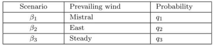
• Mod´elisation de l’incertitude afin de synth´etiser les impacts li´es aux diff´erents sc´enarios d’accident. Les sc´enarios doivent ˆetre ind´ependants et repr´esenter diff´erentes configurations possibles de la contamination.
• Analyse spatiale pour ´evaluer l’impact d’une contamination sur la glob-alit´e de l’espace ´etudi´e. Les caract´eristiques spatiales pourraient inclure
la possibilit´e d’interaction entre des zones g´eographiques contigu¨es ainsi que la possibilit´e de la pr´esence de plusieurs d´ecompositions spatiales.
Le probl`eme de l’IRSN est un probl`eme de classification ordinale (nota-tion du risque) [25]. il consiste `a partitionner un ensemble d’objets ´etudi´es en
classes d’´equivalence ordonn´ees pr´ed´efinies, appel´ees cat´egories. Dans notre cas, les objets ´etudi´es sont des unit´es g´eographiques. La notation de l’impact
d’un sc´enario donn´e sur une unit´e g´eographique doit prendre en compte la mani`ere dont les diff´erents enjeux sont impact´es `a la fois au niveau de l’unit´e
g´eographique et au niveau des unit´es voisines. Ainsi, les caract´eristiques spatiales, les crit`eres multiples et les sources d’incertitudes doivent ˆetre
syn-th´etis´es.
1.2.3
Formulation du probl`
eme
L’IRSN intervient dans le nucl´eaire en tant qu’expert et analyste pour l’ASN
3 et les pouvoirs publics. Il les fournit par des jugements d’experts, des
in-formations synth´etis´ees et des arguments solides soutenant et justifiant une
action `a entreprendre. L’IRSN n’a donc pas la l´egitimit´e pour prendre des d´ e-cisions. Dans une telle perspective, l’aide `a la d´ecision requise dans cette ´etude
de cas, vise `a fournir des outils compl´ementaires de gestion post-accidentelle, permettant d’´evaluer les impacts environnementaux et ´economiques, en
ten-ant compte des jugements d’experts. Ces impacts devraient ˆetre structur´es sur diff´erents indicateurs et synth´etis´es dans un seul indicateur repr´esentant
l’impact global. Le r´esultat de l’aide `a la d´ecision doit ˆetre justifi´e afin de convaincre le d´ecideur final.
Les objets ´etudi´es dans ce travail sont les unit´es g´eographiques de la zone
´
etudi´ee. Ces unit´es sont ´evalu´ees selon plusieurs crit`eres repr´esentant les im-pacts sur les enjeux ´economiques et environnementaux caract´erisant la baie.
Ces impacts peuvent d´ependre, d’une part, des param`etres d’accident, de sc´ e-narios d’accident, tels que la position de l’accident, l’intensit´e de l’accident,
les courants marins et, d’autre part, de la fa¸con dont les zones voisines sont affect´ees. Les impacts ´evalu´es sont repr´esent´es par des indices de risque. Par
cons´equent, nous avons affaire `a un probl`eme de notation du risque spatiale `a
crit`eres multiples.
Cette ´etude de cas consiste `a d´evelopper une aide `a la d´ecision pour:
• la mod´elisation des impacts des sc´enarios de pollution marine acciden-telle;
• synth´etiser les impacts sur les actifs consid´er´es pour chaque zone; • synth´etiser les sc´enarios envisag´es pour chaque zone;
• synth´etiser les caract´eristiques spatiales.
Le probl`eme est complexe pour des raisons techniques et scientifiques. Les difficult´es techniques du probl`eme r´esident dans:
1. la fa¸con dont la baie doit ˆetre d´ecompos´ee et le nombre d’unit´es g´ eo-graphiques `a consid´erer;
2. les sc´enarios d’accident `a consid´erer parmi l’infinit´e de sc´enarios
possi-bles;
3. la mani`ere de prendre en compte les jugements et les croyances des
experts dans notre analyse;
4. la fa¸con dont nous pouvons recueillir ou estimer les donn´ees relatives `a
certaines activit´es telles que la natation, la plong´ee...etc.
Les difficult´es scientifiques du probl`eme peuvent ˆetre d´ecompos´ees en:
• difficult´es spatiales: En supposant que les zones g´eographiques sont ho-mog`enes et ind´ependantes, ce sont des hypoth`eses tr`es fortes. Cepen-dant, ils sont n´ecessaires pour ´evaluer les impacts.
• difficult´es `a crit`eres multiples: Dans l’´evaluation des risques, les im-pacts sont repr´esent´es par des indices (notes). Afin d’agr´eger les im-pacts d’un accident sur les diff´erents enjeux, nous avons besoin d’une
m´ethode multicrit`ere bas´ee sur la r`egle de la majorit´e telle que les variantes d’ELECTRE-TRI ou sur des m´ethodes utilisant des r`egles
de d´ecision telles que DRSA. De telles m´ethodes n´ecessitent de con-naˆıtre les pr´ef´erences du d´ecideur (par exemple `a travers un
ensem-ble d’apprentissage) et de faire l’hypoth`ese de l’ind´ependance et de l’homog´en´eit´e des zones g´eographiques.
• difficult´es de la mod´elisation de l’incertitude: il est difficile d’´evaluer la probabilit´e qu’un sc´enario de pollution marine donn´e se produise en cas
d’accident. Cependant, ces informations sont tr`es importantes au cas o`u nous souhaiterions ´evaluer l’impact attendu en tenant compte des
diff´erents sc´enarios envisag´es.
• difficult´es li´ees `a l’ordre d’agr´egation: il existe six chemins d’agr´egation possibles:
– Multicrit`ere → sc´enarios → notation des cartes;
– Multicrit`ere → notation des cartes → sc´enarios;
– Notation des cartes → Multicrit`ere → sc´enarios;
– Notation des cartes → sc´enarios → Multicrit`ere;
– Sc´enarios → Notation des cartes → Multicrit`ere;
– Sc´enarios → Multicrit`ere → Notation des cartes;
La difficult´e r´eside ici dans la possibilit´e que le r´esultat d´epende du
chemin choisi.
1.2.4
Hypoth`
eses
Plusieurs probl`emes et questions ouvertes sont li´es `a notre cas d’´etude. Afin de r´esoudre le probl`eme, nous avons fait les hypoth`eses suivantes:
• Nous ne consid´ererons pas la sant´e publique comme un attribut. Cela est dˆu `a la politique publique adopt´ee en France: d`es qu’il y a un accident,
bas´e sur la qualit´e de l’eau, certains plans d’urgence sont activ´es comme l’interdiction de certaines activit´es comme la baignade ou l’´evacuation
des personnes vivant dans une zone.
• Nous ne consid´ererons pas les probl`emes sociaux, tels que la pauvret´e, comme des attributs. La prise en compte de tels attributs sera
re-dondante, car nous consid´ererons l’impact sur les diff´erentes activit´es ´
economiques qui auront `a leur tour un impact social.
• Nous supposerons que les unit´es g´eographiques sont homog`enes. L’utilisation de zones homog`enes est particuli`erement utile pour int´egrer et utiliser
des m´ethodes de surclassement dans les SIG, comme l’ont soulign´e plusieurs auteurs, dont [24, 61]. La raison en est que les m´ethodes de
surclasse-ment peuvent rencontrer des difficult´es car elles ont de s´erieuses limita-tions de calcul en ce qui concerne le nombre d’alternatives de d´ecision,
comme l’a remarqu´e Marinoni dans [73]. Outre les avantages mention-n´es pr´ec´edemment, le fait de supposer que les unit´es g´eographiques sont
homog`enes facilite l’ajustement des donn´ees collect´ees sur la d´ ecompo-sition spatiale.
• Nous supposerons que les unit´es g´eographiques contigu¨es sont ind´epen-dantes dans l’´evaluation des impacts sur les enjeux caract´erisant les unit´es g´eographiques. Apr`es avoir ´evalu´e les impacts, nous pourrions
consid´erer l’interaction entre les unit´es voisines si n´ecessaire, soit pen-dant l’agr´egation multicrit`ere (pour synth´etiser les impacts sur les
dif-f´erents actifs dans chaque unit´e g´eographique) ou pendant l’agr´egation spatiale (pour ´evaluer les cartes) comme dans [78]. Dans le cas o`u des
unit´es g´eographiques ayant les mˆemes impacts sont regroup´ees, il n’est pas n´ecessaire de faire cette hypoth`ese.
• `A des fins de simulation, nous substituons les pr´ef´erences du d´ecideur aux pr´ef´erences de l’expert.
1.3
Un processus d’aide `
a une d´
ecision
conva-incante
Plusieurs m´ethodes d’aide `a la d´ecision fonctionnent comme des boˆıtes noires o`u il est difficile de comprendre et d’appuyer une recommandation ou une
aide `a la d´ecision. Dans de nombreux probl`emes, un r´esultat non justifiable pourrait ˆetre acceptable. Cependant, dans le contexte de la prise de d´ecision
publique, telle que l’´evaluation des risques, une aide `a la d´ecision devrait ˆetre convaincante et justifiable.
1.3.1
Caract´
eristiques des probl`
emes d’aide `
a la d´
eci-sion
Aider `a d´ecider ou `a appuyer une d´ecision, dans la plupart des cas, n´ecessite trois ´el´ements principaux:
1. au moins deux entit´es doivent ˆetre impliqu´ees dans les processus d’aide `
a la d´ecision: la premi`ere entit´e est une personne ou un organisme
de-mandant une aide `a la d´ecision. Dans ce travail, nous ferons r´ef´erence `
a cette entit´e par client. La deuxi`eme entit´e est une personne ou un
organisme `a qui le client demande conseil. Dans notre contexte, ces con-seils interviennent lors de la formulation et de la r´esolution du probl`eme
d’aide `a la d´ecision. Nous ferons r´ef´erence tout au long de ce manuscrit `
a cette entit´e par analyste de d´ecision;
2. un contexte (caract´eristiques du probl`eme) qui comprend: une
connais-sance de l’objectif de l’aide `a la d´ecision; les parties prenantes impliqu´ees ou concern´ees par le r´esultat de la d´ecision; la l´egitimit´e des parties
prenantes; les caract´eristiques des objets ´etudi´es; et les caract´eristiques sous lesquelles les objets ´etudi´es sont ´evalu´es;
3. diff´erents types d’informations li´ees au contexte ou aux parties prenantes:
aider `a la d´ecision n´ecessite une connaissance, d’une part, des informa-tions techniques li´ees au contexte, telles que les diff´erents types d’incertitudes
entourant l’environnement du probl`eme, ou les interactions possibles en-tre les objets ´etudi´es; et d’autre part des pr´ef´erences de certaines parties
prenantes et leur l´egitimit´e pour influencer la d´ecision finale.
Ainsi, un mod`ele d’aide `a la d´ecision est construit en fonction des caract´ eris-tiques du probl`eme et des pr´ef´erences des d´ecideurs. Il consiste `a agr´eger les
diff´erentes informations de ces deux param`etres afin de d´eriver une recom-mandation. Le choix des m´ethodes et des outils d’agr´egation d´epend du type
d’aide `a la d´ecision demand´ee et de l’analyse du probl`eme sur la base de crit`ere(s) unique ou multiples; un unique ou multiple d´ecideur(s), un unique
ou multiples sc´enario(s).
1.3.2
Probl`
emes pratiques
Dans plusieurs probl`emes, aider `a d´ecider peut ˆetre difficile. C’est le cas lorsque:
1. certaines parties prenantes ne sont pas directement impliqu´ees dans le
processus de d´ecision et devraient ˆetre prises en compte dans l’analyse, comme les citoyens dans les probl`emes de prise de d´ecision de politique
publique;
2. plusieurs parties prenantes sont impliqu´ees dans le processus de prise de d´ecision avec diff´erents degr´es d’influence;
En ce qui concerne le point 3., le lecteur doit noter que toute m´ethode d’aide `a la d´ecision n´ecessite les pr´ef´erences des d´ecideurs afin d’´elaborer une solution.
Il existe diff´erentes techniques pour obtenir ces pr´ef´erences au cas ou notre client est l’unique d´ecideur: soit par le biais d’un processus interactif [50, 58],
soit en apprenant des d´ecisions pass´ees [56, 72]. Cependant, dans le cas o`u le client n’est pas un d´ecideur ou n’est pas le seul d´ecideur, l’apprentissage de
pr´ef´erences ainsi que la validation du mod`ele d’aide `a la d´ecision deviennent plus complexes. Dans le cas o`u les pr´ef´erences d’un expert sont utilis´ees pour
remplacer les pr´ef´erences des d´ecideurs, une solution convaincante (stable sous critique) devrait ˆetre d´eriv´ee afin d’ˆetre communiqu´ee aux diff´erentes parties
prenantes.
1.3.3
Projet de recherche
Afin de r´esoudre les probl`emes mentionn´es ci-dessus, nous nous sommes
con-centr´es sur le d´eveloppement d’une m´ethode d’aide `a la d´ecision multicrit`ere convaincante pour les probl`emes dans laquelle certains crit`eres sont ´evalu´es
sur une ´echelle ordinale. Le choix de travailler sur des probl`emes muticrit`eres de classification ordinale (notation) est dˆu au probl`eme de l’´etude de cas. Ce
dernier sera pr´esent´e dans la section suivante.
Dans le contexte de l’agr´egation multicrit`ere, o`u certains crit`eres sont ´ eval-u´es sur des ´echelles ordinales, nous utilisons souvent des m´ethodes bas´ees sur
la r`egle d’agr´egation majoritaire. De telles m´ethodes peuvent conduire `a dif-f´erents probl`emes d’intransitivit´e [15] li´es au th´eor`eme d’impossibilit´e d’Arrow
[65]. Cela rend l’apprentissage des pr´ef´erences des d´ecideurs, lorsque le client n’est pas un des d´ecideurs, `a partir de d´ecisions historiques insignifiant, car
nous ne pouvons pas valider le mod`ele d’aide `a la d´ecision et nous pouvons avoir des cycles de pr´ef´erences. Ainsi, nous appelons une classification ordinale
ou une notation “convaincante”:
cat´egorie pire. Un tel r´esultat n’est pas atteint pour les m´ethodes utilisant la r`egle majoritaire, car des cycles de pr´ef´erences traversant
diff´erentes cat´egories peuvent se produire;
• une ´evaluation efficace: une ´evaluation compl`ete o`u tous les objets sont ´
evalu´es dans un temps polynomial, sans ˆetre forc´es d’ˆetre affect´es `a la
mˆeme cat´egorie.
• une classification justifiable: la capacit´e de l’analyste `a justifier la clas-sification.
L’avantage d’utiliser une m´ethode de notation multicrit`ere convaincante r´eside
dans la flexibilit´e du r´esultat `a communiqu´es et justifi´es aux diff´erentes parties prenantes, et ceci quelle que soit leurs l´egitimit´es et leurs qualit´es d’ˆetre client
ou non. En outre, tirer des enseignements des d´ecisions pass´ees est logique en raison de la caract´eristiques susmentionn´ees d’une classification ordinale
“convaincante”.
Nous devons mentionner que malgr´e l’importance des sujets de recherche
suiv-ants, ces derniers sont hors de la port´ee de ce travail:
• La m´ethodologie de prise de d´ecision dans le contexte des probl`emes de la pollution environnementale. Nous nous concentrerons sur les
pro-cessus d’aide `a la d´ecision et en particulier sur la mise `a la disposition de notre client une description (notation) convaincante des impacts
induits par un accident nucl´eaire sans s’aventurer sur le processus de prise de d´ecision. Des r´ef´erences li´ees aux processus de prise de d´ecision
peuvent ˆetre trouv´ees dans [4, 95, 97].
• La prise de d´ecision par un groupe, plus de r´ef´erences li´ees `a ce probl`eme dans notre contexte peuvent ˆetre trouv´ees dans [12, 13, 41, 63, 74].
1.4
Conclusion
Il n’est pas rare dans les probl`emes environnementaux de faire face `a des situ-ations o`u le client a soit besoin d’avoir des arguments justifiant une aide `a la
d´ecision soit n’a pas un pouvoir d´ecisif. Notre objectif dans cette th`ese est de r´esoudre ces probl`emes dans le cas particulier des probl`emes de classification
ordinales (probl`emes de notation) en analyse multicrit`ere, o`u certains crit`eres sont ´evalu´es sur des ´echelles ordinales (probl`emes dans lesquels on utilise
des approches de surclassement). Ainsi, l’objectif de cette recherche est de d´evelopper une m´ethode de multicrit`ere de classification ordinale fournissant
un r´esultat “convainquant”. Un tel objectif consiste `a r´esoudre plusieurs prob-l`emes th´eoriques en relation avec le paradoxe de Condorcet, la question de
l’incomparabilit´e, la s´eparation entre profils limites et centraux dans les ap-proches existantes et l’interdiction des comparaisons entre objets.
Ce sujet de recherche est motiv´e par un cas d’´etude r´eel, o`u notre client (l’IRSN) demande des outils d’aide `a la d´ecision permettant d’´evaluer les
risques. L’´evaluation du risque consiste `a noter les unit´es g´eographiques en fonction de leurs impacts sur les diff´erents enjeux pr´esent dans chaque unit´e.
Les objets ´etudi´es, dans notre travail, sont les unit´es g´eographiques. Les enjeux sont consid´er´es comme des crit`eres permettant d’´evaluer les unit´es
g´eographiques. Par cons´equent, nous avons affaire `a un probl`eme de classi-fication multicrit`ere spatiale. En plus, plusieurs sc´enarios d’accident doivent
ˆ
etre envisag´es avec des probabilit´es diff´erentes. Ainsi, nous avons affaire `a un probl`eme de notation du risque multicrit`ere spatiale.
2
Introduction
Environmental risk problems, are in general characterized by the presence of different dimensions from which the problem might be apprehended. This
thesis is motivated by an interesting case study related to environmental risk assessment. The case study problem consists in assessing the impact of a
nuclear accident in the marine environment. The assessment of the marine pollution is widely studied in the literature. Most of these studies are focused
on simulating the physical dispersion process of pollutants. Such information is not sufficient to take informed decisions. This is because different impacts
might be assessed based on the intensity of the accident, the sea currents and the vulnerability of the assets characterizing the geographic area. As far as
we are concerned, we aim at studying the way risk associated to the marine pollution can be assessed in order to provide the interested stakeholders by a
common knowledge allowing to take informed decisions.
The problem we are dealing with is characterized by spatial characteristics,
different assets characterizing the spatial area, incomplete knowledge about the possible stakeholders, and a high number of possible accident scenarios.
Our focus in this work will be on:
• assessing the impact of a radioactive substance concentration on the assets in each geographic unit (small zones);
in order to rate the geographic units vulnerability;
• aggregating the different accident scenarios in order to assess the risk of a nuclear accident in the studied area.
To do so, decision science propose numerous tools allowing to deal with
this type of problems. A first solution of the case study problem was pro-posed where different decision analysis techniques were used such as lotteries
comparison, and MCDA, Multiple Criteria Decision Analysis, tools. Different theoretical problems raised from this case study, such as:
1. should we aggregate scenarios before criteria, or should we proceed in
the reverse order?
2. should we consider the interaction between neighboring geographic units?
3. In case our client is not the final decision maker, how should we provide a “convincing”1 solution?
In this work, we decided to develop the third point. For the first point the aggregation order is very important and represent an interesting research
ques-tion. However, in my opinion, the question depends on the client needs. A way to tackle this problem is to define with a set of examples where the client
is able to rate the risk, and to chose the aggregation order with the highest accuracy. Considering interaction between neighboring units is also an
inter-esting question, which was studied in the literature and solved using Choquet integrals and by considering geographic units as criteria. Also, in problems of
the type we are dealing with, it is very frequent to have geographic units with the same impact. On the one hand, this can be due to the physical continuity.
On the other hand it is very likely that the assets involved in neighboring units have the same importance.
The method used to solve the MCDA problem associated to the case study is the rating method ELECTRE-Tri, because the criteria are assessed on
or-dinal scales. ELECTRE-Tri, as most of the majority principle2 based meth-ods, is subject to Condorcet Paradox3. The idea behind the ELECTRE TRI
method is to not compare the studied objects to each other, but to rate them based only on their relative position with typical profiles characterizing the
ratings. However, on the one hand, a decision analyst has no right to forbid his client from questioning the relative position of two rated studied objects,
and on the other hand, it is not acceptable that an object x worse than y is rated better than y. Even if we assume that the parameters used to rate the
studied objects might be different from the ones used to compare objects, our literature review revealed that there is no rating procedure aiding to rate some
objects better than others which are worse when directly compared. For these reasons, we decided to undergo the construction of a new MCDA method. The
aim of the developed rating method is to provide a rating that we are com-pletely able to justify: no better object is assigned to a worse category. This
method provided interesting results to the case study, and very interesting theoretical properties that will be detailed later in this manuscript.
The manuscript is organized, in five chapters, as follow:
1. Chapter 1. Problem setting: In this chapter, we present the general context related to both the practical and the theoretical problems
char-acterizing this thesis.
2. Chapter 2. State of art: In this chapter, we present the main
theoret-ical tools in decision science aiming to deal with multicriteria decision support systems, risk analysis and spatial decision support.
3. Chapter 3. Case study: In this chapter, we model the client’s problem.
This consists on modeling impacts induced by nuclear accident scenarios
2Making an action corresponding to a sufficient majority of criteria 3Cycles of preferences
on the involved assets in the studied area. Then we solve the multiple criteria problem. Several conclusions are drown, mainly concerning
in-coherences over the rating.
4. Chapter 4. Dynamic-R and its variants: In this chapter, we present the
new MCDA rating method. The proposed method aims at providing a justifiable rating, which is also consistent.
5. Chapter 5. Experimental study. The first part of this chapter, is ded-icated to present algorithms related to the main concepts introduced
in Dynamic-R. We then apply the developed method to an imaginary example with randomly generated data, where we experiment different
intuitions that drove the development of the method. We end the chap-ter by an application on the case study where the resulting rating is
3
Problem Setting
3.1
Introduction
Aiding to decide or supporting a decision in most of the cases requires in-formation related to decision-makers preferences. However, in many decision
aiding problems, the client (the entity requiring a decision aiding) is not a decision maker, or at least, not the only decision maker. For instance, the
client can be a company in charge of providing expertise to a final decision maker. Likewise, it is possible that several stakeholders have to be taken into
consideration. It is the case in many problems related to public decision mak-ing, and particularly in environmental risk assessment. For instance, citizens
do not intervene directly in the decision making process, however, they will be impacted by the outcome of the decision; hence, it is important for a decision
aiding to be “convincing” (stable under criticism), so that it can be reported to the final decision maker or justified to the different stakeholders.
Our research is driven by a real case study, concerning environmental risk assessment, specifically, a case of a nuclear accident in a marine environment.
The term “environmental risk” covers a wide range of phenomena related to the interaction between human activities and environmental areas. Risk is
generally defined as an association of the hazard to the vulnerability. Hence, taking into account the hazard in the decision aiding process requires
un-certainty modeling tools while taking into account the vulnerability requires assessing the impact of a given nuclear accident on different assets present
in different geographic areas. Thus, assessing the vulnerability involves spa-tial analysis and MCDA tools in order to evaluate the impact of a nuclear
accident over the assets involved in the studied area. In our case study, the client is the IRSN (Institut de Radioprotection et de Sˆuret´e Nucl´eaire
https://www.irsn.fr/FR/Pages/Home.aspx), a French government agency in charge of providing expertise to public authorities for problems in relation
with the nuclear sector. Hence, our client is not the final decision maker.
Several decision aiding problems are characterized by the presence of sev-eral dimensions, named criteria, under which a problem can be described, and
hence a decision aiding can be built. Such problems are referred to in the asso-ciate literature by Multiple Criteria Decision Analysis (MCDA) problems. In
this work, we are concerned by a particular type of MCDA problems, in which we partition a set of studied objects, also called in the associate literature
alternatives or actions, into predefined ordered equivalence classes, called cat-egories. Such problems are called rating problem statements [25]. Our aim in
this work is to provide a complete and “convincing” rating for such problems. By complete, we mean any rating procedure which can rate consistently the
whole set of objects given. The term convincing will be discussed in section 3.3.
This chapter is organized as follow. The second section is dedicated to present and describe the case study motivating our work and the hypothesis
made for simplification. In the third section, we present the research project.
3.2
Case Study
The idea of developing a convincing MCDA rating method, comes from a case
study concerning post-accident nuclear risk assessment, specifically a case of environmental risk assessment. Environmental risk problems involve different
assets, and different types of stakeholders, such as citizens, companies, NGO (Non-Governmental Organizations), public authorities, to name but a few.
Our client in this work is the IRSN1, a French government agency of expertise and research in radiation protection and safety of nuclear installations. In this
section, we will present the IRSN’s problem and the objective of the decision aiding required. Then, we will present the characteristics of the problems and
the hypothesis made in this work.
3.2.1
IRSN’s Problem
Our case study concerns the management of a major nuclear accident in a
marine environment and is studied through the simulation of releases from a nuclear submarine at the bay of Toulon, where one of the most important
bases of the French Navy is located. In case of a nuclear accident, the incum-bent Prefect (the regional authority), and other stakeholders, need synthetic
information to support decisions, such as banning certain economic activities, setting a new water management policy at each relevant zone or impeding the
access to specific areas. The IRSN is in charge of a research project aiming at improving models predicting the radioactive substances dispersion and
assess-ing their impact on the environment2. The impact assessment of an accident on the marine environment, before this work, was based on the concentration
of different isotopes in each geographic unit: A highly impacted area is an area with a high contamination level. Based on the concentration in water
and in the marine organisms, many decisions were undertaken based on norms, e.g. the Maximum Eligible Levels. Based on these norms, the undertaken
de-cisions are prohibition measures, such as banning some economic activities. However, the population may react to an information about the presence of a
low concentration levels in an area.
1More information can be found at http://www.irsn.fr 2
https://www.irsn.fr/FR/Larecherche/Organisation/Programmes/Amorad/ Pages/projet-Amorad.aspx#.XJeYzi17RQI
Despite the existing literature aiming at understanding the processes gov-erning the fate of radionuclides in the environment, [5, 6, 7], we note that the
concentration of a given isotope is a necessary but not sufficient information for making informed decisions. Let us consider the example of two geographic
zones: the first one is characterised by an average concentration level and very important economic and environmental assets while the second one is highly
contaminated but does not present any economic or environmental relevance. Clearly, the involved stakeholders will be differently sensitive to the impacts
in both geographic plots.
Several papers have been proposed to address the problem of nuclear risk
assessment, see [9, 86, 99, 103, 107]. Most of previous works rest upon opera-tional research analyses and very few papers addressed the post-accident risk
assessment from a multiple criteria decision analysis point of view, see [8, 77]. Our role in this project consists on developing decision aiding tools in order
to:
1. assess the impacts of different accidental marine pollution scenarios on the different assets involved in the Bay of Toulon;
2. synthesize these impacts by structuring indicators in order to provide the interested stakeholders, by a common knowledge allowing to take
informed decisions.
3.2.2
Problem’s Characteristics
The bay of Toulon is surrounded by five municipalities: Toulon, La
Seyne-Sur-Mer, Pradet, Saint-Mandrier, and La Garde. The bay is also characterized by maritime activities such as professional fishers, fish-framing, and tourism
activities such as swimming and diving. Moreover, it is an important natural area of ecological faunistic and floristic interest due to the presence of
sea-grass Posidonia, which is very important for sea-life. Hence, our case study is characterized by several stakeholders representing the public authority in the
different territories, the citizens and the heads of the companies. In addition, the case study requires different competencies in decision science in order to
develop a decision aiding model, mainly:
• MCDA in order to synthesize the impact of a given concentration on the assets involved on the area.
• Uncertainty modeling in order to synthesize the impacts related to dif-ferent accident scenarios. The scenarios should be independent and rep-resent different possible configurations of contamination.
• Spatial analysis in order to rate the impact of a concentration over a map. The spatial characteristics might include the possibility of inter-action between contiguous geographic zones as well as the possibility of
the presence of several spatial decompositions.
The IRSN’s problem is a rating problem [25]. It consists on partitioning a
set of studied objects into predefined ordered equivalence classes, called cat-egories. In our case, the studied objects are geographic units. Rating the
impact of a given scenario on a geographic unit has to take into account the way the different assets are impacted in both the geographic unit and in
neigh-boring units. Thus, spatial characteristics, multiple criteria, and uncertainties have to be synthesized in order to provide the IRSN by a common knowledge.
3.2.3
Problem Formulation
The IRSN acts in the nuclear sector as an expert and analyst for the ASN3
and the public authorities. It provides them by expert judgments, synthe-sized information and strong arguments supporting and justifying an action
to take. Thus, IRSN does not have the legitimacy to take decisions. Un-der such a perspective, the decision aiding required in this case study, aims at
providing supplementary post-accident management tools allowing to evaluate
environment and economic impacts, taking into account expert’s judgments. These impacts should be structured on different indicators, and synthesized in
a single indicator representing the global impact. The outcome of the decision aiding should be justified in order to convince the final decision maker.
The studied objects in this work are the geographic units in the studied area. These units are assessed under several criteria representing the impacts
on economic and environment assets characterizing the Bay. These impacts might depend, on the one hand, upon accident parameters, named accident
scenarios, such as the accident position, the intensity of the accident, the sea currents, and on the other hand, upon the way neighboring zones are
impacted. The assessed impacts are represented by risk rates. Hence, we are dealing with a spatial multiple criteria rating risk problem.
This case study consists on developing decision aiding for:
• modeling the impacts of accidental marine pollution scenarios; • synthesizing the impacts over the considered assets for each zone; • synthesizing the considered scenarios for each zone;
• synthesizing the spatial characteristics.
The problem is complex for technical and scientific reasons. The technical difficulties of the problem lie on
1. the way the Bay should be decomposed and on the number of geographic units;
2. the accident scenarios that should be considered, since in reality, there exist infinite possible scenarios;
3. the way to take into account experts judgments and beliefs in our anal-ysis;
4. the way we can collect or estimate data related to some activities such as swimming, diving, to name but a few.
The scientific difficulties of the problem can be decomposed on:
• spatial difficulties: Assuming that the geographic zones are homoge-neous and that they are independent, are very strong assumptions.
How-ever, they are necessary in order to assess the impacts.
• multiple criteria difficulties: In risk assessment, the impacts are rep-resented by rates. In order to aggregate the impacts of an accident on different assets, we need an MCDA method based on either the majority
rule such as the variants of ELECTRE-TRI or methods using decision rules such as DRSA. Such methods require knowing the decision maker’s
preferences, for instance through a learning set, and the independence and the homogeneity of the geographic zones.
• uncertainty modeling difficulties: It is difficult to assess the likelihood of a given marine pollution scenario occurring in case of an accident.
How-ever, such information is very important in case we want to assess the expected impact taking into account the different considered scenarios.
• order of aggregation difficulties: there are six possible aggregation paths: – Multiple criteria → scenarios → maps rating;
– Multiple criteria → maps rating → scenarios;
– Maps rating → multiple criteria → scenarios;
– Maps rating → scenarios → multiple criteria;
– Scenarios → maps rating → multiple criteria;
– Scenarios → multiple criteria → maps rating;
The difficulty here lies on the possibility that the result depends on the chosen path.
3.2.4
Hypothesis
Several problems and open questions are related to our case study. In order to solve the problem, we made the following hypothesis:
• We will not consider the public health as an attribute. This is due to the public policy adopted in France: as soon as there is an accident, based
on water quality, some emergency plans are activated such as forbidding some activities such as swimming or evacuating people living in some
area.
• We will not consider as attributes social issues such as poverty. Con-sidering such attributes will be redundant, since we will consider the
impact upon different economic activities which in their turn will have a social impact.
• We will assume that the geographic units are homogeneous. The use of homogeneous zones is particularly useful for integrating and using
outranking methods in GIS, as underlined by several authors, including [24, 61]. The reason is that outranking methods may run into
difficul-ties since they have serious computational limitations with respect to the number of decision alternatives, as remarked by Marinoni in [73].
Assuming that the geographic units are homogeneous facilitates fitting the collected data on the decomposition of the spatial area.
• We will assume that the contiguous geographic units are independent in the assessment of the impacts on the assets present in the geographic
units. After assessing the impacts, we might consider the interaction be-tween neighboring units if it is needed either during the MCDA
aggrega-tion (to synthesise the impacts on the different assets in each geographic unit) or during the spatial aggregation (to rate the maps) such as in [78].
In case geographic units having the same impacts are grouped, there is no need to revise such hypothesis.
• For simulation purposes, we substitute the decision maker’s preferences by the expert’s preferences.
3.3
Convincing Decision Aiding Process
Several decision aiding methods work like black-boxes where it is difficult to understand and support a recommendation or a decision aiding. In many
problems, a non-justifiable result could be acceptable. However, the decision aiding in the context of public decision making, such as risk assessment, should
be convincing and justifiable.
3.3.1
Characteristics of Decision Aiding Problems
Aiding to decide or supporting a decision in most of the cases requires three
main components:
1. at least two entities must be involved in the decision aiding processes:
the first entity is a person or an organism requesting a decision aiding. In this work, we will refer to this entity by client. The second entity
is a person or an organism to whom the client demands an advice. In our setting this advice occurs under formulating and solving the decision
aiding problem. We will refer all along this manuscript to this entity by decision analyst;
2. a context (problem’s characteristics) which includes: a knowledge about
the objective of the decision aiding; the stakeholders involved or con-cerned by the outcome of the decision; the legitimacy of the
stakehold-ers; characteristics of the studied objects; and the features under which the studied objects are assessed;
3. different types of information either related to the context or to the stakeholders: aiding to decide requires knowing on the one hand
tech-nical information related to the context, such as the different types of uncertainties surrounding the environment of the problem, or the
pos-sible interactions between the studied objects; and on the other hand some stakeholder’s preferences and their legitimacy to influence the final
decision.
Thus, a decision aiding model is built based on the problem’s characteristics and the decision makers preferences. It consists on aggregating the different
information from these two parameters in order to derive a recommendation. The choice of the aggregation methods and tools depends on the type of
the decision aiding required and on whether the problem should be analysed based on single or multiple criteria; single or multiple decision makers, single
or multiple scenarios.
3.3.2
Practical Problems
In several problems, aiding to decide can be hard. It is the case when:
1. some stakeholders are not directly involved in the decision process and should be taken into account in the analysis such as citizens in public
policy decision making problems;
2. multiple stakeholders are involved in the decision making process with
different degrees of influence;
3. the client is not a decision maker.
With respect to point 3. the reader should note that any decision aiding method requires preferences in order to elaborate a solution. There exist
different techniques to elicit preferences in case the client is a decision maker: either through an interactive process [50, 58], or through learning from past
decisions [56, 72]. However, in case the client is not a decision maker or is not the only decision maker, learning preferences as well as validating the decision
aiding model becomes more complex. In case an expert’s preferences are used in order to substitute the decision makers preferences, a convincing (stable
under criticism) solution should be derived in order to be communicated to the different stakeholders.
3.3.3
Research Project
In order to tackle the above mentioned problems, we focused on developing
a convincing multiple criteria decision aiding method for problems in which some criteria are assessed on ordinal scales. The choice of working on multiple
criteria rating problems is due to the case study problem. This last will be presented in the next section.
In the context of MCDA, where some criteria are assessed on ordinal scales, we often use methods based on the majority principle. Such methods may lead
to different problems [15] related to Condoret paradox (as a special case of the Arrow’s impossibility theorem [65]). This makes learning the decision makers
preferences, when the client is not a decision maker, from historical decisions meaningless, as we cannot validate the decision aiding model and we might
have cycles of preferences. Thus, we refer to a “convincing” rating as:
• a monotonic rating: no better object assigned to a worse category. Such result is not fulfilled for methods using the majority rule, since
cycles of preferences crossing different categories might occur.
• an efficient rating: a complete rating where all objects are rated in a polynomial time, without being forced to be assigned to the same category.
• a justifiable rating: the ability of the decision analyst to justify the rating.
The advantage of using a convincing MCDA rating method, lies on the flexibil-ity of the result to be communicated and justified to the different stakeholders,
regardless of their legitimacy and their quality of being clients or not. More-over, learning from past decisions makes sense because of the above mentioned
characteristics of a “convincing” rating.
We have to mention that the following research topics are out of the scope of
this work:
• Decision making methodology in environmental pollution. We will focus on decision aiding processes and particularly on providing a client by a convincing description (rating) of the impacts induced by a nuclear
accident without making any recommendation. More references can be found in [4, 95, 97].
• Group decision making. More references related to this problem in our context can be found in [12, 13, 41, 63, 74].
• Protocols for preferences elicitation [50, 56, 58, 72].
3.4
Conclusion
It is not seldom in environmental problems to face situations where the client
has no decisive power, or s.he requires a justifiable decision aiding. Solving these issues is our goal in this thesis, in the particular case of MCDA rating
problems where some criteria are assessed on ordinal scales (problems to which outranking methods fit). Thus, the objective of this research is to develop an
MCDA rating method providing a “convinicing” rating. Such aim consists on solving several theoretical problems in relation with the Condorcet Paradox,
the incomparability issue, the separation between limiting and central profiles in the existing approaches, the prohibition of comparisons among objects.
This research topic is motivated by a real case study, where our client (The IRSN) asks for decision aiding tools allowing risk assessment. Assessing
risk comes to rating the geographic units based on their impacts regarding the different assets in each unit. The studied objects, in our work, are the
geographic units. The assets are considered as criteria allowing to evaluate the geographic units. Likewise, several scenarios of accident should be considered
with different likelihoods. Thus, we are dealing with a multiple criteria spatial risk rating problem.
4
State of art
4.1
Introduction
For centuries voices have been raised advising us to take time to reflect, to cal-culate, to anticipate before reaching a decision and acting on it. (B. Roy[92]).
In the previous chapter, we presented different problems associated to my research topic and to the case study. We also mentioned different hypothesis
that will be considered as our starting point, and different topics that will be out of the scope of this work but that might be seen as perspectives. Our
research project involves different theoretical and technical problems. The theoretical problems, in our concern, consist on developing a “convincing”
MCDA rating method for problems requiring the use of the majority rule. The term “convincing”, in our context, refers to a complete and consistent
rating such that “no better object assigned to a lower category”. Such results are achieved, through a new method that will be presented later in this
manuscript. The different preference modeling and multicriteria aggregation techniques, used in the developed method, will be presented in this chapter.
The technical problems are related to the case study. As mentioned in the previous chapter, our client is not a decision maker and the decision maker
is not clearly identified, leading to several questions about the way we might take into account the decision maker’s preferences over the different impacted
assets. The case study, at the origin of this work, is in a crossroad between MCDA modeling, risk assessment, spatial analysis, leading to a complex
sit-uation. The methods and the recent developments that will be required to address these technical problems will be also presented in this chapter.
The chapter is organized as follows: the first sections we will be dedi-cated into introducing the main decision aiding concepts and the preference
modeling tools. Then, we will present different decision aiding approaches for problems involving multiple criteria (MCDA problems). We end by a
littera-ture review about spatial decision support systems and risk analysis.
4.2
Main Definitions
Before any further developments, I will introduce the definitions of ”decision aiding process”, ”client”, ”decision maker”, and ”decision analyst”.
Definition 1. (Decision aiding process)
According to Tsouki`as [100], a decision aiding process is an interactive process between an entity having a decision problem, and an entity in charge
of building a consensual representation of the problem.
Definition 2. (Client)
Client is the intervening entity in the decision process, on whose account
the decision aiding is exercised. Such entity might be a person or an organism.
Definition 3. (Decision maker)
A decision maker is the entity having the power and the responsibility of
taking a decision.
Definition 4. (Decision Analyst)
Decision analyst is the entity in charge of analysing the problem in order
to support the client in the decision problem. For simplicity we will use the “analyst” instead of “decision analyst”.
To synthesize the above mentioned definitions, decision aiding can be seen as the activity of the analyst: providing answers to the client’s problem based
on, explicit but not necessarily formalized, models. The client is not necessar-ily a decision maker, he can be also an analyst for another entity. For example,
in case of a nuclear accident, the prefect might ask the IRSN for expertise. This last might ask a decision analyst to provide a formalism, allowing the
aggregation of the way different assets are impacted in each zone.
4.3
Decision Aiding Process
In this section, I will start by a joke that my PhD supervisor1, told me when I chose to work on multiple criteria decision aiding science.
A tailor (T) conceived a bent suit to one of his clients (C).
• C: Sir the suit is bent.
• T: No sir, you have just to bend your shoulders to fit on it.
When people saw the client C leaving the T shop, they said:“ what a wonderful tailor, he succeeded on conceiving an adjusted suit to a bent person.”
This story illustrates the possibility to solve correctly a wrong problem
when we force a decision to fit on a predefined model. The origin of the problem might come from the nature of the decision aiding activity. In fact,
decision aiding is not limited to well structured problems, and can constitute an interesting subject of scientific investigation. To provide the client by
el-ements allowing him to take an informed decision, the analyst and the client are committed in an interactive process aiming at defining the client’s
prob-lem, its characteristics and the objective of the requested decision aiding (see Bouyssou et al in [19]).