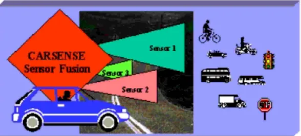
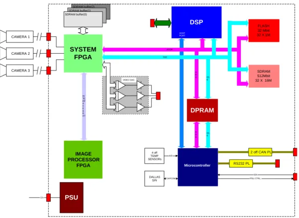
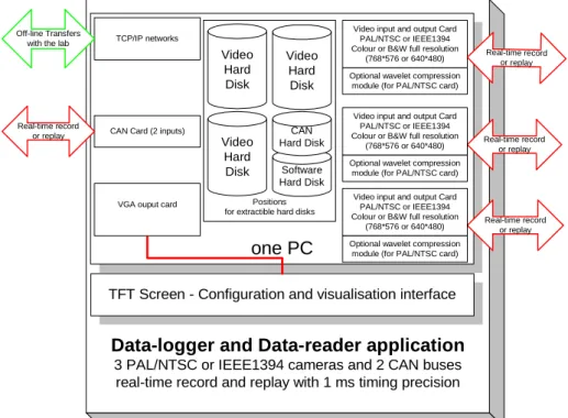
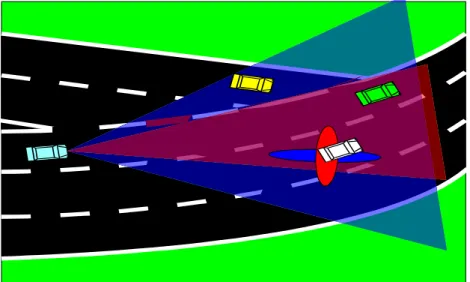
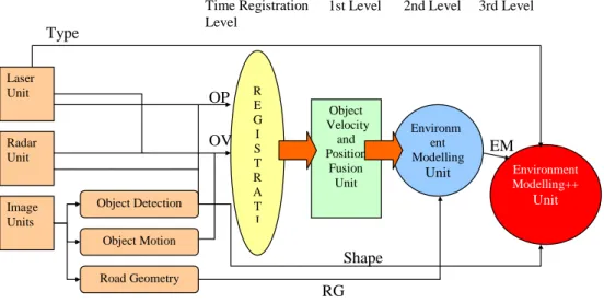
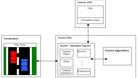
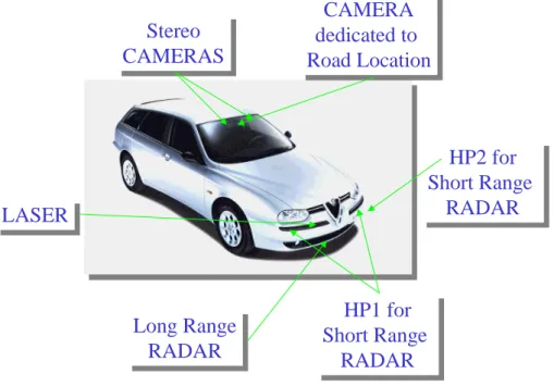
Sensing of Car Environment at Low Speed Driving
Texte intégral
Figure
Documents relatifs
A document, NIC (5480) is available in the NIC collection describing it. UCSB is also using their NCP for local interprocess communication experiments. They are using UCSB
Service type templates define the syntax of service: URLs for a particular service type, as well as the attributes which accompany a service: URL in a service
The adjective expression “ opened cyst ” , its acronym “OC”, and its definition, to qualify more precisely the total cystectomy, were accepted by a majority of voters (median:
And we believe that today, data journalism is a premier type of such intermediaries, because data journalists combine the expertise of how to access, interpret,
The immediate aim of this project is to examine across cultures and religions the facets comprising the spirituality, religiousness and personal beliefs domain of quality of life
Application of Database Management to Geographical Information Systems (GIS); Geospatial Databases; spatial data types [point, line, polygon; OGC data types], spatially-extended SQL
Asehraou Abdesslam (Prof. FS-Oujda, Morocco) Aziz Amine (Prof. FST Mohammedia, Morocco) Belkhou Rajae (Prof. EST-Fès), Morocco) Bennani Laila (Prof. ISPITS-Fès, Morocco)
Afterward, in two dimensions, we prove that the second- and the third-order accurate fully-discrete ALE-DG methods satisfy the maximum principle when the bound-preserving
