Highlands of Cameroon: a Consequence of Farmland
Erosion and Runoff
1
Henri Grisseur Djoukeng,
2Christopher Mubeteneh Tankou and
1Aurore Degré
1
Department of Biosystems Engineering, University of Liège Gembloux Agro-Bio Tech, Gembloux, Belgium
2
Department of crop production, Faculty of Agronomy And Agricultural science, University of Dschang, Dschang, Cameroon Corresponding Author’s E-mail: hgdjoukeng@doct.ulg.ac.be
Accepted 20th March, 2015
In the Western Highlands agro-ecological zone of Cameroon, rivers are constantly silted and polluted with eroded sediment and waste from cultivated land. This study characterizes and quantifies the amount of material coming from plots cultivated in the Méloh Watershed. In a natural rocky-bottomed well measuring 0.90 m deep, 3 m long, and 2.5 m wide, for a period of three years we performed the collection, differentiation, and measurement of trapped sediment in the cultivated part of river that runs through the watershed. Both cultivated sides of the watershed had fairly regular slopes of 14% on one side and 17% on the other side. The material retrieved consisted of soil, plant residues, chemical packages, and plastic casing used for irrigation. During the years 2012 and 2013, farmers practiced both flatbed cultivation and ridging along the steepest slopes. These two methods of land preparation are inefficient in terms of water conservation, as evidenced by the collection of 10.429 t.ha-1 average total sediment per year during this period. Tied ridging cultivation method was experimented during the 2013 crop year and adopted on 75% of plots in 2014. We subsequently collected 3.586 t.ha-1 total sediment, a decrease of 65.61% compared to the average of previous years. The tied ridging cultivation method significantly reduced siltation of the Méloh River (p<0.05). This study showed that traditional agricultural practices are a principal cause of siltation and pollution of the Méloh River. By extrapolation, we can state that the problem must occur in almost all rivers in the study area with similar topography and agricultural practices.
Keywords: Cameroon, Pollution, Rivers’ siltation, Water conservation, Méloh Watershed
INTRODUCTION
For several centuries, human activities have contributed to accelerating erosion and siltation, creating an imbalance that results in the loss of agricultural land, decreased water retention capacity in forests, a higher frequency of floods, faster filling of the reservoirs, and the accumulation of fine sediments in rivers (Vachon, 2003; Ward and Robinson, 1990). Water is one of the most important natural resources and helps maintain the balance of global ecosystems; it directly affects food security, socioeconomic development, and health. Sustainable land management and the protection of water resources are not only technical issues, but first and foremost social and economical ones (Anctil et al., 2012; Petretti, 1997; Soutter et al., 2007; Martin, 2010;
Giret, 2007). The Western Highlands agro-ecological zone of Cameroon is characterized by a high population density and rapid population growth (RGPH, 2010). In this area where land tenure is quite complex, farmers cultivate the steepest slopes (> 25%) for the production of vegetable crops (Valet, 1999). In order to facilitate the cultivation of the land, these farmers create flat seedbeds or form ridges along the slopes. These two methods of land preparation do not include any measure of water conservation (Fotsing, 1994). They facilitate runoff and therefore induce the transport of pesticides, fertilizers, and sediment to rivers. According to a farmer of this area, mountain agriculture is the most significant human activity contributing to the siltation of rivers.
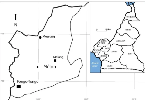
Figure 1: Geographical location of research site
Source: National Institute of Cartography Cameroon, 2013 (INC, 2013).
Rivers are the main source of household drinking water, and it is in these same rivers that farmers clean phytosanitary treatment equipment.
The most recent studies conducted on the use of water resources in Cameroonian rivers took place in the 1980’s (Olivry, 1986); these studies focused primarily on the assessment of river discharges without reference to problems provoked by local agricultural practices in hilly terrain. The population of the Western Highlands of Cameroon consists of 90% farmers (DSCE, 2009). As this population depends exclusively on river water, our challenge is to find ways to preserve land and water quality. For more than 10 years people have presented complaints about the water quality of the Méloh River, which carries the smell of plant protection products. According to the same source this river is sometimes completely blocked at certain levels of its course by sediments from cultivated plots, especially in the dry season when water flow is minimal. On these occasions the community organizes an effort to recanalize. During this period 60% of the population travels a distance between 1 to 3 km in search of water. In Central Europe, several studies have found the effectiveness of some techniques that help to fight siltation and the pollution of roads, residential houses, and rivers. Among these techniques are tied ridging, filter trips, and riparian forest
buffers, which have a sediment retention efficiency of between 70% - 98%, 80% - 90%, and 74% - 90% respectively (Bergue and Ruperd, 2000; GISER, 2013; TOPPS, 2014).
The overall objective of this study was to assess the impact of local agricultural practices and the effect of tied ridging on the siltation and pollution of the Méloh River. To achieve our goal, we worked towards two specific objectives:
1. to characterize and quantify the sediment leaving cultivated plots and migrating to the river bed;
2. to analyze and compare changes in siltation over time.
MATERIALS AND METHODS Study area
The experiment was conducted in the village of Méloh in Fongo-Tongo subdivision (Figure 1) found between the geographical coordinates 5° 27'- 5°37'N and 9° 57'-10°05'E (ECAM3, 2008).
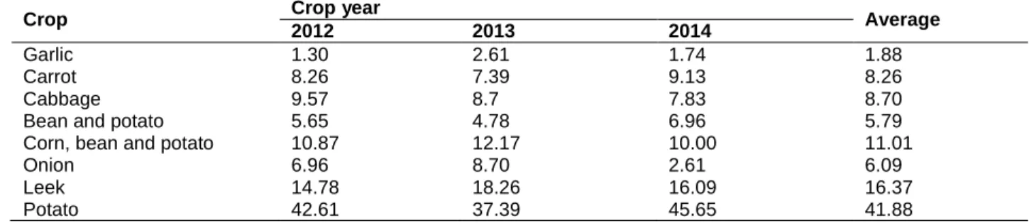
This village is one of the largest sites of truck farming production in the Western Highlands of Cameroon, which is the main production area of food in the Central
N
Garlic 1.30 2.61 1.74 1.88
Carrot 8.26 7.39 9.13 8.26
Cabbage 9.57 8.7 7.83 8.70
Bean and potato 5.65 4.78 6.96 5.79
Corn, bean and potato 10.87 12.17 10.00 11.01
Onion 6.96 8.70 2.61 6.09
Leek 14.78 18.26 16.09 16.37
Potato 42.61 37.39 45.65 41.88
1.1
Source: Computed from field survey
Figure 2: Climate data from the research site Source: Computed from field data
Climatic data of the study area
Climate data represented in the Ombrothermic diagram (Figure 2) are the average temperature and rainfall readings of three experimental years (from 2012 to 2014). These data were collected on site using a rain gauge for rainfall and an ambient air thermometer for temperature.
Hydrography of the study area
The Méloh Watershed is crossed by a river that originates in the Bamboutos mountain range and is
named after the village. The watershed of the Méloh River at the location of our sediment trap has an area of 31.5 ha and drains a 1,300 m watercourse whose width varies between 2 m and 3.5 m.
Data collection
To measure the impact of agricultural practices on the silting of the Méloh River we installed a sediment trap in an inactive natural rocky-bottomed well measuring 0.90 m deep, 3 m long, and 2.5 m wide (Figure 3). The sediment trap was isolated to prevent it receiving sediment from upstream and from water flowing over the Figure 1: Climate data from the research site
Source: Computed from field data 0.010.0 20.0 30.0 40.0 50.0 60.0 70.0 80.0 90.0 100.0 110.0 120.0 130.0 140.0 150.0 0 20 40 60 80 100 120 140 160 180 200 220 240 260 280 300 Jan uar y Fe bru ar y Ma rch April May June July Au gu st Se ptem be r Oc to be r N ov em be r De ce m be r A ve rag e Te m pe ratu re (° C) A ve rag e R ai nfal l (m m ) Time (month) Average Rainfall (mm) Average Temperature (°C)
A: Well 7 days after the rain
B: Well immediately after rain during full vegetative cover C: Well immediately after rain during weeding and hoeing Figure 3: Presentation of the sediment collection well Source: Author images, 2012
Table 2: Collected sediment per slope per soil preparation method (t.ha-1)
Soil preparation method 11% slope 29% slope
Flatbed 13.40 22.45
Ridging along the steepest slopes 17.30 33.45
Tied ridging 2.66 6.30
Source: Computed from field data, 2013.
rocks. The natural well received heterogeneous sediments from cultivated land on both sides covering a total area of approximately 7.5 ha. The two sides had fairly regular slopes of 14% and 17% cultivated up to 150 m from the ridge on one side and 100 m on the other side. From the year 2012 onwards, the well was checked after each rainfall and measurements were taken at regular time intervals for three years from March until October. The collected and measured sediments consisted of soil, plant residues, and other wastes (chemical packages, plastic casing used for irrigation, and food packages). These sediments were dried for 5 days in a covered, well ventilated room and weighed with a scale of 50 kg maximum capacity. Measurements taken included the sediments’ physical characteristics and their respective quantities, the time and location.
During the 2013 crop year, we experimented with the cultivation of the potato using tied ridging in an attempt to reduce surface erosion. Its effectiveness was tested by comparing the amounts of runoff and sediment obtained from three types of land preparation, namely: the flatbed method; ridging along the steepest slopes; and tied ridging.
Table 2 gives the means of collected sediment in each slope according to the soil preparation modes.
Data analysis
The statistical analysis used here is the general regression and analysis of variance (ANOVA) at the probability level of 5% using MINITAB16 software. We compared the average values of the measurements taken during the years 2012 and 2013 relative to 2014 measurements. Data from the 2012 and 2013 crop years were obtained while farmers prepared the ground flat or with ridging along the steepest sloping; we experimented with tied ridging during the 2013 crop year on 160 m2 and 2014 data is taken when farmers had adopted this technique on 75% of their plots.
RESULTS
Siltation evolution
Figure 4: Siltation evolution over time Source: Computed from field data
Total annual collected sediment and rainfall
Table 3: Total quantities of collected sediment (t.ha-1) and total rainfall (mm)
Sediment Crop year
2012 2013 2014 Soil 9,858 10,755 3,501 Plant residues 0,127 0,092 0,080 Other wastes 0,012 0,014 0,005 TOTAL SEDIMENT 9,997 10,861 3,586 TOTAL RAINFALL 1517.4 1638.0 1529.2
Source; Computed from field data
Change in sediment character over time
Figure 5: Evolution of different sediment amounts over time Source: Computed from field data
Figure 1: Siltation evolution over time
Source: Computed from field data
0.000 0.500 1.000 Co lle cte Time (month) 2013 2014 New agricultural practices over 75% of the watershed
Change in sediment character over time (figure 5)
Figure 1: Evolution of different sediment amounts over time
Source: Computed from field data
0.000 0.020 0.040 0.060 0.080 0.100 0.120 0.140 0.160 0.000 2.000 4.000 6.000 8.000 10.000 12.000 14.000 2012 2013 2014 Plan t r esid ue s an d o the r w ast es (t.h a -1) So il ( t.h a -1) Time (year) Soil Plant residues Other wastes
DISCUSSION
From March onwards, when farmers begin tilling the soil, all the rainwater that falls permeates fully and produces almost no runoff until the formation of the crusting layer. Siltation starts from April and increases with the intensity of the rain and weeding and hoeing activity. Maximum siltation is reached in August, corresponding to the early post-harvest period when the soil is completely bare and plots are almost without erosion control because of harvest activities. Whilst being the wettest month, September (Figure 2) does not produce much sediment due to protection created by hillocks and vegetation re-emerging two weeks after harvest (Figure 4). In light of these observations, we can state that agricultural practices are a principal cause of the siltation and pollution of the Méloh River.
Table 3 shows that during the 2012 and 2013 crop years when tied ridging was not implemented, deposits of sediment in the river vary from 9.997 t.ha-1 to 10.861 t.ha-1, giving an average of 10.429 t.ha-1; as agricultural practices were the same in both years, this variation is due to the fact that rains in 2013 were 121 mm higher than those of 2012. During 2014 when farmers had adopted tied ridging on 75% of plots, quantities of sediment decreased from 10.429 t.ha-1 to 3.586 t.ha-1, a remarkable 65.61% reduction in siltation of the river (Figure 5). ANOVA shows that there is a significant difference between the average collected sediment in 2012-2013 and in 2014 (p <0.05). Our efficiency of 65% does not reach even the lower bound (70%) found during the use of tied ridging in Belgium on a comparable soil textural class [14]. This is explained by the difference in slopes studied, with inclines averaging 4% in Belgium and 15% in our study area.
During 2012 and 2013 when tied ridging was not implemented, the deposit of soil in the river reached an average of 10.306 t.ha-1, the deposit of plant residues reached an average of 0.109 t.ha-1, and the deposit of other wastes reached an average of 0.013 t.ha-1. During the 2014 crop year when farmers adopted tied ridging on 75% of plots, the amount of soil decreased to 3.501 t.ha -1
, a 66.02% decrease of soil sediment in the river; the amount of plant residues decreased to 0.080 t.ha-1, a 26.60% decrease of plant residues in the river; and the amount of other sediments decreased to 0.005 t.ha-1, a 61.53% decrease of other wastes in the river (Figure 4). Note that the decrease in the amounts of other wastes (chemical packages, plastic casing used for irrigation, and food packages) was not only the result of tied ridging which lowered the runoff but also due to awareness-raising among farmers who stopped throwing their packages in the river. Some plant residues arrived in the well under the influence of wind.
From the above we can state that firstly, a lack of tied
ridging will lead to the short-term obstruction of the river, and secondly, that tied ridging is an excellent method for conserving water quality.
CONCLUSION
This study has shown that mountain agriculture and its indigenous practices negatively affect rivers in the Western Highlands of Cameroon. Tied ridging is a solution that helps reduce river pollution and siltation in the context of mountain agriculture. Its ability to reduce silting in the Méloh River by 65.61% leads us to recommend tied ridging to all farmers cultivating hills who are concerned with the conservation of natural resources.
In future works it will be suitable to conduct a general assessment of Méloh River discharges and sediment load over its entire length (hydrogram construction and chemical analyses of water). Experimenting with monoculture will be conducted in order to make estimates by each cultivated crop species in the area. Given the context, it will also profitable to test alternative means of sediment control (filter trips and riparian forest buffers) to determine which are also suitable for our study area. Awareness-raising and environmental education must also remain a priority.
ACKNOWLEDGEMENTS
We would like to thank Mrs Valdea Mansutti (Codroipo, Italy) for his moral and financial support that is greatly appreciated by the entire community. Also, thanks to all interested farmers who helped in data collection and popularization of tied ridging method of land cultivation.
REFERENCES
Anctil F, Rousselle J, Lauzon N (2012). Hydrologie: Cheminements de l'eau. Presses inter Polytechnique. Bergue JM, Y Ruperd Y (2000). Storm water retention basins.
A.A. Balkema ed.
DSCE (2009). Document de Stratégie pour la Croissance et l’Emploi. Rapport annuel.
ECAM3 (2008). Enquête camerounaise sur les ménages. Rapport du Ministère de l’Agriculture et du Développement Rural.
Fotsing JM (1994). L’évolution du bocage bamiléké : exemple d’adaptation traditionnelle à une forte démographie. Introduction à la gestion conservatoire de l’eau, de la biomasse et de la fertilité des sols (GCES). Bulletin pédologique de la FAO 70 : 292-307.
Giret A (2007). Géographie de l'écoulement fluvial. L'Harmattan.
Monographies Hydrologiques. Paris: ORSTOM; MESRES. PAFPT (2004). Programme d’Appui à la Filière Pomme de
Terre. Projet PPTE.
Petretti F (1997)., Fleuves et rivières. Naturoscope ed., Paris: Naturoscope Gründ.
RGPH (2010). Troisième Recensement Général de la Population et de l’Habitat.
Soutter M, Mermoud A, Musy A (2007). Ingénierie des eaux et du sol, processus et aménagements. Première ed., France: Presses polytechniques et universitaires romandes.
TOPPS (2014). Train Operators to Promote Practices and Sustainability: Good agricultural practices to reduce water pollution by pesticides through runoff and erosion.
Valet S (1999). L’aménagement traditionnel des versants et le maintien des cultures associées : cas de l’Ouest-Cameroun, influence de l’homme sur l’érosion à l’échelle du versant. Bulletin réseau érosion 19.
Ward RC, Robinson M (1990). Principles of hydrology. 1990, London: McGraw-Hill Book Company